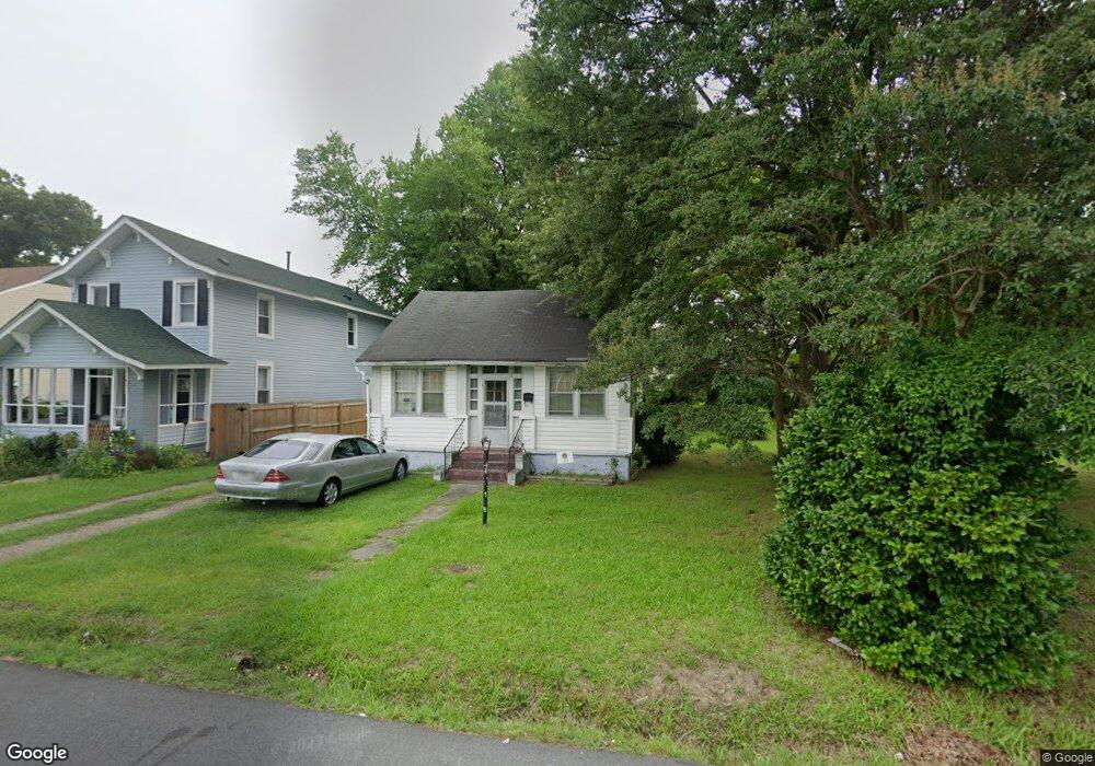
310 Locust Ave Hampton, VA 23661
Wythe NeighborhoodEstimated Value: $158,000 - $194,000
2
Beds
1
Bath
972
Sq Ft
$172/Sq Ft
Est. Value
About This Home
This home is located at 310 Locust Ave, Hampton, VA 23661 and is currently estimated at $167,654, approximately $172 per square foot. 310 Locust Ave is a home located in Hampton City with nearby schools including Hunter B. Andrews PK-8 School, C. Alton Lindsay Middle School, and Hampton High School.
Ownership History
Date
Name
Owned For
Owner Type
Purchase Details
Closed on
Feb 24, 2026
Sold by
Whitney Willie J
Bought by
Whitney Willie J and Smith Angela L
Current Estimated Value
Purchase Details
Closed on
Mar 24, 2006
Sold by
Pruitt Howard M
Bought by
Davis Samuel R
Home Financials for this Owner
Home Financials are based on the most recent Mortgage that was taken out on this home.
Original Mortgage
$76,800
Interest Rate
6.26%
Mortgage Type
New Conventional
Create a Home Valuation Report for This Property
The Home Valuation Report is an in-depth analysis detailing your home's value as well as a comparison with similar homes in the area
Home Values in the Area
Average Home Value in this Area
Purchase History
| Date | Buyer | Sale Price | Title Company |
|---|---|---|---|
| Whitney Willie J | -- | None Listed On Document | |
| Davis Samuel R | $96,000 | -- |
Source: Public Records
Mortgage History
| Date | Status | Borrower | Loan Amount |
|---|---|---|---|
| Previous Owner | Davis Samuel R | $76,800 |
Source: Public Records
Tax History
| Year | Tax Paid | Tax Assessment Tax Assessment Total Assessment is a certain percentage of the fair market value that is determined by local assessors to be the total taxable value of land and additions on the property. | Land | Improvement |
|---|---|---|---|---|
| 2025 | $1,721 | $143,000 | $54,000 | $89,000 |
| 2024 | $1,516 | $131,800 | $54,000 | $77,800 |
| 2023 | $1,409 | $121,500 | $54,000 | $67,500 |
| 2022 | $1,333 | $113,000 | $50,000 | $63,000 |
| 2021 | $1,329 | $96,700 | $40,000 | $56,700 |
| 2020 | $1,178 | $95,000 | $40,000 | $55,000 |
| 2019 | $1,167 | $94,100 | $40,000 | $54,100 |
| 2018 | $1,201 | $89,300 | $40,000 | $49,300 |
| 2017 | $1,201 | $0 | $0 | $0 |
| 2016 | $1,201 | $89,300 | $0 | $0 |
| 2015 | $1,201 | $0 | $0 | $0 |
| 2014 | $1,292 | $97,400 | $40,800 | $56,600 |
Source: Public Records
Map
Nearby Homes
- 211 Greenbriar Ave
- 227 Hollywood Ave
- 240 Hollywood Ave
- 317 Cottonwood Ave
- 203 Hollywood Ave
- 200 Claremont Ave
- 332 Catalpa Ave
- 373 Schley Ave
- 390 Cottonwood Ave
- 531 Greenbriar Ave
- 142 Clifton St
- 1714 Victoria Blvd
- 237 Piedmont Ave
- 1105 Chesapeake Ave
- 1001 New St
- 241 Maple Ave
- 731 Chesapeake Ave
- 407 Pine Ave
- 412 Blair Ave
- 319 Sycamore Ave
- 316 Locust Ave
- 306 Locust Ave
- 322 Locust Ave
- 313 Greenbriar Ave
- 311 Greenbriar Ave
- 1001 Kecoughtan Rd
- 309 Greenbriar Ave
- 317 Greenbriar Ave
- 324 Locust Ave
- 307 Greenbriar Ave
- 1007 Kecoughtan Rd
- 311 Locust Ave
- 313 Locust Ave
- 328 Locust Ave
- 309 Locust Ave
- 319 Locust Ave
- 330 Locust Ave
- 327 Locust Ave
- 915 Kecoughtan Rd
- 1000 Kecoughtan Rd
Your Personal Tour Guide
Ask me questions while you tour the home.