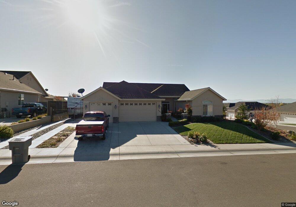
3103 Agassi Ln Redding, CA 96002
Forest Hills NeighborhoodEstimated Value: $577,792 - $610,000
4
Beds
2
Baths
2,357
Sq Ft
$255/Sq Ft
Est. Value
About This Home
This home is located at 3103 Agassi Ln, Redding, CA 96002 and is currently estimated at $601,198, approximately $255 per square foot. 3103 Agassi Ln is a home located in Shasta County with nearby schools including Alta Mesa Elementary School, Parsons Junior High School, and Enterprise High School.
Ownership History
Date
Name
Owned For
Owner Type
Purchase Details
Closed on
Aug 5, 2010
Sold by
Pereira Neal and Pereira Marscia
Bought by
Keys Bill and Keys Marjorie
Current Estimated Value
Home Financials for this Owner
Home Financials are based on the most recent Mortgage that was taken out on this home.
Original Mortgage
$225,000
Outstanding Balance
$148,521
Interest Rate
4.51%
Mortgage Type
New Conventional
Estimated Equity
$452,677
Purchase Details
Closed on
Jul 24, 2006
Sold by
Ochoa Shehan Inc
Bought by
Pereira Neal and Pereira Marscia
Home Financials for this Owner
Home Financials are based on the most recent Mortgage that was taken out on this home.
Original Mortgage
$365,000
Interest Rate
6.57%
Mortgage Type
Purchase Money Mortgage
Create a Home Valuation Report for This Property
The Home Valuation Report is an in-depth analysis detailing your home's value as well as a comparison with similar homes in the area
Home Values in the Area
Average Home Value in this Area
Purchase History
| Date | Buyer | Sale Price | Title Company |
|---|---|---|---|
| Keys Bill | $375,000 | Fidelity Natl Title Co Of Ca | |
| Pereira Neal | $475,000 | Fidelity National Title Co |
Source: Public Records
Mortgage History
| Date | Status | Borrower | Loan Amount |
|---|---|---|---|
| Open | Keys Bill | $225,000 | |
| Previous Owner | Pereira Neal | $365,000 |
Source: Public Records
Tax History
| Year | Tax Paid | Tax Assessment Tax Assessment Total Assessment is a certain percentage of the fair market value that is determined by local assessors to be the total taxable value of land and additions on the property. | Land | Improvement |
|---|---|---|---|---|
| 2025 | $5,415 | $486,962 | $102,487 | $384,475 |
| 2024 | $5,337 | $477,415 | $100,478 | $376,937 |
| 2023 | $5,337 | $468,055 | $98,508 | $369,547 |
| 2022 | $5,178 | $458,878 | $96,577 | $362,301 |
| 2021 | $4,993 | $449,882 | $94,684 | $355,198 |
| 2020 | $4,843 | $435,000 | $75,000 | $360,000 |
| 2019 | $4,783 | $425,000 | $70,000 | $355,000 |
| 2018 | $4,597 | $405,000 | $70,000 | $335,000 |
| 2017 | $4,698 | $405,000 | $70,000 | $335,000 |
| 2016 | $4,250 | $380,000 | $70,000 | $310,000 |
| 2015 | $4,199 | $380,000 | $70,000 | $310,000 |
| 2014 | $4,361 | $384,000 | $65,000 | $319,000 |
Source: Public Records
Map
Nearby Homes
- 3183 Agassi Ln
- 3685 Wimbledon Dr
- 3824 Thomason Trail
- 3874 Palm Springs Dr
- 3512 Capricorn Way
- 3035 Argyle Rd
- 0 Shasta View Unit 25-1945
- 3688 Polaris Way
- 3051 Leonard St
- 2681 Hartnell Ave
- 2875 Eastbrook Dr
- 3594 Laramie St
- 2912 Squire Ave
- 2354 Suzette Ave
- 2332 Venus Way
- 20340 Gibson Ct
- 2867 Camulos Way
- 4302 Yellowstone Dr
- 2704 Western Oak Dr
- 3361 Alta Mesa Dr
- 3119 Agassi Ln
- 3618 Deuce Way
- 3135 Agassi Ln
- 3634 Deuce Way
- 3667 Deuce Way
- 3114 Agassi Ln
- 3128 Agassi Ln
- 3648 Laver Ct
- 3602 Deuce Way
- 3100 Agassi Ln
- 3650 Deuce Way
- 3142 Agassi Ln
- 3151 Agassi Ln
- 3693 Deuce Way
- 3668 Deuce Way Unit Deuce Way
- 3668 Deuce Way
- 3156 Agassi Ln
- 3696 Laver Ct
- 3167 Agassi Ln
- 0 Laver&barton Rd
Your Personal Tour Guide
Ask me questions while you tour the home.