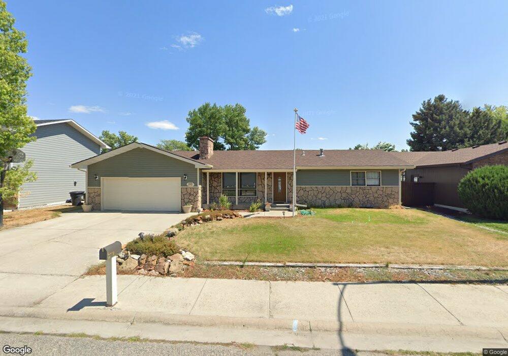
311 Montclair Dr Billings, MT 59102
West End NeighborhoodEstimated Value: $402,000 - $436,000
5
Beds
3
Baths
2,690
Sq Ft
$156/Sq Ft
Est. Value
About This Home
This home is located at 311 Montclair Dr, Billings, MT 59102 and is currently estimated at $419,992, approximately $156 per square foot. 311 Montclair Dr is a home located in Yellowstone County with nearby schools including Meadowlark School, Will James Junior High School, and Billings West High School.
Ownership History
Date
Name
Owned For
Owner Type
Purchase Details
Closed on
Oct 21, 2020
Sold by
Thompson Mavis K
Bought by
Fillingham Garrett R
Current Estimated Value
Home Financials for this Owner
Home Financials are based on the most recent Mortgage that was taken out on this home.
Original Mortgage
$283,371
Outstanding Balance
$251,584
Interest Rate
2.8%
Mortgage Type
VA
Estimated Equity
$168,408
Create a Home Valuation Report for This Property
The Home Valuation Report is an in-depth analysis detailing your home's value as well as a comparison with similar homes in the area
Home Values in the Area
Average Home Value in this Area
Purchase History
| Date | Buyer | Sale Price | Title Company |
|---|---|---|---|
| Fillingham Garrett R | -- | First Montana Title Company |
Source: Public Records
Mortgage History
| Date | Status | Borrower | Loan Amount |
|---|---|---|---|
| Open | Fillingham Garrett R | $283,371 |
Source: Public Records
Tax History Compared to Growth
Tax History
| Year | Tax Paid | Tax Assessment Tax Assessment Total Assessment is a certain percentage of the fair market value that is determined by local assessors to be the total taxable value of land and additions on the property. | Land | Improvement |
|---|---|---|---|---|
| 2025 | $3,885 | $431,100 | $87,532 | $343,568 |
| 2024 | $3,885 | $391,000 | $91,214 | $299,786 |
| 2023 | $3,876 | $391,000 | $91,214 | $299,786 |
| 2022 | $3,112 | $271,700 | $71,240 | $200,460 |
| 2021 | $2,956 | $271,700 | $0 | $0 |
| 2020 | $3,058 | $268,800 | $0 | $0 |
| 2019 | $2,924 | $268,800 | $0 | $0 |
| 2018 | $2,741 | $245,300 | $0 | $0 |
| 2017 | $2,270 | $245,300 | $0 | $0 |
| 2016 | $2,536 | $234,900 | $0 | $0 |
| 2015 | $2,483 | $234,900 | $0 | $0 |
| 2014 | $2,359 | $118,667 | $0 | $0 |
Source: Public Records
Map
Nearby Homes
- 108 30th St W
- 2937 Miles Ave
- 3113 Saint Johns Ave
- 3203 Lynn Ave
- 3087 Hunters Ridge Loop
- 2702 Howard Ave
- 3079 Hunters Ridge Loop
- 3231 Central Ave
- 2845 Cumberland Hill Rd
- 207 Boston Hill Rd
- 2645 Custer Ave
- 2636 Custer Ave
- 909 Maywood Dr
- 2905 Lynwood Cir
- 915 Maywood Dr
- 2608 Terry Ave
- 2900 Manhattan Dr
- 260 Brookshire Blvd
- 3291 Banff Ave
- 3175 Solar Blvd Unit 14
- 321 Montclair Dr
- 291 Montclair Dr
- 210 30th St W
- 214 30th St W
- 204 30th St W
- 277 Montclair Dr
- 331 Montclair Dr
- 218 30th St W
- 3051 Buttercup Dr
- 320 Montclair Dr
- 116 30th St W
- 3002 Howard Ave
- 3050 Buttercup Dr
- 265 Montclair Dr
- 328 Montclair Dr
- 112 30th St W
- 3071 Buttercup Dr
- 205 30th St W
- 319 31st St W
- 3051 S Daffodil Dr