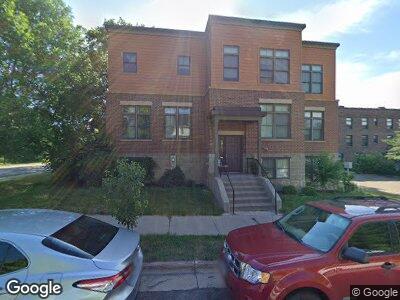
312 Queen Ave N Minneapolis, MN 55405
Harrison NeighborhoodEstimated Value: $290,000 - $385,000
4
Beds
2
Baths
1,214
Sq Ft
$270/Sq Ft
Est. Value
About This Home
This home is located at 312 Queen Ave N, Minneapolis, MN 55405 and is currently estimated at $327,393, approximately $269 per square foot. 312 Queen Ave N is a home located in Hennepin County with nearby schools including Bryn Mawr Elementary School, Anwatin Middle School, and North Community High School.
Ownership History
Date
Name
Owned For
Owner Type
Purchase Details
Closed on
May 31, 2011
Sold by
Twin Cities Habitat For Humanity Inc
Bought by
Omer Aliya
Current Estimated Value
Purchase Details
Closed on
Aug 26, 2010
Sold by
Abraha Negasy and Gebremedhin Saba
Bought by
Twin Cities Habitat For Humanity Inc
Purchase Details
Closed on
Oct 30, 2007
Sold by
Twin Cities Habitat For Humanity Inc
Bought by
Abraha Negasy and Gebremedhin Saba
Home Financials for this Owner
Home Financials are based on the most recent Mortgage that was taken out on this home.
Original Mortgage
$42,524
Interest Rate
6.45%
Mortgage Type
Stand Alone Second
Create a Home Valuation Report for This Property
The Home Valuation Report is an in-depth analysis detailing your home's value as well as a comparison with similar homes in the area
Home Values in the Area
Average Home Value in this Area
Purchase History
| Date | Buyer | Sale Price | Title Company |
|---|---|---|---|
| Omer Aliya | $170,000 | -- | |
| Twin Cities Habitat For Humanity Inc | $170,000 | -- |
Source: Public Records
Mortgage History
| Date | Status | Borrower | Loan Amount |
|---|---|---|---|
| Previous Owner | Abraha Negasy | $42,524 |
Source: Public Records
Tax History Compared to Growth
Tax History
| Year | Tax Paid | Tax Assessment Tax Assessment Total Assessment is a certain percentage of the fair market value that is determined by local assessors to be the total taxable value of land and additions on the property. | Land | Improvement |
|---|---|---|---|---|
| 2023 | $3,256 | $262,000 | $15,000 | $247,000 |
| 2022 | $2,682 | $218,000 | $15,000 | $203,000 |
| 2021 | $2,506 | $210,000 | $3,100 | $206,900 |
| 2020 | $2,351 | $204,000 | $3,100 | $200,900 |
| 2019 | $1,849 | $180,500 | $3,100 | $177,400 |
| 2018 | $1,698 | $144,500 | $3,100 | $141,400 |
| 2017 | $1,680 | $131,000 | $3,100 | $127,900 |
| 2016 | $1,736 | $131,000 | $3,100 | $127,900 |
| 2015 | $1,820 | $131,000 | $3,100 | $127,900 |
| 2014 | -- | $119,500 | $3,100 | $116,400 |
Source: Public Records
Map
Nearby Homes
- 2111 2nd Ave N
- 2011 3rd Ave N
- 2107 5th Ave N
- 1925 Glenwood Ave
- 8 Queen Ave S
- 319 Vincent Ave N
- 1806 Chestnut Ave
- 2110 Hawthorne Ave
- 627 Thomas Ave N
- 722 Newton Ave N
- 809 Russell Ave N
- 160 Cedar Lake Rd N
- 166 Cedar Lake Rd N
- 243 Cedar Lake Rd N
- 241 Queen Ave S
- 823 Queen Ave N
- 727 Upton Ave N
- 914 Russell Ave N
- 2323 Laurel Ave
- 915 Thomas Ave N
- 312 Queen Ave N
- 2215 Glenwood Ave
- 2217 Glenwood Ave
- 2301 Glenwood Ave
- 2307 Glenwood Ave
- 2222 Glenwood Ave
- 310 Queen Ave N
- 2226 Glenwood Ave
- 2218 Glenwood Ave
- 308 Queen Ave N
- 306 Queen Ave N
- 304 Queen Ave N
- 302 Queen Ave N
- 300 Queen Ave N
- 2212 Glenwood Ave
- 2208 Glenwood Ave
- 2300 Glenwood Ave
- 2313 Glenwood Ave
- 2306 Glenwood Ave
- 2306 Glenwood Ave Unit 2