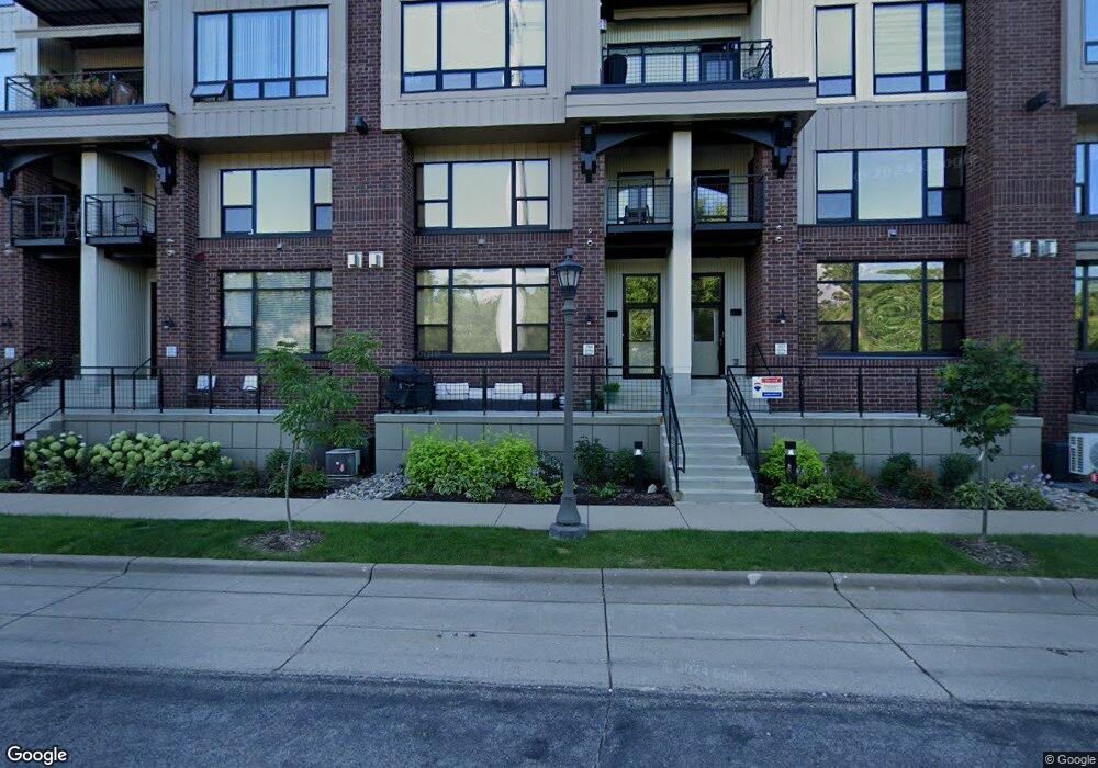
312 Spring St Unit 312 Saint Paul, MN 55102
West Seventh NeighborhoodEstimated Value: $552,000 - $754,000
2
Beds
2
Baths
1,455
Sq Ft
$426/Sq Ft
Est. Value
About This Home
This home is located at 312 Spring St Unit 312, Saint Paul, MN 55102 and is currently estimated at $619,938, approximately $426 per square foot. 312 Spring St Unit 312 is a home located in Ramsey County with nearby schools including Maxfield Magnet Elementary School, Hidden River Middle School, and Central Senior High School.
Ownership History
Date
Name
Owned For
Owner Type
Purchase Details
Closed on
Jul 24, 2024
Sold by
Dewane Douglas J and Dewane Marcia R
Bought by
Strand Lindsay G and Strand Michael D
Current Estimated Value
Purchase Details
Closed on
Aug 17, 2022
Sold by
Healy Thomas C
Bought by
Thomas C Healy Revocable Trust
Purchase Details
Closed on
May 27, 2015
Sold by
Eijadi David A and Eijadi Barbara A
Bought by
Eijadi David Azziz and Eijadi Barbara Anne
Create a Home Valuation Report for This Property
The Home Valuation Report is an in-depth analysis detailing your home's value as well as a comparison with similar homes in the area
Home Values in the Area
Average Home Value in this Area
Purchase History
| Date | Buyer | Sale Price | Title Company |
|---|---|---|---|
| Strand Lindsay G | $550,000 | Edina Realty Title | |
| Thomas C Healy Revocable Trust | $500 | -- | |
| Eijadi David Azziz | $515 | None Available |
Source: Public Records
Tax History
| Year | Tax Paid | Tax Assessment Tax Assessment Total Assessment is a certain percentage of the fair market value that is determined by local assessors to be the total taxable value of land and additions on the property. | Land | Improvement |
|---|---|---|---|---|
| 2025 | $8,638 | $561,200 | $1,000 | $560,200 |
| 2023 | $8,638 | $553,000 | $1,000 | $552,000 |
| 2022 | $7,708 | $519,500 | $1,000 | $518,500 |
| 2021 | $7,066 | $478,800 | $1,000 | $477,800 |
| 2020 | $7,612 | $455,100 | $1,000 | $454,100 |
| 2019 | $7,090 | $455,100 | $1,000 | $454,100 |
| 2018 | $6,582 | $418,400 | $1,000 | $417,400 |
| 2017 | $6,514 | $399,200 | $1,000 | $398,200 |
| 2016 | $5,890 | $0 | $0 | $0 |
| 2015 | $5,934 | $359,100 | $35,900 | $323,200 |
| 2014 | $5,738 | $0 | $0 | $0 |
Source: Public Records
Map
Nearby Homes
- 290 Spring St
- 190 Elm St
- 312 Spring St Unit 309
- 294 Spring St
- 256 Spring St Unit 413
- 336 Spring St
- 240 Spring St Unit 510
- 240 Spring St Unit 204
- 5 Irvine Park Unit 5B
- 162 McBoal St
- 360 Sherman St Unit 1607
- 89 Douglas St
- 334 Cherokee Ave Unit 103
- 359 Pleasant Ave
- 309 W Harrison Ave
- 350 Saint Peter St Unit 512
- 350 Saint Peter St Unit 701
- 350 Saint Peter St Unit 908
- 350 Saint Peter St Unit 405
- 350 Saint Peter St Unit 606
- 300 Spring St Unit 110
- 193 Sherman St
- 197 Sherman St
- 312 Spring St Unit 311
- 302 Spring St
- 195 Sherman St
- 312 Spring St Unit 306
- 312 Spring St Unit 310
- 296 Spring St
- 312 Spring St Unit 301
- 312 Spring St Unit 315
- 312 Spring St Unit 313
- 312 Spring St Unit 302
- 312 Spring St Unit 409
- 185 Sherman St
- 312 Spring St Unit 414
- 312 Spring St Unit 314
- 312 Spring St Unit 406
- 312 Spring St Unit 410
- 312 Spring St Unit 305