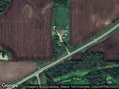
31219 Highway 19 Blvd Cannon Falls, MN 55009
Estimated Value: $335,000 - $653,000
3
Beds
3
Baths
1,904
Sq Ft
$247/Sq Ft
Est. Value
About This Home
This home is located at 31219 Highway 19 Blvd, Cannon Falls, MN 55009 and is currently estimated at $469,417, approximately $246 per square foot. 31219 Highway 19 Blvd is a home with nearby schools including Cannon Falls Elementary School, Cannon Falls High School and Middle School, and St. Paul's Lutheran Elementary School.
Ownership History
Date
Name
Owned For
Owner Type
Purchase Details
Closed on
Apr 1, 2016
Sold by
Benson Robert F and Benson Linda H
Bought by
Benson John R
Current Estimated Value
Purchase Details
Closed on
Nov 1, 2011
Sold by
Benson Robert F and Benson Linda S
Bought by
Robinson Edward J and Robinson Jane E
Purchase Details
Closed on
Dec 15, 2008
Sold by
Benson Donald F
Bought by
Benson Robert and Benson Linda
Create a Home Valuation Report for This Property
The Home Valuation Report is an in-depth analysis detailing your home's value as well as a comparison with similar homes in the area
Home Values in the Area
Average Home Value in this Area
Purchase History
| Date | Buyer | Sale Price | Title Company |
|---|---|---|---|
| Benson John R | $270,000 | -- | |
| Robinson Edward J | $424,380 | -- | |
| Benson Robert | $275,000 | -- |
Source: Public Records
Mortgage History
| Date | Status | Borrower | Loan Amount |
|---|---|---|---|
| Open | Benson John | $70,000 | |
| Open | Benson John | $317,000 |
Source: Public Records
Tax History Compared to Growth
Tax History
| Year | Tax Paid | Tax Assessment Tax Assessment Total Assessment is a certain percentage of the fair market value that is determined by local assessors to be the total taxable value of land and additions on the property. | Land | Improvement |
|---|---|---|---|---|
| 2024 | -- | $440,300 | $146,800 | $293,500 |
| 2023 | $2,410 | $334,900 | $142,000 | $192,900 |
| 2022 | $2,502 | $330,400 | $137,500 | $192,900 |
| 2021 | $2,558 | $312,900 | $134,700 | $178,200 |
| 2020 | $2,484 | $312,500 | $132,400 | $180,100 |
| 2019 | $2,624 | $304,300 | $132,400 | $171,900 |
| 2018 | $2,458 | $307,000 | $132,800 | $174,200 |
| 2017 | $2,434 | $286,800 | $121,300 | $165,500 |
| 2016 | $2,460 | $277,200 | $120,600 | $156,600 |
| 2015 | $2,238 | $272,800 | $121,200 | $151,600 |
| 2014 | -- | $281,200 | $121,700 | $159,500 |
Source: Public Records
Map
Nearby Homes
- 30931 Minnesota 19
- 601 Union Ct
- 900 Hoffman St W
- 101 Timber Lane Ct
- 328 Pine St
- 32420 59th Avenue Way
- XXX 63rd Ave
- 32955 County 24 Blvd
- xxx County Road 24 & 63rd Ave
- 425 2nd St SW
- xxxx County 14 Blvd
- xxx County 14 Blvd
- 29789 20th Avenue Way
- 5799 331st St
- 1324 7th St N
- XXX County 24 Blvd
- 200 Minnesota St W
- 201 1st St N
- 31219 Highway 19 Blvd
- 31051 Highway 19 Blvd
- 30990 Highway 19 Blvd
- 31286 Highway 19 Blvd
- 31036 Highway 19 Blvd
- 30988 Highway 19 Blvd
- 31159 37th Ave Way
- 30739 Highway 19 Blvd
- 31030 Highway 19 Blvd
- 30737 Highway 19 Blvd
- 30741 Highway 19 Blvd
- 3639 310th St
- 4898 Scout Ridge Way
- 30641 Highway 19 Blvd
- 3501 310th St
- 4659 Scout Ridge Way
- 4691 Scout Ridge Way
- 4703 Scout Ridge Way
- 4703 Scout Ridge Way
- 30740 Highway 19 Blvd
