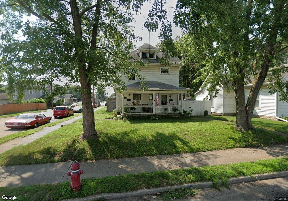
316 Moore St Middletown, OH 45044
Sherman NeighborhoodEstimated Value: $129,000 - $170,000
3
Beds
2
Baths
1,395
Sq Ft
$107/Sq Ft
Est. Value
About This Home
This home is located at 316 Moore St, Middletown, OH 45044 and is currently estimated at $148,987, approximately $106 per square foot. 316 Moore St is a home located in Butler County with nearby schools including Amanda Elementary School, Highview 6th Grade Center, and Middletown Middle School.
Ownership History
Date
Name
Owned For
Owner Type
Purchase Details
Closed on
Apr 9, 1996
Sold by
Cathey Owen E
Bought by
Rouster William H
Current Estimated Value
Home Financials for this Owner
Home Financials are based on the most recent Mortgage that was taken out on this home.
Original Mortgage
$55,000
Outstanding Balance
$1,494
Interest Rate
7.36%
Mortgage Type
New Conventional
Estimated Equity
$147,493
Purchase Details
Closed on
Sep 1, 1989
Purchase Details
Closed on
May 1, 1985
Create a Home Valuation Report for This Property
The Home Valuation Report is an in-depth analysis detailing your home's value as well as a comparison with similar homes in the area
Home Values in the Area
Average Home Value in this Area
Purchase History
| Date | Buyer | Sale Price | Title Company |
|---|---|---|---|
| Rouster William H | $58,000 | -- | |
| -- | $32,000 | -- | |
| -- | $31,000 | -- |
Source: Public Records
Mortgage History
| Date | Status | Borrower | Loan Amount |
|---|---|---|---|
| Open | Rouster William H | $55,000 |
Source: Public Records
Tax History
| Year | Tax Paid | Tax Assessment Tax Assessment Total Assessment is a certain percentage of the fair market value that is determined by local assessors to be the total taxable value of land and additions on the property. | Land | Improvement |
|---|---|---|---|---|
| 2025 | $4,216 | $29,270 | $4,850 | $24,420 |
| 2024 | $4,216 | $29,270 | $4,850 | $24,420 |
| 2023 | $1,542 | $28,510 | $4,850 | $23,660 |
| 2022 | $1,208 | $20,260 | $4,850 | $15,410 |
| 2021 | $1,162 | $20,260 | $4,850 | $15,410 |
| 2020 | $1,211 | $20,260 | $4,850 | $15,410 |
| 2019 | $644 | $8,880 | $4,840 | $4,040 |
| 2018 | $575 | $8,880 | $4,840 | $4,040 |
| 2017 | $576 | $8,880 | $4,840 | $4,040 |
| 2016 | $471 | $6,950 | $4,840 | $2,110 |
| 2015 | $464 | $6,950 | $4,840 | $2,110 |
| 2014 | $1,375 | $6,950 | $4,840 | $2,110 |
| 2013 | $1,375 | $22,380 | $4,840 | $17,540 |
Source: Public Records
Map
Nearby Homes
- 1814.5 Logan Ave
- 325 Moore St
- 319 Crawford St
- 409 Crawford St
- 2023 Arlington Ave
- 14 Moore St
- 1832 Woodlawn Ave
- 1830 Woodlawn Ave
- 2124 Sherman Ave
- 2208 Linden Ave
- 705 Crawford St
- 2020 Grand Ave
- 707 Crawford St
- 615 Cleveland St
- 2119 Central Ave
- 1907 Hill Ave
- 113 N Sutphin St
- 2005 Hill Ave
- 2312 S Sutphin St
- 500 Garfield St
Your Personal Tour Guide
Ask me questions while you tour the home.