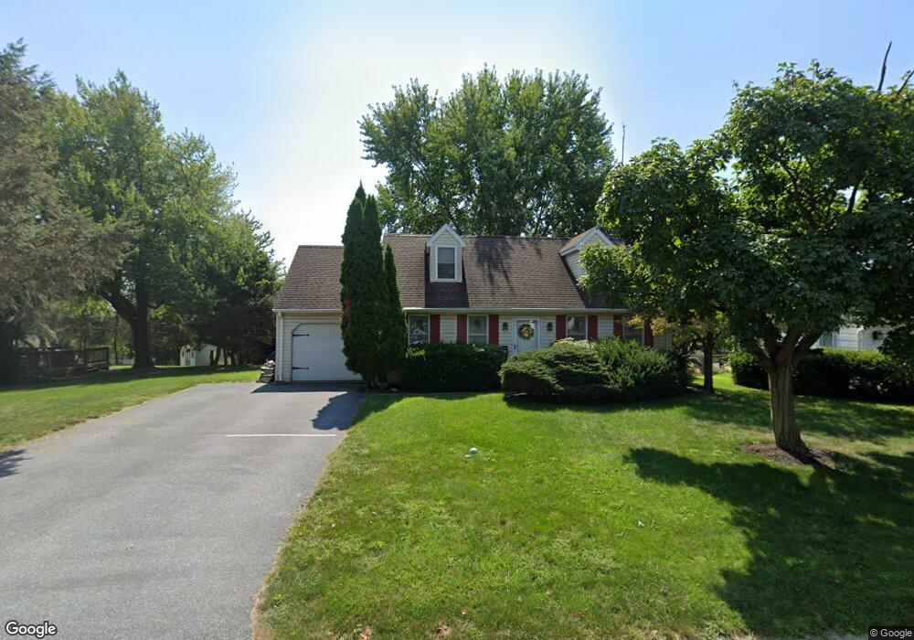
3166 Stonyridge Dr Lancaster, PA 17601
Oyster Point NeighborhoodEstimated Value: $360,285 - $393,000
3
Beds
1
Bath
1,502
Sq Ft
$250/Sq Ft
Est. Value
About This Home
This home is located at 3166 Stonyridge Dr, Lancaster, PA 17601 and is currently estimated at $376,071, approximately $250 per square foot. 3166 Stonyridge Dr is a home located in Lancaster County with nearby schools including Landisville Primary Center, Landisville Middle School, and Hempfield Senior High School.
Ownership History
Date
Name
Owned For
Owner Type
Purchase Details
Closed on
Jul 30, 1999
Sold by
Murphy Roland G and Murphy Robin M
Bought by
Stroup Jim E and Stroup Suzanne E
Current Estimated Value
Home Financials for this Owner
Home Financials are based on the most recent Mortgage that was taken out on this home.
Original Mortgage
$121,500
Interest Rate
7.54%
Create a Home Valuation Report for This Property
The Home Valuation Report is an in-depth analysis detailing your home's value as well as a comparison with similar homes in the area
Home Values in the Area
Average Home Value in this Area
Purchase History
| Date | Buyer | Sale Price | Title Company |
|---|---|---|---|
| Stroup Jim E | $127,900 | -- |
Source: Public Records
Mortgage History
| Date | Status | Borrower | Loan Amount |
|---|---|---|---|
| Closed | Stroup Jim E | $121,500 |
Source: Public Records
Tax History Compared to Growth
Tax History
| Year | Tax Paid | Tax Assessment Tax Assessment Total Assessment is a certain percentage of the fair market value that is determined by local assessors to be the total taxable value of land and additions on the property. | Land | Improvement |
|---|---|---|---|---|
| 2025 | $4,325 | $191,800 | $59,300 | $132,500 |
| 2024 | $4,325 | $191,800 | $59,300 | $132,500 |
| 2023 | $4,242 | $191,800 | $59,300 | $132,500 |
| 2022 | $4,130 | $191,800 | $59,300 | $132,500 |
| 2021 | $4,049 | $191,800 | $59,300 | $132,500 |
| 2020 | $4,049 | $191,800 | $59,300 | $132,500 |
| 2019 | $3,983 | $191,800 | $59,300 | $132,500 |
| 2018 | $836 | $191,800 | $59,300 | $132,500 |
| 2017 | $3,551 | $138,100 | $41,900 | $96,200 |
| 2016 | $3,480 | $138,100 | $41,900 | $96,200 |
| 2015 | $701 | $138,100 | $41,900 | $96,200 |
| 2014 | $2,563 | $138,100 | $41,900 | $96,200 |
Source: Public Records
Map
Nearby Homes
- 3200 Greenridge Dr
- 3210 Glengreen Dr
- 3320 Poplar Ln
- 501 Bald Eagle Ct
- Kipling Plan at Enclave at Independence Ridge
- Woodford Plan at Enclave at Independence Ridge
- Magnolia Plan at Enclave at Independence Ridge
- Sebastian Plan at Enclave at Independence Ridge
- Savannah Plan at Enclave at Independence Ridge
- Parker Plan at Enclave at Independence Ridge
- Nottingham Plan at Enclave at Independence Ridge
- Devonshire Plan at Enclave at Independence Ridge
- Arcadia Plan at Enclave at Independence Ridge
- Augusta Plan at Enclave at Independence Ridge
- Addison Plan at Enclave at Independence Ridge
- Lachlan Plan at Enclave at Independence Ridge
- Ethan Plan at Enclave at Independence Ridge
- Covington Plan at Enclave at Independence Ridge
- Hawthorne Plan at Enclave at Independence Ridge
- 2940 Marietta Ave
- 3168 Stonyridge Dr
- 3062 Todd Ln
- 3163 Thornapple Dr
- 3170 Stonyridge Dr
- 3060 Todd Ln
- 3165 Thornapple Dr
- 3161 Thornapple Dr
- 3165 Stonyridge Dr
- 3167 Thornapple Dr
- 3167 Stonyridge Dr
- 3172 Stonyridge Dr
- 3058 Todd Ln
- 3061 Todd Ln
- 3159 Thornapple Dr
- 3169 Thornapple Dr
- 3063 Todd Ln
- 3066 Todd Ln
- 3059 Todd Ln
- 313 Barberry Dr
- 3174 Stonyridge Dr