31832 Highway J3t Unionville, IA 52594
Estimated Value: $113,000 - $523,000
3
Beds
3
Baths
1,440
Sq Ft
$231/Sq Ft
Est. Value
About This Home
This home is located at 31832 Highway J3t, Unionville, IA 52594 and is currently estimated at $332,624, approximately $230 per square foot. 31832 Highway J3t is a home located in Appanoose County with nearby schools including Moravia Elementary School and Moravia High School.
Ownership History
Date
Name
Owned For
Owner Type
Purchase Details
Closed on
Jan 4, 2012
Sold by
Spring Kevin
Bought by
Spring Patricia
Current Estimated Value
Purchase Details
Closed on
Jun 14, 2006
Sold by
Swinney Patricia and Swinney Stanley L
Bought by
Spring Kevin Ray and Spring Patricia E
Home Financials for this Owner
Home Financials are based on the most recent Mortgage that was taken out on this home.
Original Mortgage
$160,000
Interest Rate
6.87%
Mortgage Type
Adjustable Rate Mortgage/ARM
Create a Home Valuation Report for This Property
The Home Valuation Report is an in-depth analysis detailing your home's value as well as a comparison with similar homes in the area
Home Values in the Area
Average Home Value in this Area
Purchase History
| Date | Buyer | Sale Price | Title Company |
|---|---|---|---|
| Spring Patricia | -- | None Available | |
| Spring Kevin Ray | $160,000 | None Available |
Source: Public Records
Mortgage History
| Date | Status | Borrower | Loan Amount |
|---|---|---|---|
| Open | Johnston Dylan | $314,833 | |
| Closed | Babbitt Patricia E | $12,000 | |
| Closed | Dell Patricia E | $164,500 | |
| Previous Owner | Springs Kevin Ray | $164,224 | |
| Previous Owner | Spring Kevin Ray | $160,000 |
Source: Public Records
Tax History Compared to Growth
Tax History
| Year | Tax Paid | Tax Assessment Tax Assessment Total Assessment is a certain percentage of the fair market value that is determined by local assessors to be the total taxable value of land and additions on the property. | Land | Improvement |
|---|---|---|---|---|
| 2024 | $3,244 | $291,910 | $58,000 | $233,910 |
| 2023 | $3,244 | $291,910 | $58,000 | $233,910 |
| 2022 | $2,718 | $229,840 | $39,000 | $190,840 |
| 2021 | $2,718 | $218,820 | $39,000 | $179,820 |
| 2020 | $2,324 | $181,270 | $34,000 | $147,270 |
| 2019 | $2,476 | $161,020 | $0 | $0 |
| 2018 | $2,508 | $161,020 | $0 | $0 |
| 2017 | $234,400 | $147,750 | $0 | $0 |
| 2016 | $2,292 | $147,750 | $0 | $0 |
| 2015 | $2,292 | $148,230 | $0 | $0 |
| 2014 | $2,258 | $148,230 | $0 | $0 |
Source: Public Records
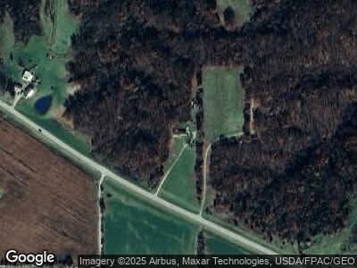
Map
Nearby Homes
- 0 County Road T61
- 0 Highway J3t
- 108 Oak St
- 11784 131th Ave
- 14091 310th Ave
- 32 Lot 32 Westview Dr
- 15300 Big Buck Run
- 30075 Westview Dr Unit d
- 2-44 Wild Turkey Ln
- 15056 Wild Turkey Ln
- 29727 N Bay Ct
- 14350 South East S East View Ct Unit 10-5
- 28681 Meadow Ct
- 28779 E View Dr
- 28590 Eagle Ridge Rd
- 14436 286th Ave
- 13792 286th Ave 286th Ave
- Phase 1 lot 13 Cove Ct
- 14585 W Bay
- 14666 W Bay