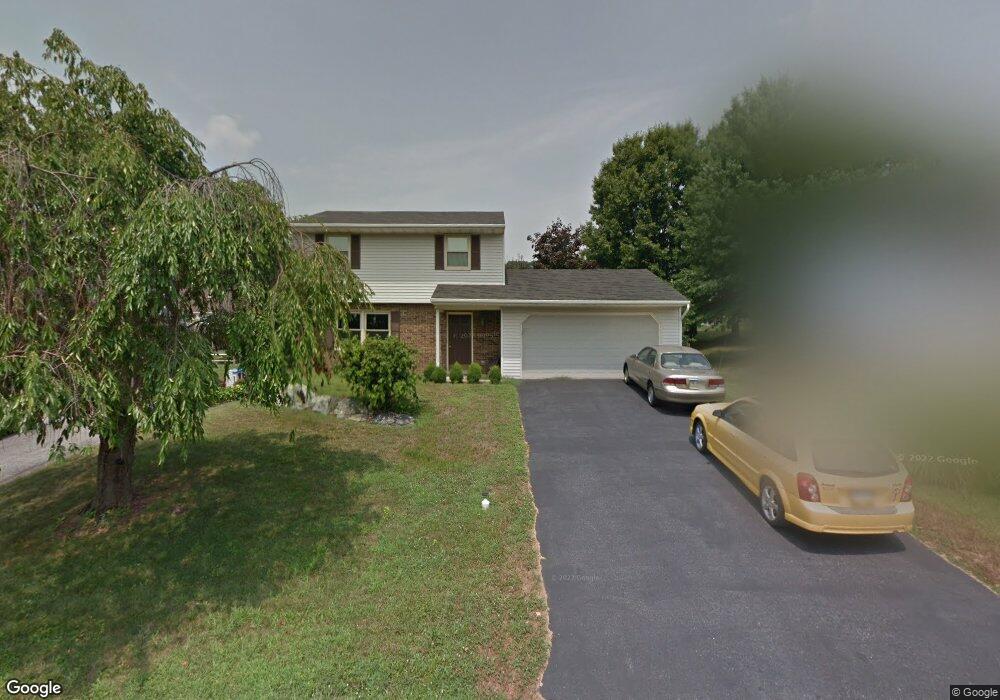
3189 Greentree Dr Lancaster, PA 17601
Oyster Point NeighborhoodEstimated Value: $363,000 - $396,000
3
Beds
2
Baths
1,811
Sq Ft
$209/Sq Ft
Est. Value
About This Home
This home is located at 3189 Greentree Dr, Lancaster, PA 17601 and is currently estimated at $378,633, approximately $209 per square foot. 3189 Greentree Dr is a home located in Lancaster County with nearby schools including Landisville Primary Center, Landisville Middle School, and Hempfield Senior High School.
Ownership History
Date
Name
Owned For
Owner Type
Purchase Details
Closed on
Jan 28, 2010
Sold by
Barnett Matt and Sload Rochelle
Bought by
Haldeman James R and Haldeman Samantha Jo
Current Estimated Value
Home Financials for this Owner
Home Financials are based on the most recent Mortgage that was taken out on this home.
Original Mortgage
$185,085
Outstanding Balance
$123,355
Interest Rate
5.25%
Mortgage Type
FHA
Estimated Equity
$255,278
Purchase Details
Closed on
Jun 12, 2009
Sold by
Cunningham Walter E and Cunningham Linda F
Bought by
Barnett Matt and Sload Rochelle
Home Financials for this Owner
Home Financials are based on the most recent Mortgage that was taken out on this home.
Original Mortgage
$183,099
Interest Rate
4.91%
Mortgage Type
FHA
Create a Home Valuation Report for This Property
The Home Valuation Report is an in-depth analysis detailing your home's value as well as a comparison with similar homes in the area
Home Values in the Area
Average Home Value in this Area
Purchase History
| Date | Buyer | Sale Price | Title Company |
|---|---|---|---|
| Haldeman James R | $188,500 | None Available | |
| Barnett Matt | $186,500 | Fidelity Natl Title Ins Co |
Source: Public Records
Mortgage History
| Date | Status | Borrower | Loan Amount |
|---|---|---|---|
| Open | Haldeman James R | $185,085 | |
| Previous Owner | Barnett Matt | $183,099 |
Source: Public Records
Tax History Compared to Growth
Tax History
| Year | Tax Paid | Tax Assessment Tax Assessment Total Assessment is a certain percentage of the fair market value that is determined by local assessors to be the total taxable value of land and additions on the property. | Land | Improvement |
|---|---|---|---|---|
| 2025 | $4,285 | $190,000 | $55,700 | $134,300 |
| 2024 | $4,285 | $190,000 | $55,700 | $134,300 |
| 2023 | $4,203 | $190,000 | $55,700 | $134,300 |
| 2022 | $4,092 | $190,000 | $55,700 | $134,300 |
| 2021 | $4,011 | $190,000 | $55,700 | $134,300 |
| 2020 | $4,011 | $190,000 | $55,700 | $134,300 |
| 2019 | $3,945 | $190,000 | $55,700 | $134,300 |
| 2018 | $829 | $190,000 | $55,700 | $134,300 |
| 2017 | $3,422 | $133,100 | $34,800 | $98,300 |
| 2016 | $3,354 | $133,100 | $34,800 | $98,300 |
| 2015 | $675 | $133,100 | $34,800 | $98,300 |
| 2014 | $2,466 | $133,100 | $34,800 | $98,300 |
Source: Public Records
Map
Nearby Homes
- 3142 Briarwood Blvd
- 3210 Glengreen Dr
- 1622 Stony Battery Rd
- 710 Dustin Dr
- 667 Golden Eagle Way
- 27 Apple Ln
- 11 Cedar Ln
- Ethan Plan at Enclave at Independence Ridge
- Kipling Plan at Enclave at Independence Ridge
- Parker Plan at Enclave at Independence Ridge
- Addison Plan at Enclave at Independence Ridge
- Savannah Plan at Enclave at Independence Ridge
- Woodford Plan at Enclave at Independence Ridge
- Devonshire Plan at Enclave at Independence Ridge
- Magnolia Plan at Enclave at Independence Ridge
- Hawthorne Plan at Enclave at Independence Ridge
- Covington Plan at Enclave at Independence Ridge
- Lachlan Plan at Enclave at Independence Ridge
- Augusta Plan at Enclave at Independence Ridge
- Sebastian Plan at Enclave at Independence Ridge
- 3187 Greentree Dr
- 3191 Greentree Dr
- 3192 Thistle Dr
- 3190 Thistle Dr
- 3185 Greentree Dr
- 3188 Thistle Dr
- 3194 Thistle Dr
- 3188 Greentree Dr
- 3193 Greentree Dr
- 3186 Thistle Dr
- 3196 Thistle Dr
- 3183 Greentree Dr
- 3186 Greentree Dr
- 3190 Greentree Dr
- 3184 Greentree Dr
- 3184 Thistle Dr
- 3195 Greentree Dr
- 3198 Thistle Dr
- 3192 Greentree Dr
- 3191 Thistle Dr