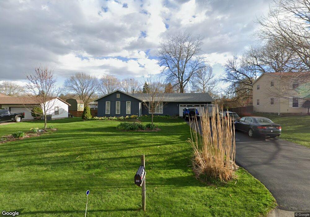
32 Boat Ln Oswego, IL 60543
Northwest Oswego NeighborhoodEstimated Value: $287,000 - $342,736
3
Beds
2
Baths
1,476
Sq Ft
$214/Sq Ft
Est. Value
About This Home
This home is located at 32 Boat Ln, Oswego, IL 60543 and is currently estimated at $315,434, approximately $213 per square foot. 32 Boat Ln is a home located in Kendall County with nearby schools including Fox Chase Elementary School, Traughber Junior High School, and Oswego High School.
Ownership History
Date
Name
Owned For
Owner Type
Purchase Details
Closed on
Aug 19, 2025
Sold by
Daniel P Schlutz Declaration Of Living T and Schultz Daniel P
Bought by
Schultz Joshua T
Current Estimated Value
Purchase Details
Closed on
May 6, 2024
Sold by
Schultz Daniel P
Bought by
Daniel P Schultz Living Trust and Schultz
Purchase Details
Closed on
Aug 8, 2017
Sold by
Schultz Daniel P and Schultz Daniel
Bought by
Schultz Daniel P and Daniel P Schultz Living Trust
Purchase Details
Closed on
Jun 1, 1991
Bought by
Schultz Daniel P
Purchase Details
Closed on
Apr 1, 1987
Create a Home Valuation Report for This Property
The Home Valuation Report is an in-depth analysis detailing your home's value as well as a comparison with similar homes in the area
Home Values in the Area
Average Home Value in this Area
Purchase History
| Date | Buyer | Sale Price | Title Company |
|---|---|---|---|
| Schultz Joshua T | -- | None Listed On Document | |
| Daniel P Schultz Living Trust | -- | Chicago Title | |
| Schultz Daniel P | -- | Attorney | |
| Schultz Daniel P | $138,000 | -- | |
| -- | $87,000 | -- |
Source: Public Records
Mortgage History
| Date | Status | Borrower | Loan Amount |
|---|---|---|---|
| Closed | Schultz Daniel P | -- |
Source: Public Records
Tax History Compared to Growth
Tax History
| Year | Tax Paid | Tax Assessment Tax Assessment Total Assessment is a certain percentage of the fair market value that is determined by local assessors to be the total taxable value of land and additions on the property. | Land | Improvement |
|---|---|---|---|---|
| 2024 | $7,665 | $96,829 | $24,189 | $72,640 |
| 2023 | $6,982 | $86,454 | $21,597 | $64,857 |
| 2022 | $6,982 | $78,596 | $19,814 | $58,782 |
| 2021 | $5,750 | $73,454 | $18,518 | $54,936 |
| 2020 | $6,018 | $75,726 | $19,091 | $56,635 |
| 2019 | $6,057 | $70,114 | $19,091 | $51,023 |
| 2018 | $5,444 | $61,315 | $16,695 | $44,620 |
| 2017 | $5,347 | $58,957 | $16,053 | $42,904 |
| 2016 | $2,556 | $55,883 | $15,216 | $40,667 |
| 2015 | $2,512 | $52,720 | $14,355 | $38,365 |
| 2014 | -- | $50,692 | $13,803 | $36,889 |
| 2013 | -- | $51,204 | $13,942 | $37,262 |
Source: Public Records
Map
Nearby Homes
- 7.43 Acres Vacant La State Route 31
- 5.43 B-3 Commercial State Route 31
- 11-13 W Anchor Rd
- 2600 Light Rd Unit 210
- 2300 Light Rd Unit 209
- 2100 Light Rd Unit 109
- 1415 State Route 31
- 9 Cebold Dr
- 107 Kristine St
- 38 Ashlawn Ave
- 119 Garden Dr
- 3 Scarsdale Rd
- 40 Codorus Rd
- 117 Boulder Hill Pass Unit 117
- 141 River Mist Dr
- 156 River Mist Dr
- 47 Old Post Rd
- 22 Sherwick Rd
- 2110 State Route 31
- 409 Fawn Dr