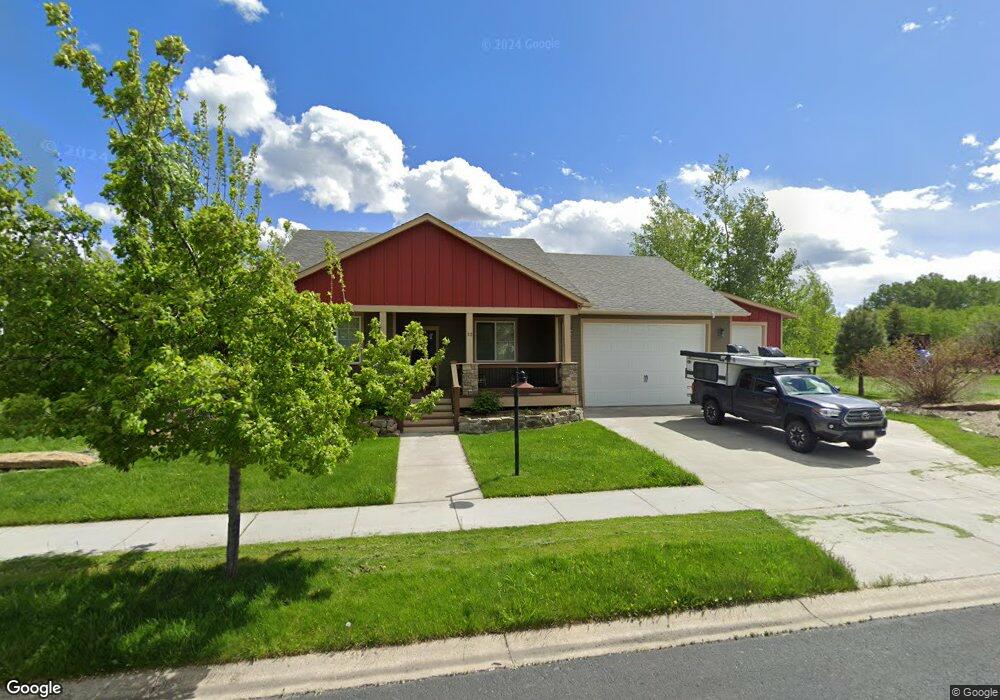
32 Mathew Bird Cir Bozeman, MT 59715
South Bozeman NeighborhoodEstimated Value: $858,602 - $1,006,000
4
Beds
3
Baths
2,179
Sq Ft
$425/Sq Ft
Est. Value
About This Home
This home is located at 32 Mathew Bird Cir, Bozeman, MT 59715 and is currently estimated at $925,401, approximately $424 per square foot. 32 Mathew Bird Cir is a home located in Gallatin County with nearby schools including Morning Star School, Sacajawea Middle School, and Bozeman High School.
Ownership History
Date
Name
Owned For
Owner Type
Purchase Details
Closed on
Jun 20, 2018
Sold by
Rundle Marcia B
Bought by
West Robert R and Capek Sonya
Current Estimated Value
Purchase Details
Closed on
Jul 1, 2010
Sold by
Purdie Joanne
Bought by
Rundle Marcia B
Home Financials for this Owner
Home Financials are based on the most recent Mortgage that was taken out on this home.
Original Mortgage
$277,600
Interest Rate
4.76%
Mortgage Type
New Conventional
Purchase Details
Closed on
Jan 30, 2006
Sold by
Hense Elaine Marie and Hense Matthew Gerard
Bought by
Purdie Joanne
Home Financials for this Owner
Home Financials are based on the most recent Mortgage that was taken out on this home.
Original Mortgage
$134,700
Interest Rate
6.21%
Mortgage Type
Purchase Money Mortgage
Purchase Details
Closed on
Jan 14, 2005
Sold by
West Meadows Llc
Bought by
Hense Elaine Marie and Hense Matthew Gerard
Create a Home Valuation Report for This Property
The Home Valuation Report is an in-depth analysis detailing your home's value as well as a comparison with similar homes in the area
Home Values in the Area
Average Home Value in this Area
Purchase History
| Date | Buyer | Sale Price | Title Company |
|---|---|---|---|
| West Robert R | -- | Security Title Co | |
| Rundle Marcia B | -- | Security Title Company | |
| Purdie Joanne | -- | Security Title Company | |
| Hense Elaine Marie | -- | Stc |
Source: Public Records
Mortgage History
| Date | Status | Borrower | Loan Amount |
|---|---|---|---|
| Previous Owner | Rundle Marcia B | $277,600 | |
| Previous Owner | Purdie Joanne | $134,700 |
Source: Public Records
Tax History
| Year | Tax Paid | Tax Assessment Tax Assessment Total Assessment is a certain percentage of the fair market value that is determined by local assessors to be the total taxable value of land and additions on the property. | Land | Improvement |
|---|---|---|---|---|
| 2025 | $4,335 | $898,700 | $0 | $0 |
| 2024 | $5,528 | $830,500 | $0 | $0 |
| 2023 | $5,347 | $830,500 | $0 | $0 |
| 2022 | $4,599 | $599,700 | $0 | $0 |
| 2021 | $4,644 | $599,700 | $0 | $0 |
| 2020 | $4,390 | $513,900 | $0 | $0 |
| 2019 | $4,475 | $512,200 | $0 | $0 |
| 2018 | $4,447 | $471,800 | $0 | $0 |
| 2017 | $4,158 | $471,800 | $0 | $0 |
| 2016 | $3,821 | $405,100 | $0 | $0 |
| 2015 | $3,825 | $405,100 | $0 | $0 |
| 2014 | $3,283 | $204,580 | $0 | $0 |
Source: Public Records
Map
Nearby Homes
- 17 W Fieldview Cir
- 3726 Bungalow Ln
- 407 Fieldstone Dr
- 3166 Gardenbrook Ln
- 1521 Cambridge Dr
- 1301 Cambridge Dr
- 1605 Cambridge Dr
- 1517 Cambridge Dr
- 1525 Cambridge Dr
- 1617 Cambridge Dr
- 1621 Cambridge Dr
- 1609 Cambridge Dr
- 1613 Cambridge Dr
- 3281 Gardenbrook Ln
- 3005 Westridge Dr
- 3021 Teslow Dr
- 3751 Sourdough Rd
- 2503 Spring Creek Dr
- 4510 Morning Sun Dr
- TBD Spring Creek Dr
- 22 Mathew Bird Cir
- 35 Cir
- 43 Mathew Bird Cir
- 23 W Fieldview Cir
- 29 Mathew Bird Cir
- 12 Mathew Bird Cir
- 1 Mathew Bird Cir Unit LOT 1A
- 1 Mathew Bird Cir Unit LOT 1B
- LOT 109 Mathew Bird
- 19 Mathew Bird Cir
- 11 W Fieldview Cir
- 55 Mathew Bird Cir
- 4 Mathew Bird Cir
- 124 Nash Creek Ln
- TBD Mathew Bird Cir Cir
- 166 Nash Creek Ln
- 5 W Fieldview Cir
- 69 Mathew Bird Cir
- 184 Nash Creek Ln
- 116 Nash Creek Ln
Your Personal Tour Guide
Ask me questions while you tour the home.