Estimated Value: $257,471 - $296,000
3
Beds
2
Baths
1,130
Sq Ft
$243/Sq Ft
Est. Value
About This Home
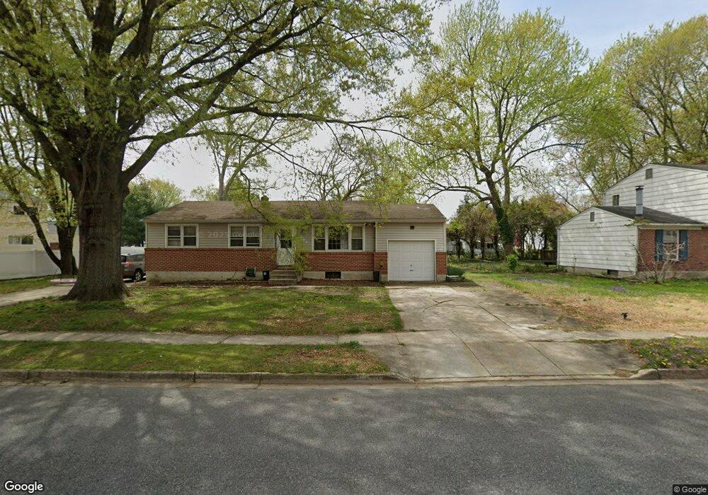
This home is located at 320 Nimitz Rd, Dover, DE 19901 and is currently estimated at $274,868, approximately $243 per square foot. 320 Nimitz Rd is a home located in Kent County with nearby schools including Towne Point Elementary School, William Henry Middle School, and Central Middle School.
Ownership History
Date
Name
Owned For
Owner Type
Purchase Details
Closed on
May 25, 2018
Sold by
Bayview Loan Servicing Llc
Bought by
Lin Family Property Llc
Current Estimated Value
Purchase Details
Closed on
Mar 5, 2010
Sold by
Russo Albert J
Bought by
Ampadu Christian
Home Financials for this Owner
Home Financials are based on the most recent Mortgage that was taken out on this home.
Original Mortgage
$145,319
Interest Rate
5.25%
Mortgage Type
FHA
Create a Home Valuation Report for This Property
The Home Valuation Report is an in-depth analysis detailing your home's value as well as a comparison with similar homes in the area
Home Values in the Area
Average Home Value in this Area
Purchase History
| Date | Buyer | Sale Price | Title Company |
|---|---|---|---|
| Lin Family Property Llc | $87,900 | None Available | |
| Ampadu Christian | $148,000 | None Available |
Source: Public Records
Mortgage History
| Date | Status | Borrower | Loan Amount |
|---|---|---|---|
| Previous Owner | Ampadu Christian | $145,319 |
Source: Public Records
Tax History
| Year | Tax Paid | Tax Assessment Tax Assessment Total Assessment is a certain percentage of the fair market value that is determined by local assessors to be the total taxable value of land and additions on the property. | Land | Improvement |
|---|---|---|---|---|
| 2025 | $1,413 | $240,500 | $91,000 | $149,500 |
| 2024 | $1,365 | $240,500 | $91,000 | $149,500 |
| 2023 | $939 | $31,900 | $9,600 | $22,300 |
| 2022 | $908 | $31,900 | $9,600 | $22,300 |
| 2021 | $874 | $31,900 | $9,600 | $22,300 |
| 2020 | $845 | $31,900 | $9,600 | $22,300 |
| 2019 | $798 | $31,900 | $9,600 | $22,300 |
| 2018 | $729 | $31,900 | $9,600 | $22,300 |
| 2017 | $717 | $31,900 | $0 | $0 |
| 2016 | $719 | $31,900 | $0 | $0 |
| 2015 | $719 | $31,900 | $0 | $0 |
| 2014 | $721 | $31,900 | $0 | $0 |
Source: Public Records
Map
Nearby Homes
- 40 Anchor Ln
- 1221 Garfield Dr
- 139 Spruance Rd
- 348 W Wind Dr
- 1014 White Oak Rd
- 114 Spruance Rd
- 108 N Halsey Rd
- 33 Spruance Rd
- 848 Townsend Blvd
- 750 Miller Dr
- 915 E Division St
- 920 E Division St
- 809 Bacon Ave
- 10 Loockerman Ct
- 711 E Division St
- 436 Nob Hill Rd
- 223 Shadybrook Dr
- 162 Lexington Place
- 107 Lakeview Dr
- 714 Marta Dr
- 330 Nimitz Rd
- 205 Macarthur Dr
- 211 Macarthur Dr
- 217 Macarthur Dr
- 338 Nimitz Rd
- 325 Nimitz Rd
- 317 Nimitz Rd
- 221 Macarthur Dr
- 331 Nimitz Rd
- 344 Nimitz Rd
- 337 Nimitz Rd
- 206 Macarthur Dr
- 225 Macarthur Dr
- 222 Macarthur Dr
- 228 Macarthur Dr
- 218 Macarthur Dr
- 210 Macarthur Dr
- 234 Macarthur Dr
- 345 Nimitz Rd
- 352 Nimitz Rd