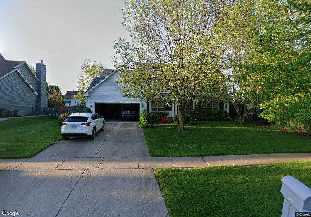
324 Millstream Ln Oswego, IL 60543
Northwest Oswego NeighborhoodEstimated Value: $444,000 - $479,000
4
Beds
3
Baths
2,756
Sq Ft
$167/Sq Ft
Est. Value
About This Home
This home is located at 324 Millstream Ln, Oswego, IL 60543 and is currently estimated at $461,351, approximately $167 per square foot. 324 Millstream Ln is a home located in Kendall County with nearby schools including Fox Chase Elementary School, Traughber Junior High School, and Oswego High School.
Ownership History
Date
Name
Owned For
Owner Type
Purchase Details
Closed on
Aug 1, 2006
Sold by
Savicki Alan F
Bought by
Sutton Brent and Parchert Laura
Current Estimated Value
Home Financials for this Owner
Home Financials are based on the most recent Mortgage that was taken out on this home.
Original Mortgage
$32,450
Interest Rate
6.44%
Mortgage Type
Stand Alone Second
Purchase Details
Closed on
Jun 12, 2001
Sold by
The Old Second National Bank Of Aurora
Bought by
Savicki Alan F
Home Financials for this Owner
Home Financials are based on the most recent Mortgage that was taken out on this home.
Original Mortgage
$195,414
Interest Rate
7.22%
Create a Home Valuation Report for This Property
The Home Valuation Report is an in-depth analysis detailing your home's value as well as a comparison with similar homes in the area
Home Values in the Area
Average Home Value in this Area
Purchase History
| Date | Buyer | Sale Price | Title Company |
|---|---|---|---|
| Sutton Brent | $325,000 | Ticor Title | |
| Savicki Alan F | $244,500 | -- |
Source: Public Records
Mortgage History
| Date | Status | Borrower | Loan Amount |
|---|---|---|---|
| Closed | Sutton Brent | $32,450 | |
| Open | Sutton Brent | $259,920 | |
| Previous Owner | Savicki Alan F | $195,414 |
Source: Public Records
Tax History Compared to Growth
Tax History
| Year | Tax Paid | Tax Assessment Tax Assessment Total Assessment is a certain percentage of the fair market value that is determined by local assessors to be the total taxable value of land and additions on the property. | Land | Improvement |
|---|---|---|---|---|
| 2024 | $9,734 | $126,965 | $27,628 | $99,337 |
| 2023 | $8,521 | $110,404 | $24,024 | $86,380 |
| 2022 | $8,521 | $100,367 | $21,840 | $78,527 |
| 2021 | $8,468 | $96,507 | $21,000 | $75,507 |
| 2020 | $8,118 | $91,911 | $20,000 | $71,911 |
| 2019 | $8,460 | $94,136 | $20,000 | $74,136 |
| 2018 | $8,916 | $95,198 | $22,347 | $72,851 |
| 2017 | $8,380 | $87,740 | $20,596 | $67,144 |
| 2016 | $8,026 | $83,166 | $19,522 | $63,644 |
| 2015 | $3,912 | $77,725 | $18,245 | $59,480 |
| 2014 | -- | $75,462 | $17,714 | $57,748 |
| 2013 | -- | $79,433 | $18,646 | $60,787 |
Source: Public Records
Map
Nearby Homes
- 125 Presidential Blvd Unit 3248
- 514 Bentson St
- 505 Parkland Ct
- 431 Badger Ln
- 238 Willowwood Dr
- 5055 U S 34
- 114 Riverview Ct
- 548 Arbor Ln
- 2110 State Route 31
- 141 River Mist Dr
- 116 River Mist Dr
- 135 River Mist Dr Unit 2
- 133 River Mist Dr Unit 3
- 1415 State Route 31
- LOT 10 SW Station Dr
- 1900 Light Rd Unit 208
- 69 Monroe St
- 2300 Light Rd Unit 209
- 2800 Light Rd Unit 102
- 2600 Light Rd Unit 210
- 322 Millstream Ln
- 326 Millstream Ln
- 419 Stonewater Ln
- 417 Stonewater Ln
- 421 Stonewater Ln
- 320 Millstream Ln Unit 1
- 328 Millstream Ln
- 323 Millstream Ln
- 321 Millstream Ln Unit 1
- 415 Stonewater Ln
- 423 Stonewater Ln
- 327 Millstream Ln
- 319 Millstream Ln Unit 1
- 318 Millstream Ln
- 330 Millstream Ln Unit 1
- 413 Stonewater Ln
- 425 Stonewater Ln
- 418 Stonewater Ln
- 422 Reagan Dr Unit 1
- 329 Millstream Ln Unit 1