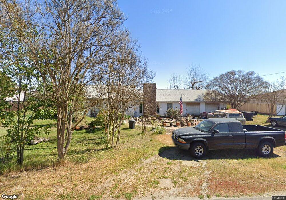
33 Reed Rd Oakdale, CA 95361
Estimated Value: $480,656 - $508,000
2
Beds
2
Baths
1,584
Sq Ft
$311/Sq Ft
Est. Value
About This Home
This home is located at 33 Reed Rd, Oakdale, CA 95361 and is currently estimated at $493,414, approximately $311 per square foot. 33 Reed Rd is a home located in Stanislaus County with nearby schools including Fair Oaks Elementary School, Oakdale Junior High School, and East Stanislaus High School.
Ownership History
Date
Name
Owned For
Owner Type
Purchase Details
Closed on
Jul 21, 2021
Sold by
Kreger Daniel J and Kreger Celia S
Bought by
Kreger Daniel J and Cunanan Kreger Celia
Current Estimated Value
Purchase Details
Closed on
Aug 8, 1994
Sold by
Stewart Carolyn Batson and Cantrell Carolynn
Bought by
Cunanan Kreger Daniel J and Cunanan Kreger Celia S
Home Financials for this Owner
Home Financials are based on the most recent Mortgage that was taken out on this home.
Original Mortgage
$133,896
Interest Rate
8.51%
Purchase Details
Closed on
Jul 7, 1994
Sold by
Batson Gordon A
Bought by
Cunanan Kreger Daniel J and Cunanan Kreger Celia S
Home Financials for this Owner
Home Financials are based on the most recent Mortgage that was taken out on this home.
Original Mortgage
$133,896
Interest Rate
8.51%
Create a Home Valuation Report for This Property
The Home Valuation Report is an in-depth analysis detailing your home's value as well as a comparison with similar homes in the area
Home Values in the Area
Average Home Value in this Area
Purchase History
| Date | Buyer | Sale Price | Title Company |
|---|---|---|---|
| Kreger Daniel J | -- | None Available | |
| Cunanan Kreger Daniel J | -- | First American Title Co | |
| Cunanan Kreger Daniel J | -- | First American Title Co | |
| Cunanan Kreger Daniel J | $136,000 | -- |
Source: Public Records
Mortgage History
| Date | Status | Borrower | Loan Amount |
|---|---|---|---|
| Previous Owner | Cunanan Kreger Daniel J | $133,896 |
Source: Public Records
Tax History
| Year | Tax Paid | Tax Assessment Tax Assessment Total Assessment is a certain percentage of the fair market value that is determined by local assessors to be the total taxable value of land and additions on the property. | Land | Improvement |
|---|---|---|---|---|
| 2025 | $2,703 | $228,422 | $109,172 | $119,250 |
| 2024 | $2,573 | $223,944 | $107,032 | $116,912 |
| 2023 | $2,522 | $219,554 | $104,934 | $114,620 |
| 2022 | $2,482 | $215,250 | $102,877 | $112,373 |
| 2021 | $2,443 | $211,030 | $100,860 | $110,170 |
| 2020 | $2,418 | $208,867 | $99,826 | $109,041 |
| 2019 | $2,384 | $204,772 | $97,869 | $106,903 |
| 2018 | $2,352 | $200,757 | $95,950 | $104,807 |
| 2017 | $2,314 | $196,821 | $94,069 | $102,752 |
| 2016 | $2,276 | $192,963 | $92,225 | $100,738 |
| 2015 | $2,250 | $190,065 | $90,840 | $99,225 |
| 2014 | $2,230 | $186,343 | $89,061 | $97,282 |
Source: Public Records
Map
Nearby Homes
- 2134 Navajo Ct
- 2337 Rainwood Ln
- 1957 Blue Spruce Dr
- 366 Romano Way
- 1879 Silvio Way
- 1810 Silvio Way
- 0 Odessa Way Unit 226014449
- 549 Fresian Dr
- 2153 Saddlebrook Way
- 206 S Lee Ave
- 2532 Laurel Ridge Ct
- 2848 Westport Cir
- 2370 Shire Way
- 2908 Westport Cir
- 225 Ash Ave
- 1766 Churchill Downs Cir
- 562 Ranger St
- 174 Warrington Ave
- 1500 Walnut St
- 332 Hinkley Ave
Your Personal Tour Guide
Ask me questions while you tour the home.