Estimated Value: $521,000 - $581,000
3
Beds
2
Baths
2,749
Sq Ft
$199/Sq Ft
Est. Value
About This Home
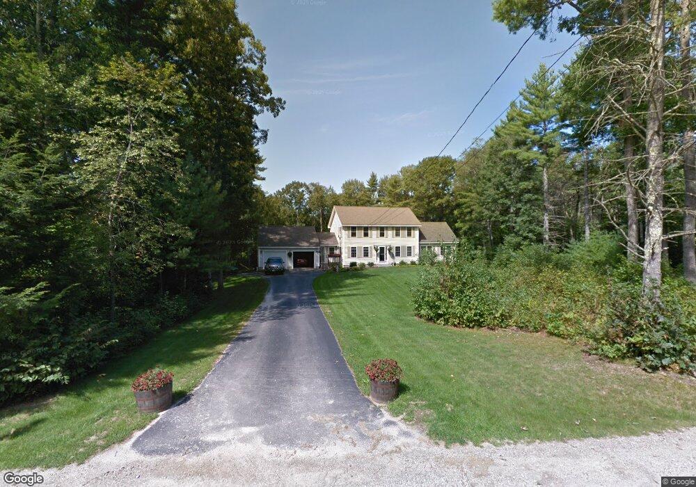
This home is located at 330 River Rd, Epsom, NH 03234 and is currently estimated at $546,316, approximately $198 per square foot. 330 River Rd is a home located in Merrimack County with nearby schools including Epsom Central School, Epsom Better Buddies, and Cornerstone Christian Academy.
Ownership History
Date
Name
Owned For
Owner Type
Purchase Details
Closed on
Apr 27, 2012
Sold by
Beck Shelley C and Goyette Michael R
Bought by
Goyette Michael R and Goyette Shelley C
Current Estimated Value
Home Financials for this Owner
Home Financials are based on the most recent Mortgage that was taken out on this home.
Original Mortgage
$230,280
Outstanding Balance
$154,967
Interest Rate
3.75%
Mortgage Type
FHA
Estimated Equity
$391,349
Purchase Details
Closed on
Jan 23, 2002
Sold by
Dube Paul R and Dube Tracey L
Bought by
Goyette Michael R
Home Financials for this Owner
Home Financials are based on the most recent Mortgage that was taken out on this home.
Original Mortgage
$194,750
Interest Rate
7.08%
Create a Home Valuation Report for This Property
The Home Valuation Report is an in-depth analysis detailing your home's value as well as a comparison with similar homes in the area
Home Values in the Area
Average Home Value in this Area
Purchase History
| Date | Buyer | Sale Price | Title Company |
|---|---|---|---|
| Goyette Michael R | -- | -- | |
| Goyette Michael R | $205,000 | -- |
Source: Public Records
Mortgage History
| Date | Status | Borrower | Loan Amount |
|---|---|---|---|
| Open | Goyette Michael R | $230,280 | |
| Previous Owner | Goyette Michael R | $220,000 | |
| Previous Owner | Goyette Michael R | $30,000 | |
| Previous Owner | Goyette Michael R | $194,750 |
Source: Public Records
Tax History
| Year | Tax Paid | Tax Assessment Tax Assessment Total Assessment is a certain percentage of the fair market value that is determined by local assessors to be the total taxable value of land and additions on the property. | Land | Improvement |
|---|---|---|---|---|
| 2025 | $10,882 | $620,400 | $188,500 | $431,900 |
| 2024 | $8,946 | $335,800 | $101,800 | $234,000 |
| 2023 | $8,271 | $335,800 | $101,800 | $234,000 |
| 2022 | $8,005 | $335,800 | $101,800 | $234,000 |
| 2021 | $7,938 | $335,800 | $101,800 | $234,000 |
| 2020 | $7,331 | $335,800 | $101,800 | $234,000 |
| 2019 | $7,615 | $281,100 | $85,100 | $196,000 |
| 2018 | $7,300 | $281,100 | $85,100 | $196,000 |
| 2017 | $7,216 | $281,100 | $85,100 | $196,000 |
| 2016 | $7,036 | $281,100 | $85,100 | $196,000 |
| 2015 | $6,696 | $281,100 | $85,100 | $196,000 |
| 2014 | $5,832 | $262,000 | $79,900 | $182,100 |
| 2013 | $5,893 | $261,100 | $79,900 | $181,200 |
Source: Public Records
Map
Nearby Homes
- 9 Princess Ln
- 11 Nash Ln
- 2 Archer Cir
- 15 Nash Ln
- 0 Poor Town Rd Unit 4
- 27 Hillside Dr
- 28 Woodlawn Dr
- 8 Bush Ave
- 1 Jefferson Ave
- 5 Catamount Hill Dr
- 365 Deerfield Rd
- 821 Cross Country Rd
- 426 Dawn Ct Unit 22
- 431 Dawn Ct Unit 17
- 441 Blane Cir Unit 12
- 474 Blane Cir Unit 40
- 88 Old Town Road Extension
- 0 Dover Unit 33 & 35
- 401 Sixth Range Rd
- 260 Church Rd
Your Personal Tour Guide
Ask me questions while you tour the home.