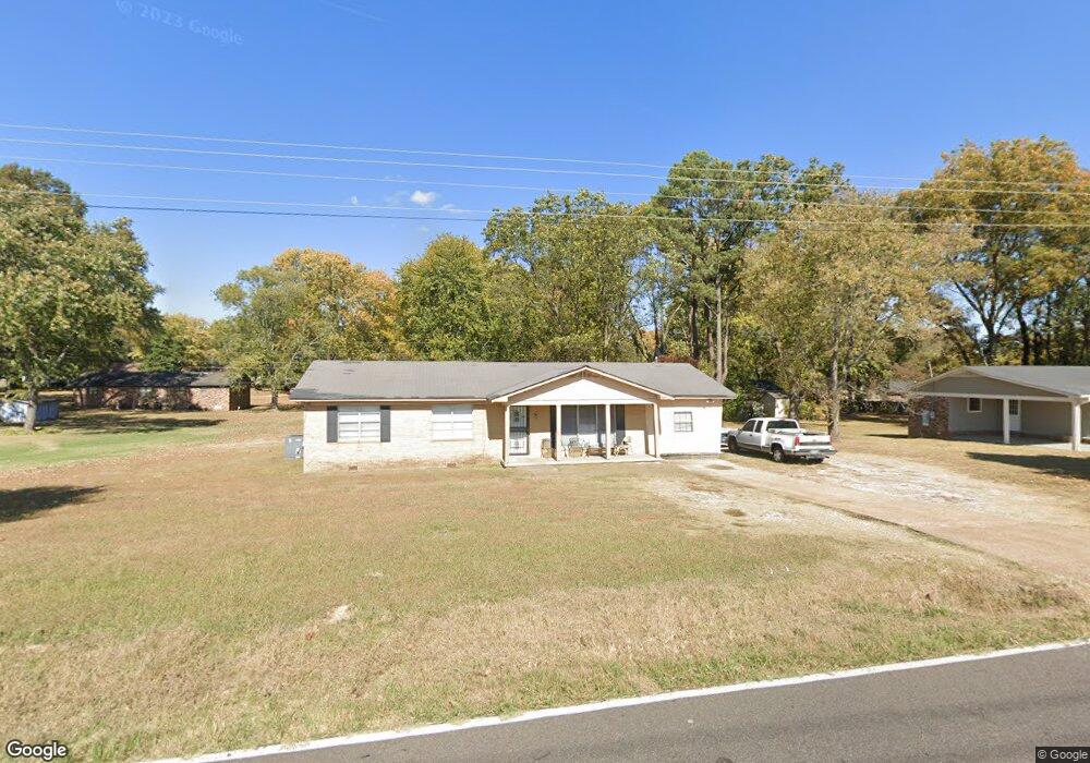
330 Wortham Rd Covington, TN 38019
Estimated Value: $158,000 - $186,000
Studio
2
Baths
1,512
Sq Ft
$115/Sq Ft
Est. Value
About This Home
This home is located at 330 Wortham Rd, Covington, TN 38019 and is currently estimated at $173,362, approximately $114 per square foot. 330 Wortham Rd is a home located in Tipton County with nearby schools including Crestview Elementary School, Crestview Middle School, and Covington High School.
Ownership History
Date
Name
Owned For
Owner Type
Purchase Details
Closed on
Nov 7, 2003
Sold by
L & D Enterprises
Bought by
Charlotte Tipton
Current Estimated Value
Purchase Details
Closed on
Dec 16, 1983
Bought by
Burnett Willie B
Purchase Details
Closed on
Jan 14, 1967
Bought by
Burnett Willie B
Create a Home Valuation Report for This Property
The Home Valuation Report is an in-depth analysis detailing your home's value as well as a comparison with similar homes in the area
Purchase History
| Date | Buyer | Sale Price | Title Company |
|---|---|---|---|
| Charlotte Tipton | $69,000 | -- | |
| Burnett Willie B | -- | -- | |
| Burnett Willie B | -- | -- |
Source: Public Records
Mortgage History
| Date | Status | Borrower | Loan Amount |
|---|---|---|---|
| Previous Owner | Burnett Willie B | $67,444 |
Source: Public Records
Tax History
| Year | Tax Paid | Tax Assessment Tax Assessment Total Assessment is a certain percentage of the fair market value that is determined by local assessors to be the total taxable value of land and additions on the property. | Land | Improvement |
|---|---|---|---|---|
| 2025 | -- | $42,900 | $4,875 | $38,025 |
| 2024 | -- | $42,900 | $4,875 | $38,025 |
| 2023 | $1,087 | $42,900 | $4,875 | $38,025 |
| 2022 | $1,007 | $30,700 | $3,575 | $27,125 |
| 2021 | $1,007 | $30,700 | $3,575 | $27,125 |
| 2020 | $928 | $30,700 | $3,575 | $27,125 |
| 2019 | $824 | $21,975 | $2,750 | $19,225 |
| 2018 | $824 | $21,975 | $2,750 | $19,225 |
| 2017 | $824 | $21,975 | $2,750 | $19,225 |
| 2016 | $824 | $21,975 | $2,750 | $19,225 |
| 2015 | $823 | $21,975 | $2,750 | $19,225 |
| 2014 | $824 | $21,986 | $0 | $0 |
Source: Public Records
Map
Nearby Homes
- 1844 Wooten St
- 0 Hwy 51
- 1186 U S 51
- 1015 Wortham Dr
- LOT 7 Oil Mill Rd
- LOT 5 Oil Mill Rd
- LOT 3 Oil Mill Rd
- LOT 4 Oil Mill Rd
- LOT 8 Oil Mill Rd
- LOT 6 Oil Mill Rd
- 845 Antioch Hwy 51 Rd
- 451 Yarbrough Rd
- 311 E Ripley Ave
- 900 Peete St
- 902 Hatchie Ave
- 417 Turner Ln
- 664 Rialto Rd
- 301 N Maple St
- 320 N High St
- 215 N Maple St
- 342 Wortham Rd
- 318 Wortham Rd
- 331 Virginia Ave
- 319 Virginia Ave
- 1529 Andrew St
- 354 Wortham Rd
- 355 Virginia Ave
- 1521 Andrew St
- 330 Virginia Ave
- 342 Virginia Ave
- 318 Virginia Ave
- 354 Virginia Ave
- 390 Wortham Rd
- 1502 Andrew St Unit 15
- 1514 Andrew St Unit 15
- 306 Virginia Ave
- 343 Sunset Ave
- 331 Sunset Ave
- 392 Wortham Rd
- 355 Sunset Ave
Your Personal Tour Guide
Ask me questions while you tour the home.