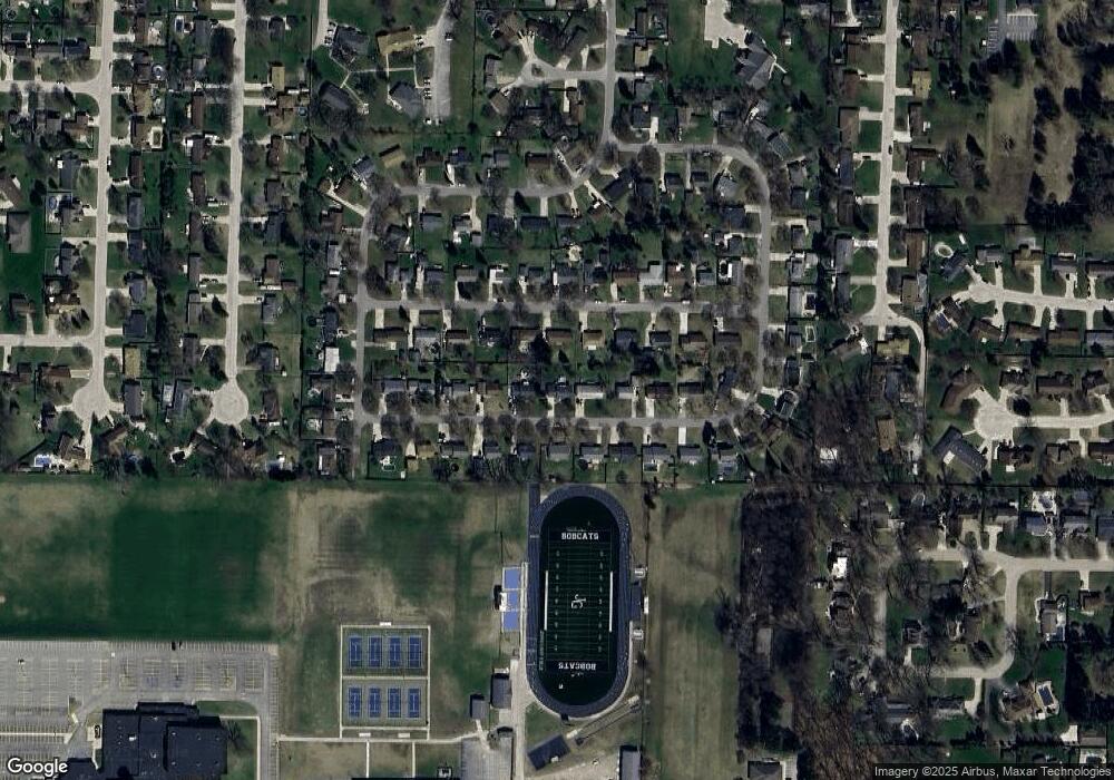
3311 Birchbrook Dr Bay City, MI 48706
Estimated Value: $200,148 - $249,000
3
Beds
2
Baths
1,887
Sq Ft
$116/Sq Ft
Est. Value
About This Home
This home is located at 3311 Birchbrook Dr, Bay City, MI 48706 and is currently estimated at $219,037, approximately $116 per square foot. 3311 Birchbrook Dr is a home located in Bay County with nearby schools including John Glenn High School, State Street Academy, and Faith Lutheran School.
Ownership History
Date
Name
Owned For
Owner Type
Purchase Details
Closed on
Jan 13, 2014
Sold by
Dryzga Vickie Lynn
Bought by
Ddddddddddddddddddddddddddddddddddd Jay Roberrrrrrrrt
Current Estimated Value
Purchase Details
Closed on
Feb 29, 2012
Sold by
Dryzga Jay
Bought by
Dryzga Jay and Dryzga Vickie Lynn
Home Financials for this Owner
Home Financials are based on the most recent Mortgage that was taken out on this home.
Original Mortgage
$93,600
Interest Rate
3.92%
Mortgage Type
New Conventional
Purchase Details
Closed on
Jul 19, 2002
Sold by
Pacynski Thomas and Beverly Ann
Bought by
Dryzga Jay
Create a Home Valuation Report for This Property
The Home Valuation Report is an in-depth analysis detailing your home's value as well as a comparison with similar homes in the area
Home Values in the Area
Average Home Value in this Area
Purchase History
| Date | Buyer | Sale Price | Title Company |
|---|---|---|---|
| Ddddddddddddddddddddddddddddddddddd Jay Roberrrrrrrrt | -- | None Available | |
| Dryzga Jay | -- | None Available | |
| Dryzga Jay | $129,900 | -- |
Source: Public Records
Mortgage History
| Date | Status | Borrower | Loan Amount |
|---|---|---|---|
| Previous Owner | Dryzga Jay | $93,600 |
Source: Public Records
Tax History Compared to Growth
Tax History
| Year | Tax Paid | Tax Assessment Tax Assessment Total Assessment is a certain percentage of the fair market value that is determined by local assessors to be the total taxable value of land and additions on the property. | Land | Improvement |
|---|---|---|---|---|
| 2025 | $2,026 | $69,950 | $0 | $0 |
| 2024 | $1,096 | $63,000 | $0 | $0 |
| 2023 | $1,009 | $56,250 | $0 | $0 |
| 2022 | $1,725 | $50,100 | $0 | $0 |
| 2021 | $1,575 | $45,600 | $45,600 | $0 |
| 2020 | $1,540 | $43,550 | $43,550 | $0 |
| 2019 | $1,479 | $41,300 | $0 | $0 |
| 2018 | $1,461 | $48,950 | $0 | $0 |
| 2017 | $1,377 | $49,400 | $0 | $0 |
| 2016 | $1,376 | $48,300 | $0 | $48,300 |
| 2015 | -- | $39,750 | $0 | $39,750 |
| 2014 | -- | $43,650 | $0 | $43,650 |
Source: Public Records
Map
Nearby Homes
- 3322 Birchbrook Dr
- 3425 Win Kae Place
- 3226 Kiesel Rd
- 3077 Glenway Place
- 3868 2 Mile Rd
- 714 Frost Dr
- 3112 Gaslight Dr
- 3112 Gaslight Unit 48 Dr
- 4464 W Park Dr
- 4543 Westfield Ct
- 538 Handy Dr
- 1005 N Wenona Ave
- 16 Cove Dr
- 12 Cove Dr
- 14 Cove Dr
- 23 Old Kawkawlin Rd
- 1707 N Henry St
- 25 State Park Dr
- 4700 Foxcroft Dr
- 1108 N Linn St
- 3305 Birchbrook Dr
- 3321 Birchbrook Dr
- 3312 Glenbrook Dr
- 3329 Birchbrook Dr
- 3306 Glenbrook Dr
- 3295 Birchbrook Dr
- 3312 Birchbrook Dr
- 3322 Glenbrook Dr
- 3330 Birchbrook Dr
- 3306 Birchbrook Dr
- 3296 Glenbrook Dr
- 3330 Glenbrook Dr
- 3296 Birchbrook Dr
- 3337 Birchbrook Dr
- 3287 Birchbrook Dr
- 3319 Glenbrook Dr
- 3338 Glenbrook Dr
- 3288 Glenbrook Dr
- 3327 Glenbrook Dr
- 3313 Glenbrook Dr
