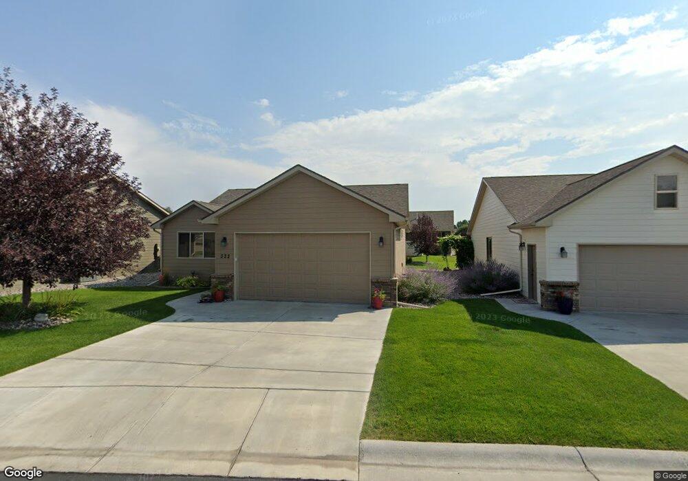
332 Stonegate Cir Billings, MT 59102
West End NeighborhoodEstimated Value: $342,000 - $520,000
3
Beds
3
Baths
1,500
Sq Ft
$296/Sq Ft
Est. Value
About This Home
This home is located at 332 Stonegate Cir, Billings, MT 59102 and is currently estimated at $443,792, approximately $295 per square foot. 332 Stonegate Cir is a home located in Yellowstone County with nearby schools including Big Sky Elementary School, Ben Steele Middle School, and Billings West High School.
Ownership History
Date
Name
Owned For
Owner Type
Purchase Details
Closed on
Aug 24, 2011
Sold by
Bts Inc
Bought by
London Susan C and Susan C London Living Trust
Current Estimated Value
Home Financials for this Owner
Home Financials are based on the most recent Mortgage that was taken out on this home.
Original Mortgage
$98,000
Outstanding Balance
$67,410
Interest Rate
4.43%
Mortgage Type
New Conventional
Estimated Equity
$376,382
Create a Home Valuation Report for This Property
The Home Valuation Report is an in-depth analysis detailing your home's value as well as a comparison with similar homes in the area
Home Values in the Area
Average Home Value in this Area
Purchase History
| Date | Buyer | Sale Price | Title Company |
|---|---|---|---|
| London Susan C | -- | Chicago Title |
Source: Public Records
Mortgage History
| Date | Status | Borrower | Loan Amount |
|---|---|---|---|
| Open | London Susan C | $98,000 |
Source: Public Records
Tax History Compared to Growth
Tax History
| Year | Tax Paid | Tax Assessment Tax Assessment Total Assessment is a certain percentage of the fair market value that is determined by local assessors to be the total taxable value of land and additions on the property. | Land | Improvement |
|---|---|---|---|---|
| 2025 | $4,154 | $485,200 | $81,291 | $403,909 |
| 2024 | $4,154 | $436,900 | $72,308 | $364,592 |
| 2023 | $4,146 | $436,900 | $72,308 | $364,592 |
| 2022 | $3,081 | $326,400 | $0 | $0 |
| 2021 | $3,370 | $326,400 | $0 | $0 |
| 2020 | $3,292 | $305,000 | $0 | $0 |
| 2019 | $3,140 | $305,000 | $0 | $0 |
| 2018 | $2,993 | $284,900 | $0 | $0 |
| 2017 | $2,907 | $284,900 | $0 | $0 |
| 2016 | $2,751 | $272,500 | $0 | $0 |
| 2015 | $2,689 | $272,500 | $0 | $0 |
| 2014 | $2,601 | $140,450 | $0 | $0 |
Source: Public Records
Map
Nearby Homes
- 2968 Daystar Dr
- 260 Brookshire Blvd
- 2916 Monad Rd
- 3121 New Hope Dr
- 3121 New Hope Dr Unit 9
- 3030 Hunters Ridge Loop
- 3087 Hunters Ridge Loop
- 3175 Solar Blvd Unit 14
- 14 Bonanza Dr
- 12 Golden Butte Dr
- 499 Greenspring Place
- 2930 Lynn Ave
- 3129 Stillwater Dr
- 3482 Shenandoah Dr
- 3468 Shenandoah Dr
- 3291 Banff Ave
- 3297 Banff Ave Unit 10
- 3340 Tahoe Dr
- 3136 Saint Johns Ave
- 3231 Central Ave
- 332 Stonegate Cir
- 330 Stonegate Cir
- 334 Stonegate Cir
- 2977 E Plymouth Place
- 2981 E Plymouth Place
- 328 Stonegate Cir
- 2983 E Plymouth Place
- 331 Stonegate Cir
- 2987 E Plymouth Place
- 2971 Spring Meadow Ct
- 335 Stonegate Cir
- 333 Stonegate Cir
- 338 Stonegate Cir
- 2938 E Plymouth Place
- 2972 Spring Meadow Ct
- 2970 Spring Meadow Ct
- 2969 Spring Meadow Ct
- 340 Stonegate Cir
- 2991 W Plymouth Place
- 2986 Daystar Dr