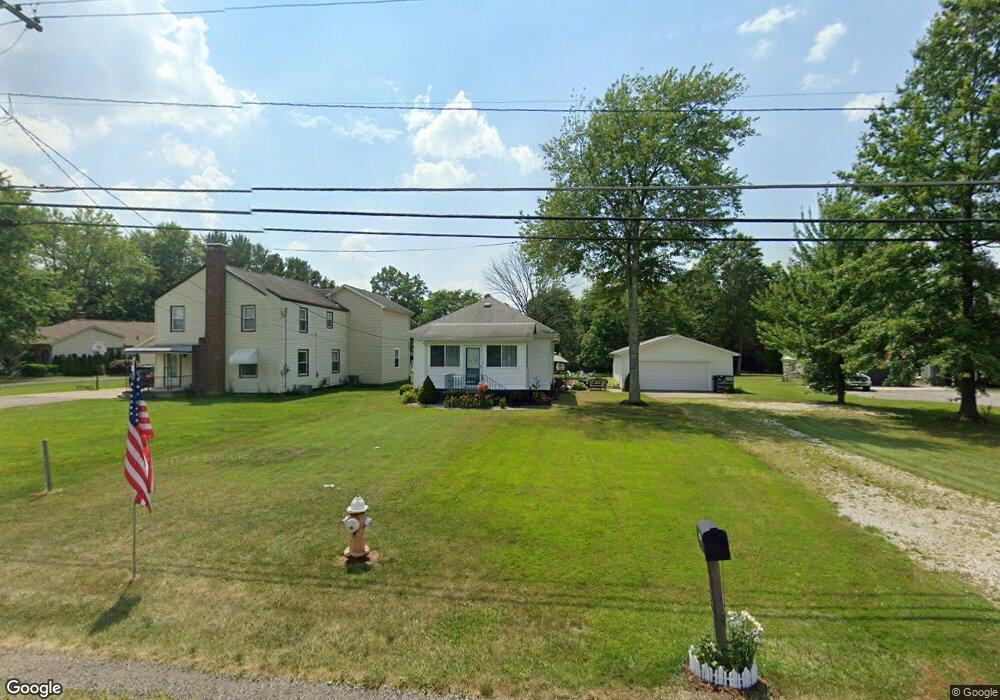
3328 S Canfield Niles Rd Canfield, OH 44406
Austintown NeighborhoodEstimated Value: $96,944 - $323,000
2
Beds
1
Bath
576
Sq Ft
$293/Sq Ft
Est. Value
About This Home
This home is located at 3328 S Canfield Niles Rd, Canfield, OH 44406 and is currently estimated at $168,736, approximately $292 per square foot. 3328 S Canfield Niles Rd is a home located in Mahoning County with nearby schools including Austintown Elementary School, Austintown Intermediate School, and Austintown Middle School.
Ownership History
Date
Name
Owned For
Owner Type
Purchase Details
Closed on
Feb 7, 2023
Sold by
Satterlee Robert A and Satterlee Lisa M
Bought by
New Rt 46 Llc
Current Estimated Value
Purchase Details
Closed on
Nov 23, 2005
Sold by
Spier William
Bought by
Not Provided Robert A and Not Provided Not Provided
Purchase Details
Closed on
Jun 3, 1993
Bought by
Spier Doris
Create a Home Valuation Report for This Property
The Home Valuation Report is an in-depth analysis detailing your home's value as well as a comparison with similar homes in the area
Home Values in the Area
Average Home Value in this Area
Purchase History
| Date | Buyer | Sale Price | Title Company |
|---|---|---|---|
| New Rt 46 Llc | -- | None Listed On Document | |
| New Rt 46 Llc | -- | None Listed On Document | |
| Not Provided Robert A | $51,000 | -- | |
| Spier Doris | -- | -- |
Source: Public Records
Tax History Compared to Growth
Tax History
| Year | Tax Paid | Tax Assessment Tax Assessment Total Assessment is a certain percentage of the fair market value that is determined by local assessors to be the total taxable value of land and additions on the property. | Land | Improvement |
|---|---|---|---|---|
| 2024 | $1,276 | $27,210 | $7,600 | $19,610 |
| 2023 | $1,257 | $27,210 | $7,600 | $19,610 |
| 2022 | $1,023 | $17,730 | $7,600 | $10,130 |
| 2021 | $1,023 | $17,730 | $7,600 | $10,130 |
| 2020 | $1,028 | $17,730 | $7,600 | $10,130 |
| 2019 | $1,129 | $17,730 | $7,600 | $10,130 |
| 2018 | $1,060 | $17,730 | $7,600 | $10,130 |
| 2017 | $1,071 | $17,730 | $7,600 | $10,130 |
| 2016 | $1,085 | $18,020 | $5,530 | $12,490 |
| 2015 | $1,052 | $18,020 | $5,530 | $12,490 |
| 2014 | $1,057 | $18,020 | $5,530 | $12,490 |
| 2013 | $1,046 | $18,020 | $5,530 | $12,490 |
Source: Public Records
Map
Nearby Homes
- 3270 S Canfield Niles Rd
- 5285 Kirk Rd
- 2792 S Canfield Niles Rd
- 3475 42nd St
- 3481 Forty Second St
- 2211 Penny Ln
- 3695 High Meadow Dr
- 4651 Warwick Dr S
- 4674 Barrington Dr
- 4643 Warwick Dr S
- 4650 Bunny Trail
- 2493 Frostwood Dr
- 4689 Crabwood Dr
- 5678 Cider Mill Crossing
- 4114 S Raccoon Rd
- 5260 Revere Run
- 2414 Ardenwood Place
- 4488 S Raccoon Rd
- 0 Grayson Dr
- 0 Lake Wobegon Dr Unit 5104965
- 3350 S Canfield Niles Rd
- 3352 S Canfield Niles Rd
- 3304 S Canfield Niles Rd
- 3315 S Canfield Niles Rd
- 3325 S Canfield Niles Rd
- 3421 S Canfield Niles Rd
- 3500 S Canfield Niles Rd
- 3271 S Canfield Niles Rd
- 3461 S Canfield Niles Rd
- 3520 S Canfield Niles Rd
- 3250 S Canfield Niles Rd
- 3267 S Canfield Niles Rd
- 3530 S Canfield Niles Rd
- 3540 S Canfield Niles Rd
- 3550 S Canfield Niles Rd
- 5420 Kirk Rd
- 3560 S Canfield Niles Rd
- 5411 Kirk Rd
- 5381 Kirk Rd
- 5347 Kirk Rd