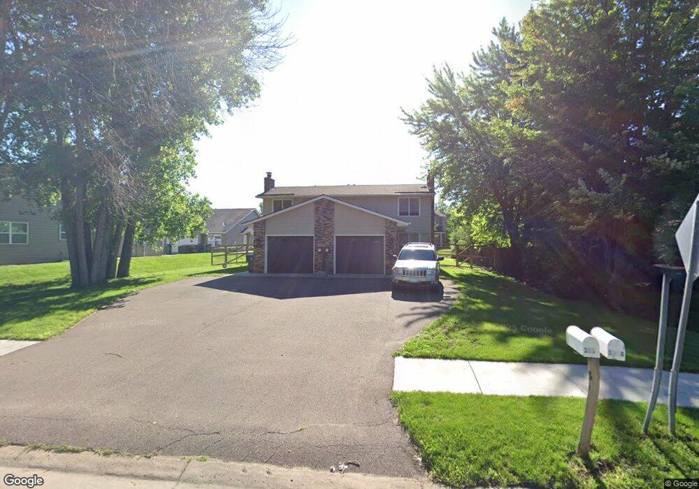
3330 Arcade St S Saint Paul, MN 55127
Estimated Value: $433,000 - $508,000
4
Beds
4
Baths
2,214
Sq Ft
$208/Sq Ft
Est. Value
About This Home
This home is located at 3330 Arcade St S, Saint Paul, MN 55127 and is currently estimated at $460,696, approximately $208 per square foot. 3330 Arcade St S is a home located in Ramsey County with nearby schools including Vadnais Heights Elementary School, Sunrise Park Middle School, and AFSA High School.
Ownership History
Date
Name
Owned For
Owner Type
Purchase Details
Closed on
Oct 29, 2020
Sold by
Worwa Edward L and Worwa Maryjean
Bought by
Worva Lindsay Marie and Worva Samuel Taylor
Current Estimated Value
Home Financials for this Owner
Home Financials are based on the most recent Mortgage that was taken out on this home.
Original Mortgage
$256,500
Outstanding Balance
$228,658
Interest Rate
2.9%
Mortgage Type
New Conventional
Estimated Equity
$232,038
Purchase Details
Closed on
Jun 3, 2019
Sold by
Andren Patricia K
Bought by
Wells Fargo Bank Na
Purchase Details
Closed on
Nov 30, 1999
Sold by
Erickson Daniel S and Erickson Lisa N
Bought by
Pignato Dauna M and Fischer Steven R
Create a Home Valuation Report for This Property
The Home Valuation Report is an in-depth analysis detailing your home's value as well as a comparison with similar homes in the area
Home Values in the Area
Average Home Value in this Area
Purchase History
| Date | Buyer | Sale Price | Title Company |
|---|---|---|---|
| Worva Lindsay Marie | $270,000 | Legacy Title | |
| Wells Fargo Bank Na | $20,778 | None Available | |
| Pignato Dauna M | $128,000 | -- | |
| Worwa Lindsay Lindsay | $270,000 | -- |
Source: Public Records
Mortgage History
| Date | Status | Borrower | Loan Amount |
|---|---|---|---|
| Open | Worva Lindsay Marie | $256,500 | |
| Closed | Worwa Lindsay Lindsay | $256,500 |
Source: Public Records
Tax History Compared to Growth
Tax History
| Year | Tax Paid | Tax Assessment Tax Assessment Total Assessment is a certain percentage of the fair market value that is determined by local assessors to be the total taxable value of land and additions on the property. | Land | Improvement |
|---|---|---|---|---|
| 2025 | $5,734 | $484,700 | $68,400 | $416,300 |
| 2023 | $5,734 | $432,400 | $68,400 | $364,000 |
| 2022 | $5,280 | $428,300 | $68,400 | $359,900 |
| 2021 | $2,440 | $381,600 | $68,400 | $313,200 |
| 2020 | $4,606 | $197,400 | $68,400 | $129,000 |
| 2019 | $5,826 | $197,400 | $68,400 | $129,000 |
| 2018 | $2,088 | $196,700 | $68,400 | $128,300 |
| 2017 | $2,058 | $172,800 | $68,400 | $104,400 |
| 2016 | $1,988 | $0 | $0 | $0 |
| 2015 | $1,864 | $155,100 | $68,400 | $86,700 |
| 2014 | $2,410 | $0 | $0 | $0 |
Source: Public Records
Map
Nearby Homes
- 832 Woodgate Dr Unit 107
- 697 Parkside Dr Unit 697H
- 731 Berwood Ave
- 3300 Greenbrier St Unit 3300C
- 3329 Greenbrier St
- 696 Monn Ave
- 963 E Berwood Ave
- 3120 Greenbrier St
- 3230 Edgerton St
- 3003 Greenbrier St
- 3000 Ontario Rd
- 3028 Edgerton St
- 3611 Edgerton St
- 3736 Centerville Rd
- 3092 Vanderbie St
- 3309 Nathaniel Ct
- 3015 Basswood St
- Revere Plan at Pioneer Commons - Colonial Manor Collection
- Franklin Plan at Pioneer Commons - Colonial Manor Collection
- Raleigh Plan at Pioneer Commons - Liberty Collection