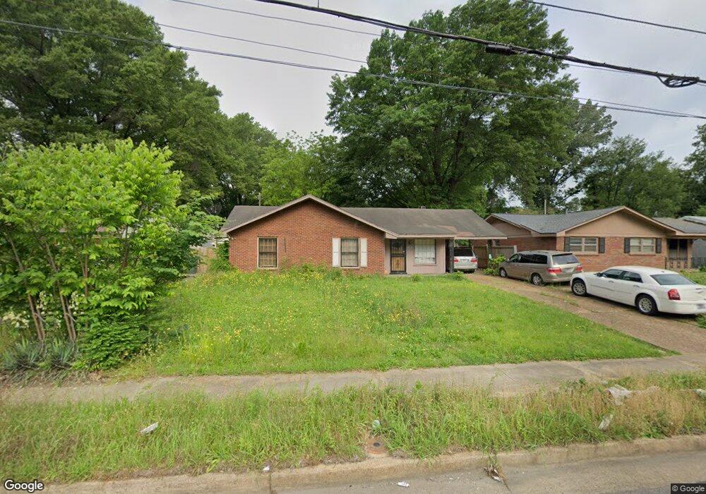
3353 S Perkins Rd Memphis, TN 38118
Parkway Village NeighborhoodEstimated Value: $120,000 - $150,000
3
Beds
2
Baths
1,328
Sq Ft
$103/Sq Ft
Est. Value
About This Home
This home is located at 3353 S Perkins Rd, Memphis, TN 38118 and is currently estimated at $136,463, approximately $102 per square foot. 3353 S Perkins Rd is a home located in Shelby County with nearby schools including Parkway Village Elementary School, Sheffield High School, and Memphis Merit Academy.
Ownership History
Date
Name
Owned For
Owner Type
Purchase Details
Closed on
Oct 31, 2003
Sold by
White Bernard and White Rebecca Duster
Bought by
Bah Alusine
Current Estimated Value
Home Financials for this Owner
Home Financials are based on the most recent Mortgage that was taken out on this home.
Original Mortgage
$79,373
Outstanding Balance
$36,798
Interest Rate
6%
Mortgage Type
FHA
Estimated Equity
$99,665
Purchase Details
Closed on
Oct 30, 1995
Bought by
Smith Fred H and Smith Edith G
Create a Home Valuation Report for This Property
The Home Valuation Report is an in-depth analysis detailing your home's value as well as a comparison with similar homes in the area
Home Values in the Area
Average Home Value in this Area
Purchase History
| Date | Buyer | Sale Price | Title Company |
|---|---|---|---|
| Bah Alusine | $80,000 | -- | |
| Smith Fred H | $59,900 | -- |
Source: Public Records
Mortgage History
| Date | Status | Borrower | Loan Amount |
|---|---|---|---|
| Open | Bah Alusine | $79,373 | |
| Closed | Bah Alusine | $5,178 |
Source: Public Records
Tax History Compared to Growth
Tax History
| Year | Tax Paid | Tax Assessment Tax Assessment Total Assessment is a certain percentage of the fair market value that is determined by local assessors to be the total taxable value of land and additions on the property. | Land | Improvement |
|---|---|---|---|---|
| 2025 | $588 | $30,500 | $4,250 | $26,250 |
| 2024 | $588 | $17,350 | $3,350 | $14,000 |
| 2023 | $1,057 | $17,350 | $3,350 | $14,000 |
| 2022 | $1,057 | $17,350 | $3,350 | $14,000 |
| 2021 | $1,069 | $17,350 | $3,350 | $14,000 |
| 2020 | $1,071 | $14,775 | $3,350 | $11,425 |
| 2019 | $1,071 | $14,775 | $3,350 | $11,425 |
| 2018 | $1,071 | $14,775 | $3,350 | $11,425 |
| 2017 | $607 | $14,775 | $3,350 | $11,425 |
| 2016 | $627 | $14,350 | $0 | $0 |
| 2014 | $627 | $14,350 | $0 | $0 |
Source: Public Records
Map
Nearby Homes
- 3347 S Perkins Rd
- 3339 S Perkins Rd
- 3274 Gaylord Ln
- 3433 S Perkins Rd
- 4616 Blanding Dr
- 4612 Chuck Ave
- 3287 Boxdale St
- 4833 Scottsdale Ave
- 3240 Boxdale St
- 4763 Wooddale Ave
- 4817 Wooddale Ave
- 4864 Cloister Ave
- 3118 Arrendale St
- 4947 Demeter Cove
- 4772 James Kent Ct
- 3408 Clearbrook St
- 3083 Arrendale St
- 4773 Aloha Ave
- 3419 Brutonwood Cove
- 3626 Outland Rd Unit 86
- 3359 S Perkins Rd
- 4701 Blanding Cove
- 4701 Blanding Ave
- 4700 Blanding Cove
- 4700 Blanding Ave
- 4697 Blanding Ave
- 4710 Chuck Ave
- 3331 S Perkins Rd
- 4696 Blanding Ave
- 4700 Chuck Ave
- 4693 Blanding Ave
- 3356 S Perkins Rd
- 3368 S Perkins Rd
- 3350 S Perkins Rd
- 3344 S Perkins Rd
- 4713 Scottsdale Ave
- 3323 S Perkins Rd
- 4692 Blanding Cove
- 4692 Blanding Ave
- 4705 Scottsdale Ave