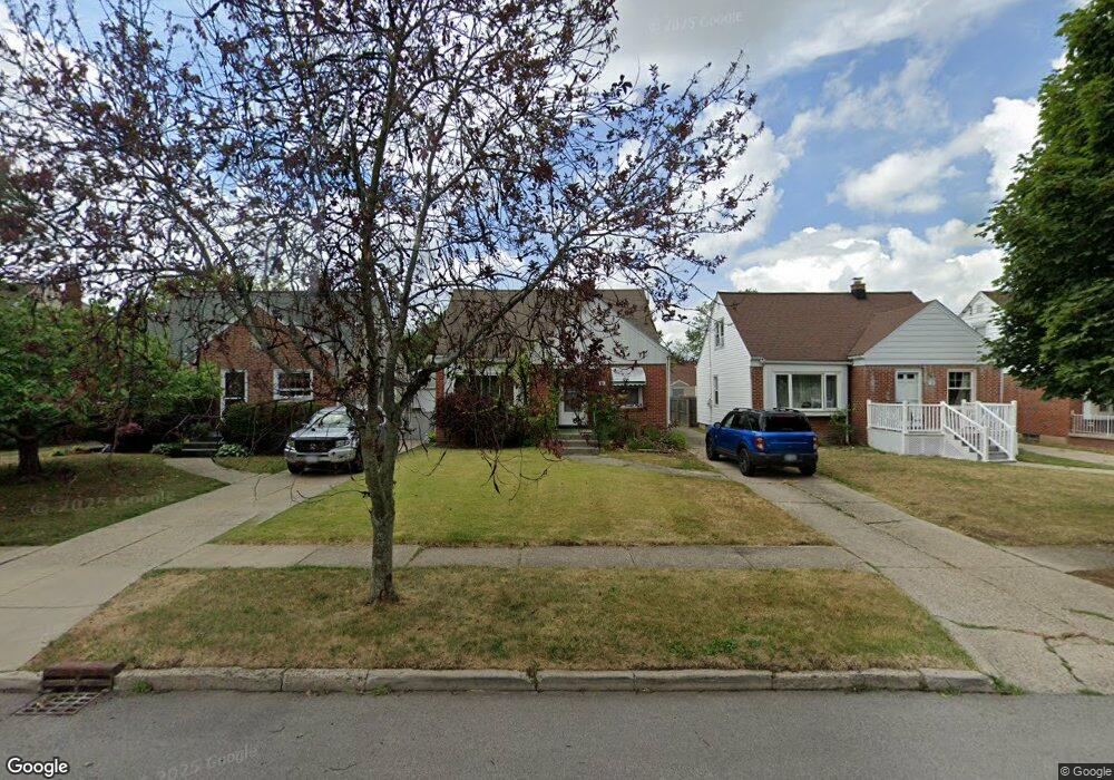
34 Manning Rd Buffalo, NY 14226
Eggertsville NeighborhoodEstimated Value: $243,000 - $270,967
2
Beds
2
Baths
1,198
Sq Ft
$213/Sq Ft
Est. Value
About This Home
This home is located at 34 Manning Rd, Buffalo, NY 14226 and is currently estimated at $254,742, approximately $212 per square foot. 34 Manning Rd is a home located in Erie County with nearby schools including Windermere Boulevard School, Amherst Middle School, and Amherst Central High School.
Ownership History
Date
Name
Owned For
Owner Type
Purchase Details
Closed on
Jul 12, 2007
Sold by
Gordon Joanne and Kozlowski Barbara
Bought by
Kujawa Jeffrey A
Current Estimated Value
Home Financials for this Owner
Home Financials are based on the most recent Mortgage that was taken out on this home.
Original Mortgage
$105,864
Outstanding Balance
$66,307
Interest Rate
6.54%
Mortgage Type
FHA
Estimated Equity
$188,435
Purchase Details
Closed on
Dec 2, 2004
Sold by
Gordon Joanne and Zimmerman Ruth
Bought by
Gordon Joanne and Kozlowski Barbara
Create a Home Valuation Report for This Property
The Home Valuation Report is an in-depth analysis detailing your home's value as well as a comparison with similar homes in the area
Home Values in the Area
Average Home Value in this Area
Purchase History
| Date | Buyer | Sale Price | Title Company |
|---|---|---|---|
| Kujawa Jeffrey A | $89,500 | None Available | |
| Gordon Joanne | -- | -- |
Source: Public Records
Mortgage History
| Date | Status | Borrower | Loan Amount |
|---|---|---|---|
| Open | Kujawa Jeffrey A | $105,864 |
Source: Public Records
Tax History Compared to Growth
Tax History
| Year | Tax Paid | Tax Assessment Tax Assessment Total Assessment is a certain percentage of the fair market value that is determined by local assessors to be the total taxable value of land and additions on the property. | Land | Improvement |
|---|---|---|---|---|
| 2024 | -- | $236,000 | $33,000 | $203,000 |
| 2023 | $4,645 | $123,000 | $23,000 | $100,000 |
| 2022 | $4,377 | $123,000 | $23,000 | $100,000 |
| 2021 | $4,372 | $123,000 | $23,000 | $100,000 |
| 2020 | $3,634 | $123,000 | $23,000 | $100,000 |
| 2019 | $3,551 | $123,000 | $23,000 | $100,000 |
| 2018 | $3,462 | $123,000 | $23,000 | $100,000 |
| 2017 | $1,344 | $123,000 | $23,000 | $100,000 |
| 2016 | $2,863 | $94,300 | $11,800 | $82,500 |
| 2015 | -- | $94,300 | $11,800 | $82,500 |
| 2014 | -- | $94,300 | $11,800 | $82,500 |
Source: Public Records
Map
Nearby Homes
- 470 Maynard Dr
- 450 Maynard Dr
- 4335 Bailey Ave
- 4363 Bailey Ave
- 247 Rosedale Blvd
- 396 Maynard Dr
- 1789 Eggert Rd
- 64 Gresham Dr
- 483 Longmeadow Rd
- 300 Maynard Dr
- 403 Springville Ave
- 51 Fairchild Dr
- 80 Alberta Dr
- 302 Hendricks Blvd
- 114 Mapleview Dr
- 540 Longmeadow Rd
- 144 Alberta Dr
- 150 Meadow Lea Dr
- 17 Morton Dr
- 89 Olney Dr
- 38 Manning Rd
- 30 Manning Rd
- 42 Manning Rd
- 26 Manning Rd
- 327 Rosedale Blvd
- 323 Rosedale Blvd
- 46 Manning Rd
- 331 Rosedale Blvd
- 18 Manning Rd
- 321 Rosedale Blvd
- 335 Rosedale Blvd
- 50 Manning Rd
- 315 Rosedale Blvd
- 339 Rosedale Blvd
- 35 Manning Rd
- 27 Manning Rd
- 14 Manning Rd
- 39 Manning Rd
- 311 Rosedale Blvd Unit Upper
- 311 Rosedale Blvd