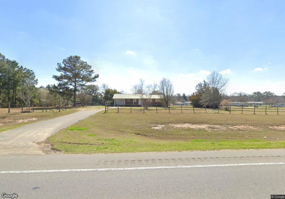
3402 Ga Highway 133 S Moultrie, GA 31788
Estimated Value: $129,000 - $166,000
--
Bed
1
Bath
1,310
Sq Ft
$112/Sq Ft
Est. Value
About This Home
This home is located at 3402 Ga Highway 133 S, Moultrie, GA 31788 and is currently estimated at $147,036, approximately $112 per square foot. 3402 Ga Highway 133 S is a home located in Colquitt County with nearby schools including Odom Elementary School, Willie J. Williams Middle School, and C.A. Gray Junior High School.
Ownership History
Date
Name
Owned For
Owner Type
Purchase Details
Closed on
Sep 29, 2020
Sold by
Us Bank National Association Trustee
Bought by
Stripling Roy Lavon
Current Estimated Value
Purchase Details
Closed on
Dec 3, 2019
Sold by
Cagley C W
Bought by
Us Bank National Association
Purchase Details
Closed on
Sep 19, 2001
Sold by
Stripling Donnie E
Bought by
Cagley C Wayne
Purchase Details
Closed on
Jun 2, 1978
Bought by
Stripling Donnie E
Create a Home Valuation Report for This Property
The Home Valuation Report is an in-depth analysis detailing your home's value as well as a comparison with similar homes in the area
Home Values in the Area
Average Home Value in this Area
Purchase History
| Date | Buyer | Sale Price | Title Company |
|---|---|---|---|
| Stripling Roy Lavon | $69,900 | -- | |
| Us Bank National Association | $64,000 | -- | |
| Cagley C Wayne | $67,500 | -- | |
| Stripling Donnie E | $18,000 | -- |
Source: Public Records
Tax History Compared to Growth
Tax History
| Year | Tax Paid | Tax Assessment Tax Assessment Total Assessment is a certain percentage of the fair market value that is determined by local assessors to be the total taxable value of land and additions on the property. | Land | Improvement |
|---|---|---|---|---|
| 2024 | $1,223 | $51,495 | $3,132 | $48,363 |
| 2023 | $1,086 | $40,864 | $3,132 | $37,732 |
| 2022 | $874 | $36,721 | $2,784 | $33,937 |
| 2021 | $679 | $32,012 | $2,784 | $29,228 |
| 2020 | $747 | $30,211 | $2,784 | $27,427 |
| 2019 | $719 | $28,166 | $2,784 | $25,382 |
| 2018 | $720 | $28,166 | $2,784 | $25,382 |
| 2017 | $754 | $29,717 | $4,335 | $25,382 |
| 2016 | $764 | $29,717 | $4,335 | $25,382 |
| 2015 | $772 | $29,717 | $4,335 | $25,382 |
| 2014 | $757 | $29,717 | $4,335 | $25,382 |
| 2013 | -- | $29,716 | $4,334 | $25,382 |
Source: Public Records
Map
Nearby Homes
- 2262 Sardis Church Rd
- 0 Upper Trail Unit 913421
- 0 Upper Trail Unit 913422
- 277 Indian Creek Subdivision
- 182 Horseshoe Dr
- 0 Sardis Church Rd
- 124 Flint Dr
- 1114 Cannon Rd
- 132 Tallokas Trail
- 5808 Georgia 133
- 270 Old Timey Trail
- 1113 Georgia 133
- 410 Indian Trail
- 313 Langford St
- 0 Old Timey Trail
- 31 31st Ave SE
- 5940 Georgia 37
- 65 Packer Pride Dr SE
- 292 Robin Ln
- 48 Packer Pride Dr SE
- 118 Cook Rd
- 162 Cook Rd
- 176 Cook Rd
- 205 Cook Rd
- 220 Cook Rd
- 3566 Georgia 133
- 369 Jerusalem Church Rd
- 625 Jerusalem Church Rd
- 379 Jerusalem Church Rd
- 220 Gibbs Rd
- 371 Jerusalem Church Rd
- 3602 Ga Highway 133 S
- 374 Cook Rd
- 409 Jerusalem Church Rd
- 523 Jerusalem Church Rd
- 607 Mcmullen Rd
- 3125 Ga Highway 133 S
- 668 Jerusalem Church Rd
- 3122 Ga Highway 133 S
- 594 Mcmullen Rd