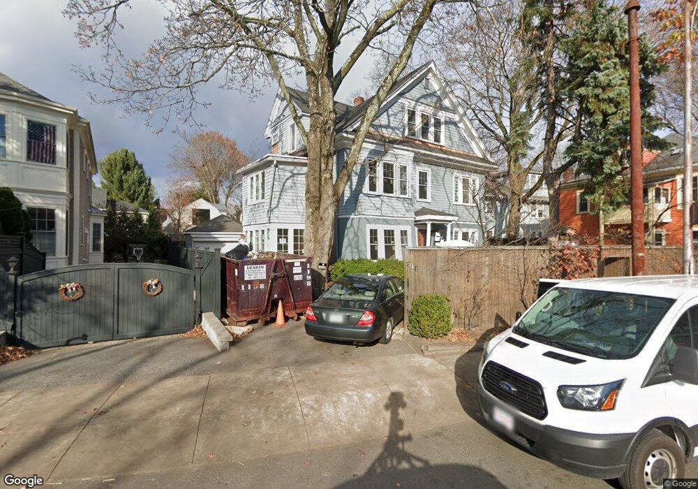
341 Mount Auburn St Cambridge, MA 02138
West Cambridge NeighborhoodEstimated Value: $3,701,000 - $4,176,000
7
Beds
3
Baths
3,343
Sq Ft
$1,181/Sq Ft
Est. Value
About This Home
This home is located at 341 Mount Auburn St, Cambridge, MA 02138 and is currently estimated at $3,947,654, approximately $1,180 per square foot. 341 Mount Auburn St is a home located in Middlesex County with nearby schools including Buckingham Browne & Nichols School, Shady Hill School, and St Peter School.
Ownership History
Date
Name
Owned For
Owner Type
Purchase Details
Closed on
Jun 1, 1989
Sold by
Stuart Charles C
Bought by
Kalavrezou Ioli
Current Estimated Value
Home Financials for this Owner
Home Financials are based on the most recent Mortgage that was taken out on this home.
Original Mortgage
$339,000
Interest Rate
10.92%
Mortgage Type
Purchase Money Mortgage
Purchase Details
Closed on
Jan 29, 1988
Sold by
Doherty Mary K
Bought by
Stuart Charles C
Home Financials for this Owner
Home Financials are based on the most recent Mortgage that was taken out on this home.
Original Mortgage
$200,000
Interest Rate
10.65%
Mortgage Type
Purchase Money Mortgage
Create a Home Valuation Report for This Property
The Home Valuation Report is an in-depth analysis detailing your home's value as well as a comparison with similar homes in the area
Home Values in the Area
Average Home Value in this Area
Purchase History
| Date | Buyer | Sale Price | Title Company |
|---|---|---|---|
| Kalavrezou Ioli | $565,000 | -- | |
| Stuart Charles C | $386,500 | -- |
Source: Public Records
Mortgage History
| Date | Status | Borrower | Loan Amount |
|---|---|---|---|
| Closed | Stuart Charles C | $226,000 | |
| Closed | Stuart Charles C | $339,000 | |
| Previous Owner | Stuart Charles C | $200,000 |
Source: Public Records
Tax History Compared to Growth
Tax History
| Year | Tax Paid | Tax Assessment Tax Assessment Total Assessment is a certain percentage of the fair market value that is determined by local assessors to be the total taxable value of land and additions on the property. | Land | Improvement |
|---|---|---|---|---|
| 2025 | $21,595 | $3,400,800 | $1,663,200 | $1,737,600 |
| 2024 | $19,486 | $3,291,500 | $1,628,400 | $1,663,100 |
| 2023 | $15,044 | $2,567,300 | $1,593,600 | $973,700 |
| 2022 | $14,121 | $2,385,300 | $1,522,800 | $862,500 |
| 2021 | $13,429 | $2,295,500 | $1,493,300 | $802,200 |
| 2020 | $12,656 | $2,201,100 | $1,441,500 | $759,600 |
| 2019 | $11,677 | $1,965,900 | $1,264,100 | $701,800 |
| 2018 | $11,978 | $1,904,300 | $1,256,800 | $647,500 |
| 2017 | $12,156 | $1,873,000 | $1,256,800 | $616,200 |
| 2016 | $11,855 | $1,696,000 | $1,105,200 | $590,800 |
| 2015 | $12,076 | $1,544,200 | $1,016,500 | $527,700 |
| 2014 | $11,918 | $1,422,200 | $924,100 | $498,100 |
Source: Public Records
Map
Nearby Homes
- 172 Brattle St
- 158 Brattle St
- 1010 Memorial Dr Unit 6G
- 48 Hubbard Park Rd
- 20 Maynard Place
- 153 Brattle St
- 15 Hubbard Park Rd
- 43 Larch Rd
- 134 Lexington Ave Unit 2
- 382 Huron Ave
- 234 Huron Ave
- 92 Fayerweather St Unit 2
- 71-73 Reservoir St
- 31 Chilton St Unit 1
- 3 Berkeley Place
- 422-424 Walden St
- 107 Grozier Rd Unit 1
- 32 Hawthorn St
- 465 Huron Ave Unit 1
- 988 Memorial Dr Unit 386
- 17 Channing St
- 17 Channing St Unit 1
- 19 Channing St
- 15 Channing St
- 20 Traill St
- 18 Traill St
- 11 Channing St
- 16 Channing St
- 16 Channing St Unit 16
- 361 Mount Auburn St Unit 2
- 361 Mount Auburn St Unit 1
- 361 Mt Auburn St Unit 2
- 363 Mount Auburn St
- 18 Channing St
- 18 Channing St
- 18 Channing St Unit 3
- 16 Traill St
- 14 Channing St
- 9 Channing St
- 365 Mount Auburn St