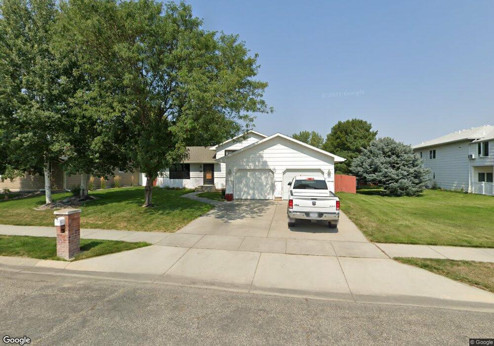
3425 Cook Ave Billings, MT 59102
West End NeighborhoodEstimated Value: $366,000 - $408,762
5
Beds
3
Baths
1,380
Sq Ft
$285/Sq Ft
Est. Value
About This Home
This home is located at 3425 Cook Ave, Billings, MT 59102 and is currently estimated at $393,941, approximately $285 per square foot. 3425 Cook Ave is a home located in Yellowstone County with nearby schools including Meadowlark School, Will James Junior High School, and Billings West High School.
Ownership History
Date
Name
Owned For
Owner Type
Purchase Details
Closed on
Mar 27, 2006
Sold by
Garrad Timothy L and Garrad Catherine J
Bought by
Laplant Robert and Laplant Carman
Current Estimated Value
Home Financials for this Owner
Home Financials are based on the most recent Mortgage that was taken out on this home.
Original Mortgage
$173,600
Outstanding Balance
$98,722
Interest Rate
6.18%
Mortgage Type
New Conventional
Estimated Equity
$295,219
Create a Home Valuation Report for This Property
The Home Valuation Report is an in-depth analysis detailing your home's value as well as a comparison with similar homes in the area
Home Values in the Area
Average Home Value in this Area
Purchase History
| Date | Buyer | Sale Price | Title Company |
|---|---|---|---|
| Laplant Robert | -- | None Available |
Source: Public Records
Mortgage History
| Date | Status | Borrower | Loan Amount |
|---|---|---|---|
| Open | Laplant Robert | $173,600 | |
| Closed | Laplant Robert | $32,550 |
Source: Public Records
Tax History Compared to Growth
Tax History
| Year | Tax Paid | Tax Assessment Tax Assessment Total Assessment is a certain percentage of the fair market value that is determined by local assessors to be the total taxable value of land and additions on the property. | Land | Improvement |
|---|---|---|---|---|
| 2025 | $3,619 | $418,300 | $58,423 | $359,877 |
| 2024 | $3,619 | $358,400 | $50,786 | $307,614 |
| 2023 | $3,627 | $358,400 | $50,786 | $307,614 |
| 2022 | $3,070 | $264,200 | $0 | $0 |
| 2021 | $2,919 | $264,200 | $0 | $0 |
| 2020 | $2,979 | $259,600 | $0 | $0 |
| 2019 | $2,856 | $259,600 | $0 | $0 |
| 2018 | $2,893 | $259,100 | $0 | $0 |
| 2017 | $2,817 | $259,100 | $0 | $0 |
| 2016 | $2,512 | $230,700 | $0 | $0 |
| 2015 | $2,459 | $230,700 | $0 | $0 |
| 2014 | $2,137 | $104,887 | $0 | $0 |
Source: Public Records
Map
Nearby Homes
- 3515-3517 Central
- 3517 Central Ave
- 3231 Central Ave
- 3203 Lynn Ave
- 3653 Custer Ave
- 3113 Saint Johns Ave
- 3641 Glantz Dr
- 3291 Banff Ave
- 3712 Mount Rushmore Ave
- 3297 Banff Ave Unit 10
- 3468 Shenandoah Dr
- 3482 Shenandoah Dr
- 108 30th St W
- 3749 Heritage Dr
- 131 S 38th St W
- 3533 Rachelle Cir
- 3175 Solar Blvd Unit 14
- 3087 Hunters Ridge Loop
- 3340 Tahoe Dr
- 2937 Miles Ave
- 3435 Cook Ave
- 220 34th St W
- 3420 Howard Ave
- 3445 Cook Ave
- 3410 Howard Ave
- 3430 Howard Ave
- 3420 Cook Ave
- 3430 Cook Ave
- 3410 Cook Ave
- 3440 Howard Ave
- 3455 Cook Ave
- 3440 Cook Ave
- 3450 Howard Ave
- 3450 Cook Ave
- 3465 Cook Ave
- 3435 Saint Johns Ave
- 3415 Saint Johns Ave
- 3460 Howard Ave
- 3460 Cook Ave
- 3445 Saint Johns Ave