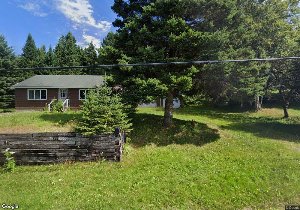
344 Nh Route 145 Clarksville, NH 03592
Estimated Value: $128,828 - $316,000
1
Bed
1
Bath
864
Sq Ft
$240/Sq Ft
Est. Value
About This Home
This home is located at 344 Nh Route 145, Clarksville, NH 03592 and is currently estimated at $207,457, approximately $240 per square foot. 344 Nh Route 145 is a home located in Coos County.
Ownership History
Date
Name
Owned For
Owner Type
Purchase Details
Closed on
Apr 5, 2013
Sold by
Daniel C Lefebvre Lt and Lamb
Bought by
Saunders Travis H
Current Estimated Value
Home Financials for this Owner
Home Financials are based on the most recent Mortgage that was taken out on this home.
Original Mortgage
$46,400
Outstanding Balance
$32,577
Interest Rate
3.58%
Mortgage Type
New Conventional
Estimated Equity
$174,880
Create a Home Valuation Report for This Property
The Home Valuation Report is an in-depth analysis detailing your home's value as well as a comparison with similar homes in the area
Home Values in the Area
Average Home Value in this Area
Purchase History
| Date | Buyer | Sale Price | Title Company |
|---|---|---|---|
| Saunders Travis H | $58,000 | -- | |
| Saunders Travis H | $58,000 | -- | |
| Saunders Travis H | $58,000 | -- | |
| Saunders Travis H | $58,000 | -- |
Source: Public Records
Mortgage History
| Date | Status | Borrower | Loan Amount |
|---|---|---|---|
| Open | Saunders Travis H | $46,400 | |
| Closed | Saunders Travis H | $46,400 |
Source: Public Records
Tax History Compared to Growth
Tax History
| Year | Tax Paid | Tax Assessment Tax Assessment Total Assessment is a certain percentage of the fair market value that is determined by local assessors to be the total taxable value of land and additions on the property. | Land | Improvement |
|---|---|---|---|---|
| 2024 | $2,364 | $108,900 | $26,300 | $82,600 |
| 2023 | $2,060 | $108,900 | $26,300 | $82,600 |
| 2022 | $2,255 | $108,900 | $26,300 | $82,600 |
| 2021 | $2,067 | $108,900 | $26,300 | $82,600 |
| 2020 | $1,771 | $108,900 | $26,300 | $82,600 |
| 2019 | $1,589 | $102,200 | $22,800 | $79,400 |
| 2018 | $1,834 | $102,200 | $22,800 | $79,400 |
| 2017 | $1,965 | $102,200 | $22,800 | $79,400 |
| 2016 | $0 | $102,200 | $22,800 | $79,400 |
| 2015 | $1,688 | $102,200 | $22,800 | $79,400 |
| 2014 | $1,575 | $101,300 | $29,500 | $71,800 |
| 2013 | $1,428 | $101,300 | $29,500 | $71,800 |
Source: Public Records
Map
Nearby Homes
- 57 Rudy Ln Unit 24
- 75 Heritage Rd
- 72 Heritage Rd
- 97 Cobblestone Rd
- 8 Haynes Rd
- 393 G P Loop Rd
- 11 Downing Rd
- Lot 1, 2, & 3 Creampoke Rd
- 7 Cedric Rd
- 220 Creampoke Rd
- 0 Bacon Rd
- 1354 S Main St
- 1495 Main St
- 1298 S Main St
- 1463 Main St
- 1459 Main St
- 26 Dalton Rd
- 12 River Rd
- TBD Hollow Rd
- - Bishop Brook Rd
- 344 Nh Route 145
- 429 Wiswell Rd
- 361 Nh Route 145
- 317 Nh Route 145
- 372 Nh Route 145
- 37 Finch Ln
- 17 Finch Rd
- 17 Finch Ln
- 395 Nh Route 145
- 333 Wiswell Rd
- 0 Moose Trail Unit 4627787
- 0 Moose Trail Unit Lot 31-2 4694602
- 91 Nh Route 145
- 05 Blueberry Ln
- 05 Clarksville Pond Rd
- 278 Nh Route 145
- 322 Nh Route 145
- 04 Blueberry Ln
- 04 Clarksville Pond Rd
- 262 Nh Route 145