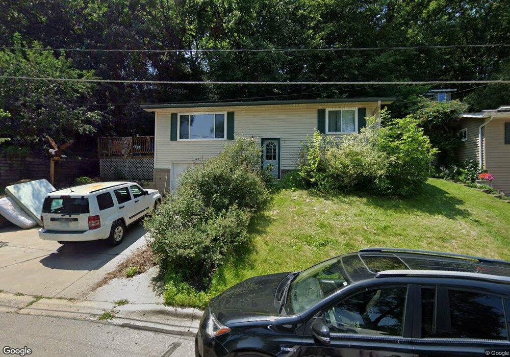
3443 Forrest Ln Red Wing, MN 55066
Estimated Value: $222,000 - $276,000
2
Beds
2
Baths
864
Sq Ft
$285/Sq Ft
Est. Value
About This Home
This home is located at 3443 Forrest Ln, Red Wing, MN 55066 and is currently estimated at $246,092, approximately $284 per square foot. 3443 Forrest Ln is a home located in Goodhue County with nearby schools including Burnside Elementary School, Sunnyside Elementary School, and Twin Bluff Middle School.
Ownership History
Date
Name
Owned For
Owner Type
Purchase Details
Closed on
May 31, 2016
Sold by
Plumley Aaron and Machtemes Plumley Nealy Kay
Bought by
Sam Jonell M and Sam Steven M
Current Estimated Value
Home Financials for this Owner
Home Financials are based on the most recent Mortgage that was taken out on this home.
Original Mortgage
$144,850
Outstanding Balance
$115,547
Interest Rate
3.64%
Estimated Equity
$130,545
Purchase Details
Closed on
May 25, 2016
Sold by
Ruege Noelle Ashley and Plumley Noelle Ashley
Bought by
Plumley Aaron Matthew
Home Financials for this Owner
Home Financials are based on the most recent Mortgage that was taken out on this home.
Original Mortgage
$144,850
Outstanding Balance
$115,547
Interest Rate
3.64%
Estimated Equity
$130,545
Purchase Details
Closed on
Dec 29, 2006
Sold by
Sloan Eric R
Bought by
Plumley Aaron and Plumley Noelle
Purchase Details
Closed on
Apr 27, 2000
Sold by
Jonas Kevin D and Jonas Shirley A
Bought by
Sloan Eric R
Create a Home Valuation Report for This Property
The Home Valuation Report is an in-depth analysis detailing your home's value as well as a comparison with similar homes in the area
Home Values in the Area
Average Home Value in this Area
Purchase History
| Date | Buyer | Sale Price | Title Company |
|---|---|---|---|
| Sam Jonell M | $144,852 | Goodhue County Abstract | |
| Sam Jonell Jonell | $144,900 | -- | |
| Plumley Aaron Matthew | -- | Goodhue County Abstract | |
| Plumley Aaron | $145,000 | -- | |
| Sloan Eric R | $87,000 | -- |
Source: Public Records
Mortgage History
| Date | Status | Borrower | Loan Amount |
|---|---|---|---|
| Open | Sam Jonell Jonell | $144,850 |
Source: Public Records
Tax History Compared to Growth
Tax History
| Year | Tax Paid | Tax Assessment Tax Assessment Total Assessment is a certain percentage of the fair market value that is determined by local assessors to be the total taxable value of land and additions on the property. | Land | Improvement |
|---|---|---|---|---|
| 2025 | $2,828 | $212,000 | $46,100 | $165,900 |
| 2024 | $2,828 | $208,800 | $46,100 | $162,700 |
| 2023 | $1,378 | $196,900 | $46,100 | $150,800 |
| 2022 | $2,454 | $190,700 | $41,000 | $149,700 |
| 2021 | $2,292 | $164,100 | $41,000 | $123,100 |
| 2020 | $2,298 | $155,200 | $41,000 | $114,200 |
| 2019 | $2,274 | $145,100 | $41,000 | $104,100 |
| 2018 | $1,898 | $145,300 | $39,500 | $105,800 |
| 2017 | $1,510 | $128,500 | $39,500 | $89,000 |
| 2016 | $1,394 | $126,500 | $39,500 | $87,000 |
| 2015 | $1,336 | $123,300 | $39,500 | $83,800 |
| 2014 | -- | $119,700 | $39,500 | $80,200 |
Source: Public Records
Map
Nearby Homes
- 3560 Graves Dr
- 3463 Briarview Ct
- 946 Briarwood Dr
- 168 Johnson Ave
- 113 Burnside Ave S
- 237 Motel Ave
- 240 Motel Ave
- 132 Motel Ave
- 232 Fern Ave
- 4336 Lookout Ln
- 998 Hewitt Blvd
- 2773 Ridgeview Dr
- 1125 Hewitt Blvd
- 1181 Hewitt Blvd
- 1180 Hewitt Blvd
- 936 Aurora Cir
- 980 Aurora Cir
- 135 Kingswood Dr
- 912 Aurora Cir
- 853 Aurora Cir
- 3453 Forrest Ln
- 3448 Forrest Ln
- 3440 Forrest Ln
- 3618 Martha Ln
- 3628 Martha Ln
- 3463 Forrest Ln
- 3430 Forrest Ln
- 3473 Helen Ln
- 3610 Martha Ln
- 3420 Forrest Ln
- 3463 Helen Ln
- 3473 Forrest Ln
- 3648 Martha Ln
- 210 Carol Ln
- 3449 Helen Ln
- 149 Spring Creek Rd S
- 212 Carol Ln
- 3429 Helen Ln
- 164 Carol Ln
- 213 Spring Creek Rd S