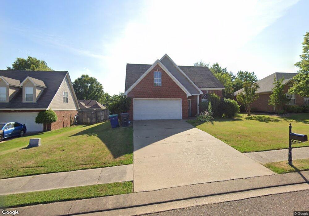
3447 Sundial Dr Hernando, MS 38632
Estimated Value: $281,359 - $310,000
3
Beds
3
Baths
1,680
Sq Ft
$175/Sq Ft
Est. Value
About This Home
This home is located at 3447 Sundial Dr, Hernando, MS 38632 and is currently estimated at $293,340, approximately $174 per square foot. 3447 Sundial Dr is a home located in DeSoto County with nearby schools including Oak Grove Central Elementary School, Hernando Elementary School, and Hernando Hills Elementary.
Ownership History
Date
Name
Owned For
Owner Type
Purchase Details
Closed on
Feb 16, 2021
Sold by
Alford Billy Ray and Alford Raney B
Bought by
Yamasa Co Ltd
Current Estimated Value
Purchase Details
Closed on
May 7, 2010
Sold by
Hall James A and Hall Whitney L
Bought by
Alford Billy Ray and Alford Raney B
Home Financials for this Owner
Home Financials are based on the most recent Mortgage that was taken out on this home.
Original Mortgage
$119,047
Interest Rate
5.15%
Mortgage Type
FHA
Create a Home Valuation Report for This Property
The Home Valuation Report is an in-depth analysis detailing your home's value as well as a comparison with similar homes in the area
Home Values in the Area
Average Home Value in this Area
Purchase History
| Date | Buyer | Sale Price | Title Company |
|---|---|---|---|
| Yamasa Co Ltd | -- | Realty Title & Escrow Co Inc | |
| Alford Billy Ray | -- | First National Financial Tit |
Source: Public Records
Mortgage History
| Date | Status | Borrower | Loan Amount |
|---|---|---|---|
| Previous Owner | Alford Billy Ray | $119,047 | |
| Previous Owner | Alford Billy Ray | $0 |
Source: Public Records
Tax History
| Year | Tax Paid | Tax Assessment Tax Assessment Total Assessment is a certain percentage of the fair market value that is determined by local assessors to be the total taxable value of land and additions on the property. | Land | Improvement |
|---|---|---|---|---|
| 2025 | $2,937 | $25,212 | $3,750 | $21,462 |
| 2024 | $2,576 | $18,566 | $3,750 | $14,816 |
| 2023 | $2,576 | $18,566 | $0 | $0 |
| 2022 | $2,576 | $18,566 | $3,750 | $14,816 |
| 2021 | $1,417 | $12,377 | $2,500 | $9,877 |
| 2020 | $1,300 | $11,530 | $0 | $0 |
| 2019 | $1,300 | $11,530 | $2,500 | $9,030 |
| 2017 | $1,271 | $20,034 | $11,267 | $8,767 |
| 2016 | $1,206 | $11,267 | $2,500 | $8,767 |
| 2015 | $1,506 | $20,034 | $11,267 | $8,767 |
| 2014 | $1,170 | $11,267 | $0 | $0 |
| 2013 | $1,207 | $11,267 | $0 | $0 |
Source: Public Records
Map
Nearby Homes
- 1542 Amy Taylor Dr
- 4770 Mccracken Rd
- 2953 Dove Cove
- 1999 Edgewood Blvd
- 2087 S Jefferson Loop
- 3132 E Jefferson Loop
- 2890 Jaybird Rd
- 2850 Jaybird Rd
- 3094 E Beauvoir Place
- 2556 E Beauvoir Place
- 2520 E Beauvoir Place
- 2335 Ouse Valley Ln
- 1335 Creekside Blvd
- 2333 Jaxon Dr
- 0 E Commerce St
- 537 Vinson Rd
- 2833 Mount Pleasant S
- 2539 River Ouse Dr
- 3856 Camborne
- 3162 Autumn Wind Dr
- 3433 Sundial Dr
- 3457 Sundial Dr
- 3462 Clepsyda Dr
- 3421 Sundial Dr
- 3450 Clepsyda Dr
- 3471 Sundial Dr
- 3470 Clepsyda Dr
- 1325 Pendulum Dr N
- 1325 Pendulum Dr
- 3436 Clepsyda Dr
- 3409 Sundial Dr
- 3410 Sundial Dr
- 1337 Pendulum Dr N
- 1342 Pendulum Dr
- 3426 Clepsyda Dr
- 1334 Pendulum Dr N
- 3398 Sundial Dr
- 3395 Sundial Dr
- 3412 Clepsyda Dr
- 1353 Pendulum Dr N
Your Personal Tour Guide
Ask me questions while you tour the home.