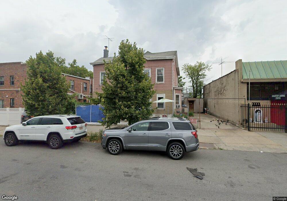
345 Quentin Rd Brooklyn, NY 11223
Gravesend NeighborhoodEstimated Value: $1,638,000 - $2,586,000
Studio
--
Bath
2,296
Sq Ft
$866/Sq Ft
Est. Value
About This Home
This home is located at 345 Quentin Rd, Brooklyn, NY 11223 and is currently estimated at $1,989,333, approximately $866 per square foot. 345 Quentin Rd is a home located in Kings County with nearby schools including P.S.177 The Marlboro, Is 228 David A Boody, and Mirrer Yeshiva Educational Institute.
Ownership History
Date
Name
Owned For
Owner Type
Purchase Details
Closed on
Jan 30, 2023
Sold by
M & M Irrevocable And Trust
Bought by
Saar Reuven
Current Estimated Value
Purchase Details
Closed on
Mar 14, 2019
Sold by
Shem Tov Mordechai Moti
Bought by
The M & M Irrevocable Land Trust Dated 3
Purchase Details
Closed on
Jan 16, 2019
Sold by
Saad Menashe
Bought by
Shem Tov Mordechai Moti
Purchase Details
Closed on
Nov 25, 1998
Sold by
Kitsis Oscar and Kitsis Ada
Bought by
Saad Menashe
Home Financials for this Owner
Home Financials are based on the most recent Mortgage that was taken out on this home.
Original Mortgage
$204,750
Interest Rate
6.78%
Create a Home Valuation Report for This Property
The Home Valuation Report is an in-depth analysis detailing your home's value as well as a comparison with similar homes in the area
Home Values in the Area
Average Home Value in this Area
Purchase History
| Date | Buyer | Sale Price | Title Company |
|---|---|---|---|
| Saar Reuven | $31,170 | -- | |
| The M & M Irrevocable Land Trust Dated 3 | -- | -- | |
| Shem Tov Mordechai Moti | $31,170 | -- | |
| Saad Menashe | $273,000 | Commonwealth Land Title Ins |
Source: Public Records
Mortgage History
| Date | Status | Borrower | Loan Amount |
|---|---|---|---|
| Previous Owner | Saad Menashe | $204,750 |
Source: Public Records
Tax History
| Year | Tax Paid | Tax Assessment Tax Assessment Total Assessment is a certain percentage of the fair market value that is determined by local assessors to be the total taxable value of land and additions on the property. | Land | Improvement |
|---|---|---|---|---|
| 2025 | $7,944 | $98,760 | $19,740 | $79,020 |
| 2024 | $7,944 | $93,420 | $19,740 | $73,680 |
| 2023 | $7,596 | $114,600 | $19,740 | $94,860 |
| 2022 | $7,389 | $97,200 | $19,740 | $77,460 |
| 2021 | $7,352 | $100,380 | $19,740 | $80,640 |
| 2019 | $7,982 | $84,900 | $19,740 | $65,160 |
| 2018 | $2,879 | $31,170 | $8,371 | $22,799 |
| 2017 | $2,844 | $30,844 | $7,556 | $23,288 |
| 2016 | $2,600 | $29,112 | $7,620 | $21,492 |
| 2015 | $1,535 | $29,112 | $11,445 | $17,667 |
| 2014 | $1,535 | $27,469 | $12,157 | $15,312 |
Source: Public Records
Map
Nearby Homes
- 1736 E 2nd St
- 380 Avenue P
- 1806 McDonald Ave
- 1684 W 2nd St
- 411 Avenue P
- 320 Avenue P
- 1815 E 3rd St
- 339 Avenue P Unit 2B
- 339 Avenue P Unit 2A
- 2500 65th St
- 1730 E 4th St
- 15 Van Sicklen St
- 447 Avenue P Unit 407
- 1733 E 4th St Unit 1A
- 33 Kings Place
- 463 Avenue P
- 1560 W 2nd St
- 1612 E 2nd St
- 1632 W 4th St
- 1664 E 4th St
- 1683 Dahill Rd
- 1679 Dahill Rd
- 1675 Dahill Rd
- 349 Quentin Rd
- 1671 Dahill Rd
- 1884 McDonald Ave
- 0 Dahill Rd Unit 7801433-11663264
- 0 Dahill Rd Unit 7721789-11512750
- 357 Quentin Rd
- 1701 Dahill Rd
- 1667 Dahill Rd
- 1874-1876 McDonald Ave
- 1705 Dahill Rd
- 1665 Dahill Rd
- 1707 Dahill Rd
- 348 Quentin Rd
- 1904 McDonald Ave
- 1661 Dahill Rd
- 1711 Dahill Rd
- 1868 McDonald Ave
Your Personal Tour Guide
Ask me questions while you tour the home.