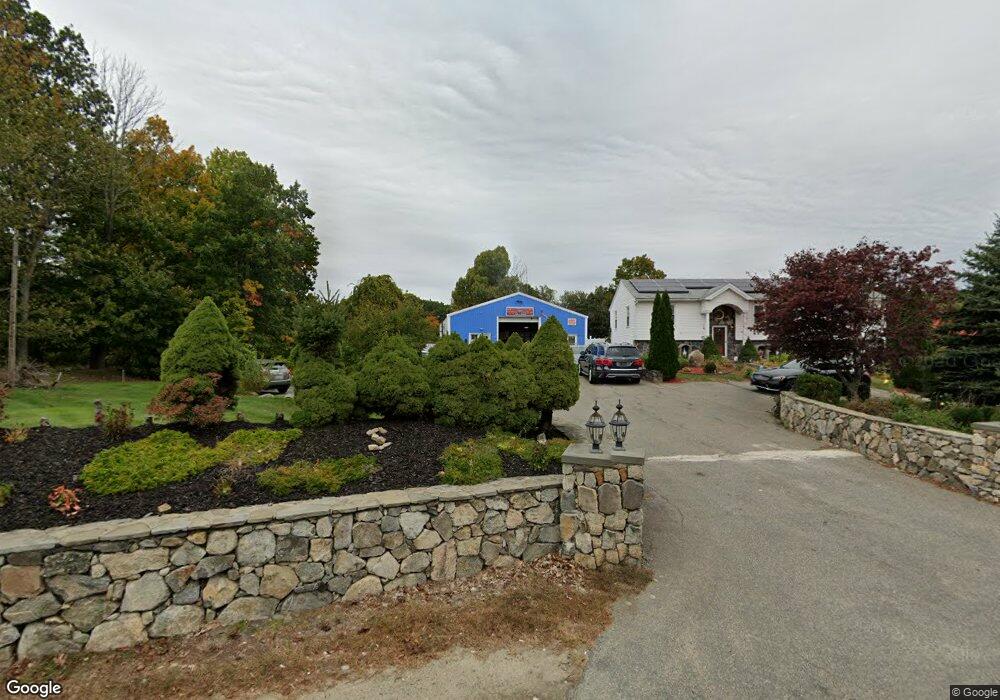
348 Howe St Methuen, MA 01844
The North End NeighborhoodEstimated Value: $1,142,662
Studio
3
Baths
--
Sq Ft
2.9
Acres
About This Home
This home is located at 348 Howe St, Methuen, MA 01844 and is currently estimated at $1,142,662. 348 Howe St is a home located in Essex County with nearby schools including Methuen High School and Notre Dame Cristo Rey High School.
Ownership History
Date
Name
Owned For
Owner Type
Purchase Details
Closed on
May 28, 2008
Sold by
Alves Manuel and Soares Eduardo
Bought by
M K Howe Street Rt and Kassis
Current Estimated Value
Home Financials for this Owner
Home Financials are based on the most recent Mortgage that was taken out on this home.
Original Mortgage
$425,000
Interest Rate
6.3%
Mortgage Type
Commercial
Purchase Details
Closed on
Oct 22, 2004
Sold by
Soares Eduarda and Alves Manuel
Bought by
M K Howe Street Rt and Kasis
Home Financials for this Owner
Home Financials are based on the most recent Mortgage that was taken out on this home.
Original Mortgage
$350,000
Interest Rate
5.85%
Mortgage Type
Commercial
Purchase Details
Closed on
Mar 30, 2001
Sold by
Poirier Ann T and Hoffman Ann
Bought by
Alves Manuel and Soares Eduarda
Create a Home Valuation Report for This Property
The Home Valuation Report is an in-depth analysis detailing your home's value as well as a comparison with similar homes in the area
Home Values in the Area
Average Home Value in this Area
Purchase History
| Date | Buyer | Sale Price | Title Company |
|---|---|---|---|
| M K Howe Street Rt | $535,000 | -- | |
| M K Howe Street Rt | $535,000 | -- | |
| M K Howe Street Rt | $535,000 | -- | |
| M K Howe Street Rt | $535,000 | -- | |
| Alves Manuel | $270,000 | -- | |
| Alves Manuel | $270,000 | -- |
Source: Public Records
Mortgage History
| Date | Status | Borrower | Loan Amount |
|---|---|---|---|
| Open | Alves Manuel | $412,000 | |
| Closed | Alves Manuel | $425,000 | |
| Previous Owner | M K Howe Street Rt | $350,000 |
Source: Public Records
Tax History
| Year | Tax Paid | Tax Assessment Tax Assessment Total Assessment is a certain percentage of the fair market value that is determined by local assessors to be the total taxable value of land and additions on the property. | Land | Improvement |
|---|---|---|---|---|
| 2025 | -- | $820,300 | $292,400 | $527,900 |
| 2024 | -- | $778,400 | $255,600 | $522,800 |
| 2023 | $0 | $691,300 | $224,900 | $466,400 |
| 2022 | $0 | $604,900 | $184,000 | $420,900 |
| 2021 | $0 | $569,200 | $173,800 | $395,400 |
| 2020 | $0 | $557,300 | $173,800 | $383,500 |
| 2019 | $0 | $508,600 | $163,600 | $345,000 |
| 2018 | $0 | $482,600 | $153,400 | $329,200 |
| 2017 | $0 | $458,000 | $153,400 | $304,600 |
| 2016 | -- | $439,500 | $143,100 | $296,400 |
| 2015 | -- | $447,400 | $155,100 | $292,300 |
Source: Public Records
Map
Nearby Homes
- 55 Phoebe St Unit 32
- 27 Mary Lou St
- 40 Phoebe St Unit 101
- 2 Sequoia Dr Unit 2
- Lot 2 Washington St
- 159-161 Howe St
- 3 Adams Ave
- 139 North St
- 47 Bailey Ct
- 48 Butler St
- 64-66 Howe St
- 10 Evelyn Rd
- Lot 108 Garden City Rd
- 52 Danforth Ct
- 41 Brookdale Ave
- 128 Pleasant Valley St
- 1513 Broadway
- 74 Ayers Village Rd
- 17 Lucy Way
- 9 Falcon Ln
Your Personal Tour Guide
Ask me questions while you tour the home.