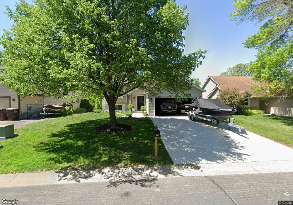
349 Wildhurst Rd Waconia, MN 55387
Estimated Value: $362,000 - $368,358
4
Beds
2
Baths
960
Sq Ft
$381/Sq Ft
Est. Value
About This Home
This home is located at 349 Wildhurst Rd, Waconia, MN 55387 and is currently estimated at $365,340, approximately $380 per square foot. 349 Wildhurst Rd is a home located in Carver County with nearby schools including Southview Elementary School, Waconia Middle School, and Waconia High School.
Ownership History
Date
Name
Owned For
Owner Type
Purchase Details
Closed on
Sep 4, 2015
Sold by
Jandl Greg A and Jandl Gail Ann
Bought by
Frank Travis T and Frank Sarah C
Current Estimated Value
Home Financials for this Owner
Home Financials are based on the most recent Mortgage that was taken out on this home.
Original Mortgage
$227,700
Outstanding Balance
$177,861
Interest Rate
3.75%
Mortgage Type
FHA
Estimated Equity
$187,479
Purchase Details
Closed on
Apr 24, 2003
Sold by
Collins Dennis and Collins Judy L
Bought by
Jandl Greg A
Create a Home Valuation Report for This Property
The Home Valuation Report is an in-depth analysis detailing your home's value as well as a comparison with similar homes in the area
Home Values in the Area
Average Home Value in this Area
Purchase History
| Date | Buyer | Sale Price | Title Company |
|---|---|---|---|
| Frank Travis T | $232,000 | Title Mark | |
| Jandl Greg A | $205,900 | -- |
Source: Public Records
Mortgage History
| Date | Status | Borrower | Loan Amount |
|---|---|---|---|
| Open | Frank Travis T | $227,700 |
Source: Public Records
Tax History Compared to Growth
Tax History
| Year | Tax Paid | Tax Assessment Tax Assessment Total Assessment is a certain percentage of the fair market value that is determined by local assessors to be the total taxable value of land and additions on the property. | Land | Improvement |
|---|---|---|---|---|
| 2025 | $4,080 | $340,500 | $85,000 | $255,500 |
| 2024 | $4,066 | $335,800 | $85,000 | $250,800 |
| 2023 | $4,190 | $338,600 | $85,000 | $253,600 |
| 2022 | $3,964 | $356,100 | $102,800 | $253,300 |
| 2021 | $3,866 | $281,400 | $85,700 | $195,700 |
| 2020 | $3,430 | $281,400 | $85,700 | $195,700 |
| 2019 | $3,488 | $234,800 | $60,500 | $174,300 |
| 2018 | $3,142 | $234,800 | $60,500 | $174,300 |
| 2017 | $2,842 | $222,900 | $55,000 | $167,900 |
| 2016 | $2,534 | $180,000 | $0 | $0 |
| 2015 | $2,288 | $176,400 | $0 | $0 |
| 2014 | $2,288 | $149,700 | $0 | $0 |
Source: Public Records
Map
Nearby Homes
- 627 Ravencroft Rd
- 550 Tiffany Ln
- 708 Lenox Dr
- 628 Tiffany Ln
- 172 Huntington Dr
- 191 Huntington Dr
- 627 Tiffany Ln
- 195 Huntington Dr
- 1240 Spring Hill Rd
- 1215 Spring Hill Rd
- 900 Countryside Rd
- 1683 Saint George St
- 211 Alva St
- 176 Huntington Dr
- 174 Huntington Dr
- 609 Sierra Pkwy
- 162 Huntington Dr
- Bristol Plan at Waterford - Discovery Collection
- St.Clair Plan at Waterford - Liberty Collection
- Clearwater Plan at Waterford - Discovery Collection
- 357 Wildhurst Rd
- 341 Wildhurst Rd
- 365 Wildhurst Rd
- 333 Wildhurst Rd
- 324 Wildhurst Rd
- 373 Wildhurst Rd
- 348 Wildhurst Rd
- 325 Wildhurst Rd
- 356 Wildhurst Rd
- 308 Wildhurst Rd
- 317 Wildhurst Rd
- 300 Wildhurst Rd
- 309 Wildhurst Rd
- 301 Wildhurst Rd
- 256 Wildhurst Rd
- 249 Wildhurst Rd
- 248 Wildhurst Rd
- 241 Wildhurst Rd
- 240 Wildhurst Rd
- 233 Wildhurst Rd