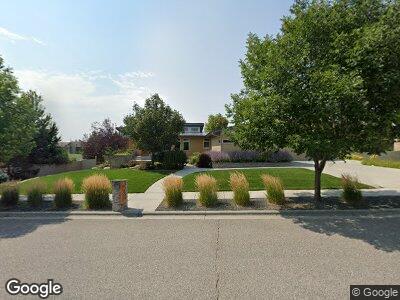
3514 Spalding Ave Billings, MT 59106
West Shiloh NeighborhoodEstimated Value: $690,000 - $895,669
5
Beds
5
Baths
2,515
Sq Ft
$322/Sq Ft
Est. Value
About This Home
This home is located at 3514 Spalding Ave, Billings, MT 59106 and is currently estimated at $810,667, approximately $322 per square foot. 3514 Spalding Ave is a home located in Yellowstone County with nearby schools including Boulder School, Ben Steele Middle School, and Billings West High School.
Ownership History
Date
Name
Owned For
Owner Type
Purchase Details
Closed on
Sep 11, 2024
Sold by
Egan Wayne H and Egan Carrie D
Bought by
Egan Family Trust and Egan
Current Estimated Value
Purchase Details
Closed on
Jul 30, 2008
Sold by
Buscher Construction & Development Inc
Bought by
Egan Wayne H and Egan Carrie D
Purchase Details
Closed on
Mar 31, 2008
Sold by
Aviara Inc
Bought by
Buscher Construction & Development Inc
Create a Home Valuation Report for This Property
The Home Valuation Report is an in-depth analysis detailing your home's value as well as a comparison with similar homes in the area
Home Values in the Area
Average Home Value in this Area
Purchase History
| Date | Buyer | Sale Price | Title Company |
|---|---|---|---|
| Egan Family Trust | -- | None Listed On Document | |
| Egan Wayne H | -- | None Available | |
| Buscher Construction & Development Inc | -- | None Available |
Source: Public Records
Mortgage History
| Date | Status | Borrower | Loan Amount |
|---|---|---|---|
| Previous Owner | Egan Wayne H | $424,847 | |
| Previous Owner | Egan Wayne H | $460,000 | |
| Previous Owner | Egan Wayne H | $408,000 | |
| Previous Owner | Egan Wayne H | $416,650 | |
| Previous Owner | Egan Wayne H | $117,400 | |
| Previous Owner | Egan Wayne H | $555,445 |
Source: Public Records
Tax History Compared to Growth
Tax History
| Year | Tax Paid | Tax Assessment Tax Assessment Total Assessment is a certain percentage of the fair market value that is determined by local assessors to be the total taxable value of land and additions on the property. | Land | Improvement |
|---|---|---|---|---|
| 2024 | $7,899 | $829,400 | $126,555 | $702,845 |
| 2023 | $7,886 | $829,400 | $126,555 | $702,845 |
| 2022 | $6,791 | $624,700 | $0 | $0 |
| 2021 | $6,414 | $624,700 | $0 | $0 |
| 2020 | $6,555 | $612,700 | $0 | $0 |
| 2019 | $6,250 | $612,700 | $0 | $0 |
| 2018 | $6,122 | $589,000 | $0 | $0 |
| 2017 | $5,946 | $589,000 | $0 | $0 |
| 2016 | $5,648 | $565,900 | $0 | $0 |
| 2015 | $5,522 | $565,900 | $0 | $0 |
| 2014 | $5,439 | $297,277 | $0 | $0 |
Source: Public Records
Map
Nearby Homes
- 6203 Western Bluffs Blvd
- 6175 Aviara Blvd
- 3671 Spalding Ave
- 3120 Falcon Ridge Way
- 3129 Falcon Cir
- 3132 Western Bluffs Blvd
- 6311 Southern Bluffs Ln
- 4703 Laila
- 6433 Southern Bluffs Ln
- 6382 Signal Peak Ave
- 6385 Signal Peak Ave
- 3906 Bushwood Dr
- 6387 Signal Peak Ave
- 6316 Decker Ln
- 3070 Western Bluffs Blvd
- 6240 Ridge Stone Dr S
- 3027 Golden Acres Dr
- Lot 8 Graphite Dr
- 3065 Western Bluffs Blvd
- 6302 Absaloka Ln
- 3514 Spalding Ave
- 3508 Spalding Ave
- 3524 Spalding Ave
- 3513 Dunlop Ave
- 3534 Spalding Ave
- 3509 Dunlop Ave
- 3525 Dunlop Ave
- 3511 Spalding Ave
- 3449 Dunlop Ave
- 3468 Spalding Ave
- 6149 Sam Snead Trail
- 3455 Spalding Ave
- 3533 Dunlop Ave
- 3447 Dunlop Ave
- 3451 Dunlop Ave
- 3524 Dunlop Ave
- 3530 Dunlop Ave
- 6130 Aviara Blvd
- 3450 Dunlop Ave
- 3445 Dunlop Ave