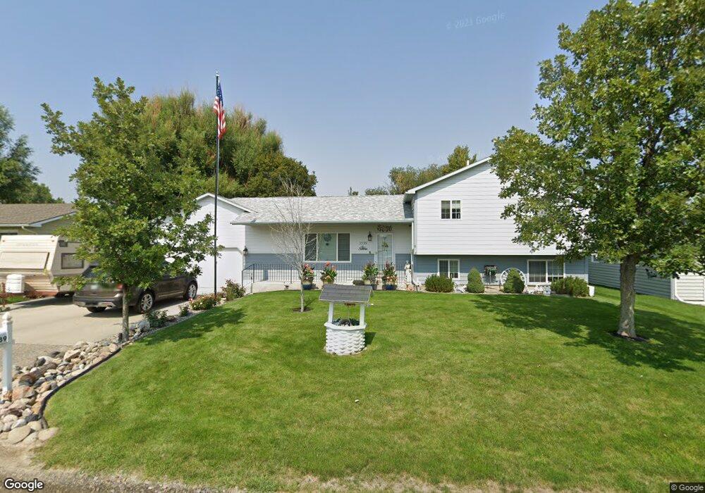
3539 Cook Ave Billings, MT 59102
West End NeighborhoodEstimated Value: $420,000 - $449,000
4
Beds
3
Baths
2,644
Sq Ft
$164/Sq Ft
Est. Value
About This Home
This home is located at 3539 Cook Ave, Billings, MT 59102 and is currently estimated at $432,489, approximately $163 per square foot. 3539 Cook Ave is a home located in Yellowstone County with nearby schools including Meadowlark School, Will James Junior High School, and Billings West High School.
Ownership History
Date
Name
Owned For
Owner Type
Purchase Details
Closed on
Oct 12, 2018
Sold by
Torpy Dunae J and Torpy Phyllis J
Bought by
Lauwers Thomas and Lauwers Margaret
Current Estimated Value
Home Financials for this Owner
Home Financials are based on the most recent Mortgage that was taken out on this home.
Original Mortgage
$228,000
Outstanding Balance
$199,253
Interest Rate
4.6%
Mortgage Type
New Conventional
Estimated Equity
$233,236
Purchase Details
Closed on
Oct 30, 2009
Sold by
Komppa Delisa
Bought by
Torpy Duane J and Torpy Phyllis J
Home Financials for this Owner
Home Financials are based on the most recent Mortgage that was taken out on this home.
Original Mortgage
$110,000
Interest Rate
5%
Mortgage Type
Credit Line Revolving
Purchase Details
Closed on
Apr 25, 2008
Sold by
Piper Blake D and Piper Kimberly A
Bought by
Komppa Delisa
Create a Home Valuation Report for This Property
The Home Valuation Report is an in-depth analysis detailing your home's value as well as a comparison with similar homes in the area
Home Values in the Area
Average Home Value in this Area
Purchase History
| Date | Buyer | Sale Price | Title Company |
|---|---|---|---|
| Lauwers Thomas | -- | -- | |
| Torpy Duane J | -- | St | |
| Komppa Delisa | -- | Ctic |
Source: Public Records
Mortgage History
| Date | Status | Borrower | Loan Amount |
|---|---|---|---|
| Open | Lauwers Thomas | $228,000 | |
| Previous Owner | Torpy Duane J | $110,000 |
Source: Public Records
Tax History
| Year | Tax Paid | Tax Assessment Tax Assessment Total Assessment is a certain percentage of the fair market value that is determined by local assessors to be the total taxable value of land and additions on the property. | Land | Improvement |
|---|---|---|---|---|
| 2025 | $3,606 | $434,300 | $59,457 | $374,843 |
| 2024 | $3,606 | $373,600 | $51,109 | $322,491 |
| 2023 | $3,610 | $373,600 | $51,109 | $322,491 |
| 2022 | $3,121 | $282,300 | $0 | $0 |
| 2021 | $2,968 | $282,300 | $0 | $0 |
| 2020 | $3,063 | $280,200 | $0 | $0 |
| 2019 | $2,922 | $280,200 | $0 | $0 |
| 2018 | $2,669 | $249,700 | $0 | $0 |
| 2017 | $2,593 | $249,700 | $0 | $0 |
| 2016 | $2,307 | $223,500 | $0 | $0 |
| 2015 | $2,255 | $223,500 | $0 | $0 |
| 2014 | $2,154 | $113,526 | $0 | $0 |
Source: Public Records
Map
Nearby Homes
- 3515-3517 Central
- 3346 Winchell Ln
- 3320 Ravalli Place
- 3334 Winchell Ln
- 13 S 38th St W
- 0 Broadwater Ave Unit 357292
- 85 S 38th St W
- 3220 Lynn Ave
- 3214 Lynn Ave
- 3203 Lynn Ave
- 3142 Saint Johns Ave
- 3136 Saint Johns Ave
- 371 W Daffodil Dr
- 3673 Jasper Park Dr
- 3821 Towhee Ln
- 3836 Sandpiper Ln
- 3839 Killdeer Ln
- 3957 Teal St
- 3175 Solar Blvd Unit 14
- 3945 N Tanager Ln
- 3533 Cook Ave
- 3543 Cook Ave
- 3538 Howard Ave
- 3527 Cook Ave
- 3532 Howard Ave
- 3542 Howard Ave
- 3538 Cook Ave
- 3532 Cook Ave
- 3542 Cook Ave
- 3524 Howard Ave
- 3517 Cook Ave
- 3526 Cook Ave
- 3518 Howard Ave
- 3541 Howard Ave
- 3511 Cook Ave
- 3520 Cook Ave
- 3531 Howard Ave
- 3537 Saint Johns Ave
- 3531 Saint Johns Ave
- 3545 Saint Johns Ave
Your Personal Tour Guide
Ask me questions while you tour the home.