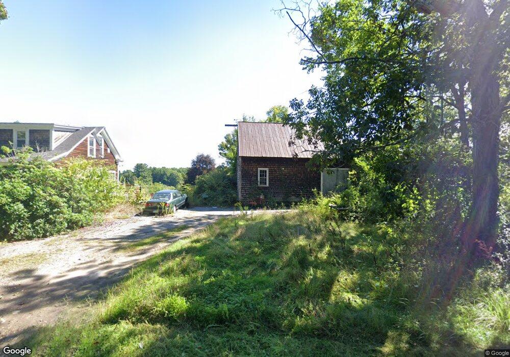
356 Back Rd Dover, NH 03820
Dover Point NeighborhoodEstimated Value: $440,000 - $547,000
2
Beds
1
Bath
1,320
Sq Ft
$384/Sq Ft
Est. Value
About This Home
This home is located at 356 Back Rd, Dover, NH 03820 and is currently estimated at $506,611, approximately $383 per square foot. 356 Back Rd is a home located in Strafford County with nearby schools including Garrison School, Dover Middle School, and Dover Senior High School.
Ownership History
Date
Name
Owned For
Owner Type
Purchase Details
Closed on
Aug 16, 2010
Sold by
Wells Fargo Bank Na Tr
Bought by
Spencer Carolyn
Current Estimated Value
Home Financials for this Owner
Home Financials are based on the most recent Mortgage that was taken out on this home.
Original Mortgage
$149,555
Outstanding Balance
$99,319
Interest Rate
4.63%
Mortgage Type
Purchase Money Mortgage
Estimated Equity
$407,292
Purchase Details
Closed on
Sep 18, 2009
Sold by
Roe Carolyn W
Bought by
Wells Fargo Bank Na Tr
Purchase Details
Closed on
Jan 23, 2002
Sold by
Hollinger Cristina and Hollinger Jeffrey
Bought by
Roe Stephen A and Roe Carolyn W
Home Financials for this Owner
Home Financials are based on the most recent Mortgage that was taken out on this home.
Original Mortgage
$125,600
Interest Rate
7.08%
Create a Home Valuation Report for This Property
The Home Valuation Report is an in-depth analysis detailing your home's value as well as a comparison with similar homes in the area
Home Values in the Area
Average Home Value in this Area
Purchase History
| Date | Buyer | Sale Price | Title Company |
|---|---|---|---|
| Spencer Carolyn | $142,000 | -- | |
| Wells Fargo Bank Na Tr | $138,000 | -- | |
| Roe Stephen A | $157,000 | -- |
Source: Public Records
Mortgage History
| Date | Status | Borrower | Loan Amount |
|---|---|---|---|
| Open | Roe Stephen A | $149,555 | |
| Previous Owner | Roe Stephen A | $125,600 |
Source: Public Records
Tax History
| Year | Tax Paid | Tax Assessment Tax Assessment Total Assessment is a certain percentage of the fair market value that is determined by local assessors to be the total taxable value of land and additions on the property. | Land | Improvement |
|---|---|---|---|---|
| 2024 | $7,971 | $438,700 | $181,300 | $257,400 |
| 2023 | $7,708 | $412,200 | $186,200 | $226,000 |
| 2022 | $7,539 | $380,000 | $176,400 | $203,600 |
| 2021 | $6,632 | $305,600 | $137,200 | $168,400 |
| 2020 | $6,627 | $266,700 | $122,500 | $144,200 |
| 2019 | $6,398 | $254,000 | $112,700 | $141,300 |
| 2018 | $5,752 | $230,800 | $98,000 | $132,800 |
| 2017 | $5,490 | $212,200 | $83,300 | $128,900 |
| 2016 | $5,413 | $205,900 | $88,600 | $117,300 |
| 2015 | $5,269 | $198,000 | $83,600 | $114,400 |
| 2014 | $5,150 | $198,000 | $83,600 | $114,400 |
| 2011 | $5,072 | $201,900 | $84,000 | $117,900 |
Source: Public Records
Map
Nearby Homes
- 6 Isaac Lucas Cir
- 1 Independence Dr
- 14 Independence Dr
- 116 Heron Cove Rd
- 55 Pointe Place Unit 108
- 55 Pointe Place Unit 208
- 55 Pointe Place Unit 201
- 55 Pointe Place Unit 304
- 51 Constitution Way
- 38 Wisteria Dr
- 6 Revolution Dr
- 16 Polly Ann Park
- 69 Polly Ann Trailer Park
- 6 Hayden Dr
- 189 Gulf Rd
- 20 Village Dr
- 38 Tideview Dr
- 11 Country Club Estates Dr Unit 11
- 25 Heritage Dr
- 31 Rosanna Dr
Your Personal Tour Guide
Ask me questions while you tour the home.