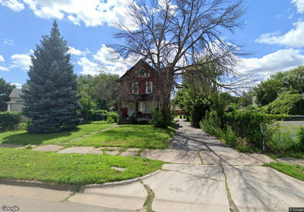
356 Como Ave Saint Paul, MN 55103
Frogtown NeighborhoodEstimated Value: $169,000 - $255,000
4
Beds
2
Baths
2,425
Sq Ft
$85/Sq Ft
Est. Value
About This Home
This home is located at 356 Como Ave, Saint Paul, MN 55103 and is currently estimated at $206,559, approximately $85 per square foot. 356 Como Ave is a home located in Ramsey County with nearby schools including Como Park Elementary School, Murray Middle School, and Como Park Senior High School.
Ownership History
Date
Name
Owned For
Owner Type
Purchase Details
Closed on
Dec 7, 2023
Sold by
Freimuth Michael
Bought by
Jensen Shaun
Current Estimated Value
Purchase Details
Closed on
Jan 16, 2009
Sold by
Us Bank Na
Bought by
Freimuth Michael
Purchase Details
Closed on
Jun 13, 2002
Sold by
Nelson Robert L
Bought by
Rojas Juan and Rojas Blasa
Purchase Details
Closed on
Jul 30, 2001
Sold by
Cooksey Lillie Olga
Bought by
Nelson Robert L
Purchase Details
Closed on
Apr 18, 1996
Sold by
Connolly James
Bought by
Connolly James and Connolly Francis Thomas
Purchase Details
Closed on
Jan 26, 1996
Sold by
Connolly James and Connolly Francis Thomas
Bought by
Cooksey Lillie Olga
Create a Home Valuation Report for This Property
The Home Valuation Report is an in-depth analysis detailing your home's value as well as a comparison with similar homes in the area
Home Values in the Area
Average Home Value in this Area
Purchase History
| Date | Buyer | Sale Price | Title Company |
|---|---|---|---|
| Jensen Shaun | $150,000 | -- | |
| Freimuth Michael | $25,000 | -- | |
| Rojas Juan | $114,900 | -- | |
| Nelson Robert L | $51,000 | -- | |
| Connolly James | $55,500 | -- | |
| Cooksey Lillie Olga | $55,500 | -- |
Source: Public Records
Mortgage History
| Date | Status | Borrower | Loan Amount |
|---|---|---|---|
| Closed | Cooksey Lillie Olga | -- |
Source: Public Records
Tax History
| Year | Tax Paid | Tax Assessment Tax Assessment Total Assessment is a certain percentage of the fair market value that is determined by local assessors to be the total taxable value of land and additions on the property. | Land | Improvement |
|---|---|---|---|---|
| 2025 | $3,356 | $169,100 | $17,500 | $151,600 |
| 2023 | $3,356 | $226,800 | $14,000 | $212,800 |
| 2022 | $3,096 | $218,500 | $14,000 | $204,500 |
| 2021 | $3,122 | $174,000 | $14,000 | $160,000 |
| 2020 | $3,216 | $180,100 | $4,800 | $175,300 |
| 2019 | $2,612 | $164,000 | $4,800 | $159,200 |
| 2018 | $1,968 | $128,400 | $4,800 | $123,600 |
| 2017 | $1,616 | $98,800 | $4,800 | $94,000 |
| 2016 | $1,592 | $0 | $0 | $0 |
| 2015 | $1,448 | $65,400 | $4,800 | $60,600 |
| 2014 | $1,376 | $0 | $0 | $0 |
Source: Public Records
Map
Nearby Homes
- 714 Western Ave N
- 697 Virginia St
- 324 Van Buren Ave
- 286 Van Buren Ave Unit 6
- 401 Lafond Ave
- 366 Topping St
- 395 Thomas Ave
- 370 Atwater St W
- 597 Virginia St
- 469 Como Ave
- 578 Elfelt St
- 924 Farrington St
- 903 Marion St
- 547 Blair Ave
- 952 Western Ave N
- 964 Western Ave N
- 351 Sherburne Ave
- 511 Edmund Ave W
- 922 N Woodbridge St
- 821 Hardenbergh Place
- 731 Virginia St
- 729 Virginia St
- 744 Western Ave N
- 740 Western Ave N
- 750 Western Ave N
- 725 Virginia St
- 378 Como Ave
- 738 Western Ave N
- 734 Western Ave N
- 721 Virginia St
- 726 Western Ave N
- 724 Virginia St
- 330 Como Ave
- 362 Minnehaha Ave W
- 707 Virginia St
- 720 Western Ave N
- 346 Minnehaha Ave W
- 699 Virginia St
- 708 Western Ave N
- 730 Western Ave N
Your Personal Tour Guide
Ask me questions while you tour the home.