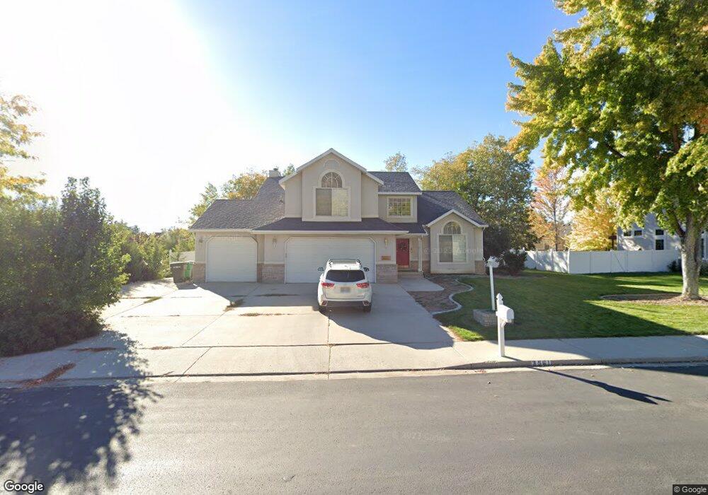
3561 N 180 E Provo, UT 84604
Rock Canyon NeighborhoodEstimated Value: $843,511 - $1,038,000
4
Beds
3
Baths
3,874
Sq Ft
$252/Sq Ft
Est. Value
About This Home
This home is located at 3561 N 180 E, Provo, UT 84604 and is currently estimated at $977,628, approximately $252 per square foot. 3561 N 180 E is a home located in Utah County with nearby schools including Edgemont School, Centennial Middle School, and Timpview High School.
Ownership History
Date
Name
Owned For
Owner Type
Purchase Details
Closed on
Aug 13, 2012
Sold by
Ka Anapu Peter M and Ka Anapu Hutia P
Bought by
Jonathan And Angela Gal Family Trust
Current Estimated Value
Purchase Details
Closed on
May 2, 2007
Sold by
Kaanapu Peter M
Bought by
Kaanapu Peter M K and Kaanapu Hutia P
Home Financials for this Owner
Home Financials are based on the most recent Mortgage that was taken out on this home.
Original Mortgage
$285,600
Interest Rate
6.15%
Mortgage Type
New Conventional
Purchase Details
Closed on
Aug 23, 2002
Sold by
Kaanapu Peter M K
Bought by
Kaanapu Peter M K and Kaanapu Hutia P
Purchase Details
Closed on
Apr 12, 1999
Sold by
Abel Kent and Abel Reta P
Bought by
Powers Properties Lc
Create a Home Valuation Report for This Property
The Home Valuation Report is an in-depth analysis detailing your home's value as well as a comparison with similar homes in the area
Home Values in the Area
Average Home Value in this Area
Purchase History
| Date | Buyer | Sale Price | Title Company |
|---|---|---|---|
| Jonathan And Angela Gal Family Trust | -- | Access Title Co | |
| Kaanapu Peter M K | -- | Empire Land Title Company | |
| Kaanapu Peter M | -- | Empire Land Title Company | |
| Kaanapu Peter M K | -- | Empire Land Title Company | |
| Kaanapu Peter M K | -- | Empire Land Title Company | |
| Powers Properties Lc | -- | First American Title Co |
Source: Public Records
Mortgage History
| Date | Status | Borrower | Loan Amount |
|---|---|---|---|
| Previous Owner | Kaanapu Peter M | $285,600 |
Source: Public Records
Tax History
| Year | Tax Paid | Tax Assessment Tax Assessment Total Assessment is a certain percentage of the fair market value that is determined by local assessors to be the total taxable value of land and additions on the property. | Land | Improvement |
|---|---|---|---|---|
| 2025 | $3,792 | $412,225 | -- | -- |
| 2024 | $3,632 | $373,230 | $0 | $0 |
| 2023 | $3,632 | $352,495 | $0 | $0 |
| 2022 | $3,952 | $386,650 | $0 | $0 |
| 2021 | $3,032 | $517,500 | $206,000 | $311,500 |
| 2020 | $2,982 | $477,100 | $171,700 | $305,400 |
| 2019 | $2,868 | $477,100 | $171,700 | $305,400 |
| 2018 | $2,528 | $426,900 | $160,700 | $266,200 |
| 2017 | $2,385 | $221,100 | $0 | $0 |
| 2016 | $2,425 | $209,550 | $0 | $0 |
| 2015 | $2,247 | $196,295 | $0 | $0 |
| 2014 | $2,068 | $188,265 | $0 | $0 |
Source: Public Records
Map
Nearby Homes
- 5600 N Canyon Rd
- 3711 N Canyon Rd
- 3305 N Shadowbrook Cir
- 111 Candlewood Place
- 158 Woodside Dr
- 3221 Shadowbrook Cir
- 407 E 3900 Rd N Unit 1
- 407 E 3900 Rd N
- 3240 Shadowbrook Dr
- 299 E 4000 N
- 3025 N 250 E
- 3057 N 100 W
- 404 W 3700 N
- 3013 N 100 W
- 2999 N Marrcrest West Dr
- 2939 N Marrcrest Dr W
- 3702 N 920 E
- 2774 N 370 E
- 758 E 3030 N
- 3129 Cherokee Ln
- 3525 N 180 E
- 3525 N 180 E Unit 5
- 3583 N 180 E
- 3584 N 100 E
- 3566 N 100 E
- 3562 N 100 E
- 3566 N 180 E
- 3588 N 100 E
- 3588 N 100 E Unit 4
- 166 E 3620 N
- 196 E 3550 N Unit 6
- 196 E 3550 N
- 3586 N 180 E
- 3612 N 100 E
- 212 E 3550 St N Unit 7
- 212 E 3550 St N
- 215 E 3550 N
- 3608 N 180 E
- 3616 N 100 E
- 3520 N 180 E Unit 5
Your Personal Tour Guide
Ask me questions while you tour the home.