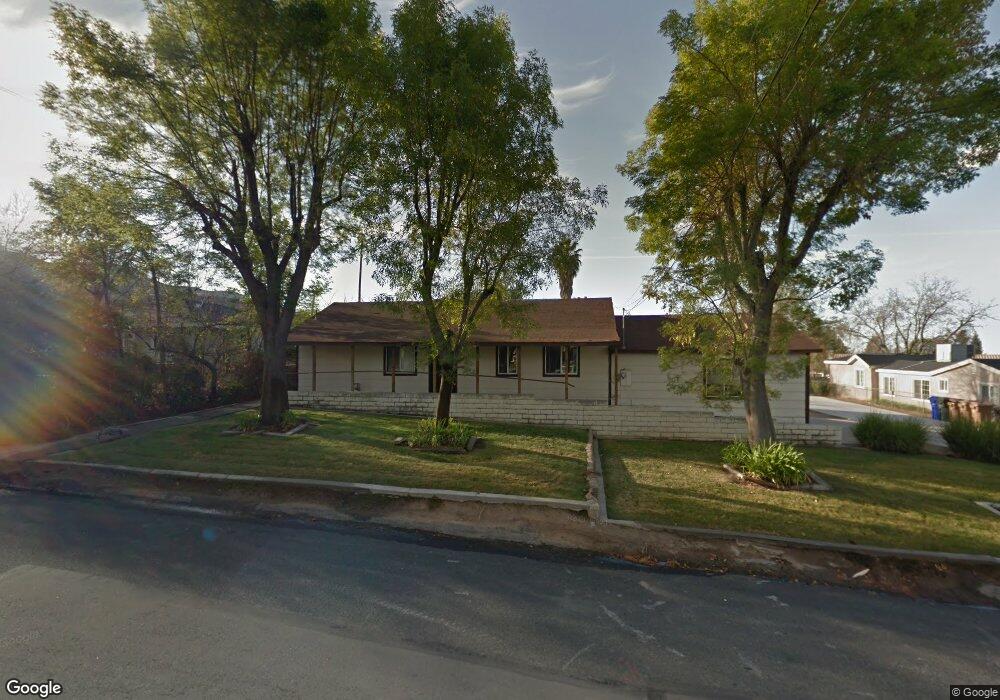
35679 Date St Yucaipa, CA 92399
Estimated Value: $503,088 - $578,000
2
Beds
2
Baths
1,702
Sq Ft
$319/Sq Ft
Est. Value
About This Home
This home is located at 35679 Date St, Yucaipa, CA 92399 and is currently estimated at $543,772, approximately $319 per square foot. 35679 Date St is a home located in San Bernardino County with nearby schools including Ridgeview Elementary School, Park View Middle School, and Yucaipa High School.
Ownership History
Date
Name
Owned For
Owner Type
Purchase Details
Closed on
Dec 14, 2012
Sold by
Joseph Jonathan
Bought by
Citrus Avenue Trust
Current Estimated Value
Purchase Details
Closed on
May 24, 2001
Sold by
Hooyenga James J
Bought by
Joseph Jonathan and Joseph Rebecca Joan
Home Financials for this Owner
Home Financials are based on the most recent Mortgage that was taken out on this home.
Original Mortgage
$1,400,000
Interest Rate
7.05%
Mortgage Type
Purchase Money Mortgage
Create a Home Valuation Report for This Property
The Home Valuation Report is an in-depth analysis detailing your home's value as well as a comparison with similar homes in the area
Home Values in the Area
Average Home Value in this Area
Purchase History
| Date | Buyer | Sale Price | Title Company |
|---|---|---|---|
| Citrus Avenue Trust | -- | None Available | |
| Date Street Trust | -- | None Available | |
| Wildwood Canyon Road Trust | -- | None Available | |
| Fir Avenue Trust | -- | None Available | |
| Peach Tree Road Trust | -- | None Available | |
| 6Th Place Trust | -- | None Available | |
| Aaron Drive Trust | -- | None Available | |
| Joseph Jonathan | $1,225,000 | First American Title |
Source: Public Records
Mortgage History
| Date | Status | Borrower | Loan Amount |
|---|---|---|---|
| Previous Owner | Joseph Jonathan | $1,400,000 |
Source: Public Records
Tax History Compared to Growth
Tax History
| Year | Tax Paid | Tax Assessment Tax Assessment Total Assessment is a certain percentage of the fair market value that is determined by local assessors to be the total taxable value of land and additions on the property. | Land | Improvement |
|---|---|---|---|---|
| 2025 | $3,354 | $215,690 | $59,093 | $156,597 |
| 2024 | $3,354 | $211,460 | $57,934 | $153,526 |
| 2023 | $3,185 | $207,314 | $56,798 | $150,516 |
| 2022 | $3,135 | $203,249 | $55,684 | $147,565 |
| 2021 | $3,068 | $199,264 | $54,592 | $144,672 |
| 2020 | $3,076 | $197,221 | $54,032 | $143,189 |
| 2019 | $2,986 | $193,354 | $52,973 | $140,381 |
| 2018 | $2,320 | $189,562 | $51,934 | $137,628 |
| 2017 | $2,270 | $185,845 | $50,916 | $134,929 |
| 2016 | $2,240 | $182,201 | $49,918 | $132,283 |
| 2015 | $2,217 | $179,464 | $49,168 | $130,296 |
| 2014 | $2,172 | $175,949 | $48,205 | $127,744 |
Source: Public Records
Map
Nearby Homes
- 35688 Date St
- 9813 Fremont St
- 11764 Sutter Ave
- 11740 Grant St
- 11610 Dodd St
- 11748 Douglas St
- 11639 Lennox St
- 11744 Auburn Ct
- 0 Pendleton Unit SW24186609
- 12040 Sutter Ave
- 35345 Panorama Dr
- 36041 Highland Ave
- 11570 Bryant St
- 36126 Panorama Dr
- 11707 Pendleton Rd
- 12151 Fremont St Unit 33
- 12151 Fremont St Unit 72
- 11425 Bryant St
- 35263 Beech Ave
- 35892 Oak Glen Rd
- 35681 Date Ave
- 35681 Date St
- 35665 Date St
- 11742 Fremont St
- 35651 Date St
- 35672 Sutter Ct
- 35651 Date Ave
- 11744 Fremont St
- 11711 Fremont St
- 35672 Date St
- 35688 Date Ave
- 35720 Fremont Ct
- 35639 Date St
- 35656 Date St
- 35671 Sutter Ct
- 35654 Sutter Ct
- 35723 Date St
- 35642 Date St
- 35716 Date St
- 35730 Fremont Ct