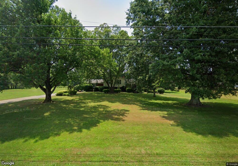
3570 S Canfield Niles Rd Canfield, OH 44406
Austintown NeighborhoodEstimated Value: $235,988 - $283,000
3
Beds
2
Baths
1,752
Sq Ft
$144/Sq Ft
Est. Value
About This Home
This home is located at 3570 S Canfield Niles Rd, Canfield, OH 44406 and is currently estimated at $252,497, approximately $144 per square foot. 3570 S Canfield Niles Rd is a home located in Mahoning County with nearby schools including Austintown Elementary School, Austintown Intermediate School, and Austintown Middle School.
Ownership History
Date
Name
Owned For
Owner Type
Purchase Details
Closed on
Aug 27, 2003
Sold by
Slater Donald D
Bought by
Emerick Charles E
Current Estimated Value
Home Financials for this Owner
Home Financials are based on the most recent Mortgage that was taken out on this home.
Original Mortgage
$143,910
Outstanding Balance
$64,225
Interest Rate
5.69%
Mortgage Type
Purchase Money Mortgage
Estimated Equity
$188,272
Purchase Details
Closed on
Apr 28, 1999
Sold by
Ott Edwin L and Ott Joanne J
Bought by
Slater Donald D and Slater Joann
Home Financials for this Owner
Home Financials are based on the most recent Mortgage that was taken out on this home.
Original Mortgage
$117,300
Interest Rate
7.05%
Purchase Details
Closed on
Sep 19, 1966
Bought by
Ott Edwin L and J J
Create a Home Valuation Report for This Property
The Home Valuation Report is an in-depth analysis detailing your home's value as well as a comparison with similar homes in the area
Home Values in the Area
Average Home Value in this Area
Purchase History
| Date | Buyer | Sale Price | Title Company |
|---|---|---|---|
| Emerick Charles E | $159,000 | Bauman Land Title Agency Inc | |
| Slater Donald D | $138,001 | -- | |
| Ott Edwin L | -- | -- |
Source: Public Records
Mortgage History
| Date | Status | Borrower | Loan Amount |
|---|---|---|---|
| Open | Emerick Charles E | $143,910 | |
| Previous Owner | Slater Donald D | $117,300 |
Source: Public Records
Tax History Compared to Growth
Tax History
| Year | Tax Paid | Tax Assessment Tax Assessment Total Assessment is a certain percentage of the fair market value that is determined by local assessors to be the total taxable value of land and additions on the property. | Land | Improvement |
|---|---|---|---|---|
| 2024 | $2,628 | $57,270 | $8,610 | $48,660 |
| 2023 | $2,587 | $57,270 | $8,610 | $48,660 |
| 2022 | $2,438 | $43,240 | $8,610 | $34,630 |
| 2021 | $2,439 | $43,240 | $8,610 | $34,630 |
| 2020 | $2,450 | $43,240 | $8,610 | $34,630 |
| 2019 | $2,688 | $43,240 | $8,610 | $34,630 |
| 2018 | $2,587 | $43,240 | $8,610 | $34,630 |
| 2017 | $2,584 | $43,240 | $8,610 | $34,630 |
| 2016 | $2,461 | $40,730 | $6,140 | $34,590 |
| 2015 | $2,386 | $40,730 | $6,140 | $34,590 |
| 2014 | $2,397 | $40,730 | $6,140 | $34,590 |
| 2013 | $2,372 | $40,730 | $6,140 | $34,590 |
Source: Public Records
Map
Nearby Homes
- 3270 S Canfield Niles Rd
- 5285 Kirk Rd
- 2792 S Canfield Niles Rd
- 3481 Forty Second St
- 3475 42nd St
- 4651 Warwick Dr S
- 3695 High Meadow Dr
- 4643 Warwick Dr S
- 5260 Revere Run
- 2211 Penny Ln
- 0 Lake Wobegon Dr Unit 5104965
- 0 Lake Wobegon Dr Unit 5104960
- 0 Lake Wobegon Dr Unit 5104948
- 0 Lake Wobegon Dr Unit 5104946
- 0 Grayson Dr
- 4650 Bunny Trail
- 4488 S Raccoon Rd
- 4674 Barrington Dr
- 4114 S Raccoon Rd
- 6264 Herbert Rd
- 3560 S Canfield Niles Rd
- 3580 S Canfield Niles Rd
- 3550 S Canfield Niles Rd
- 3886 S Canfield Niles Rd
- 3896 S Canfield Niles Rd
- 3540 S Canfield Niles Rd
- 3530 S Canfield Niles Rd
- 3932 S Canfield Niles Rd
- 3520 S Canfield Niles Rd
- 3500 S Canfield Niles Rd
- 3934 S Canfield Niles Rd
- 3461 S Canfield Niles Rd
- 3352 S Canfield Niles Rd
- 3421 S Canfield Niles Rd
- 3992 S Canfield Niles Rd
- 3350 S Canfield Niles Rd
- 3985 S Canfield Niles Rd
- 3328 S Canfield Niles Rd
- 4015 S Canfield Niles Rd
- 3325 S Canfield Niles Rd