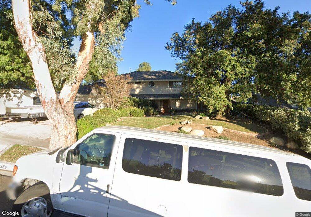
3590 Scofield Ave Simi Valley, CA 93063
Central Simi Valley NeighborhoodEstimated Value: $970,000 - $1,059,000
5
Beds
3
Baths
2,378
Sq Ft
$426/Sq Ft
Est. Value
About This Home
This home is located at 3590 Scofield Ave, Simi Valley, CA 93063 and is currently estimated at $1,013,910, approximately $426 per square foot. 3590 Scofield Ave is a home located in Ventura County with nearby schools including Township Elementary School, Valley View Middle School, and Simi Valley High School.
Ownership History
Date
Name
Owned For
Owner Type
Purchase Details
Closed on
May 15, 2013
Sold by
Ward Robert C and Ward Christine M
Bought by
Ward Robert C and Ward Christine M
Current Estimated Value
Home Financials for this Owner
Home Financials are based on the most recent Mortgage that was taken out on this home.
Original Mortgage
$138,700
Interest Rate
3.38%
Mortgage Type
New Conventional
Purchase Details
Closed on
Jun 1, 2006
Sold by
Cheney Don Michael and Cheney Catherine L
Bought by
Cheney Don M and Cheney Catherine L
Create a Home Valuation Report for This Property
The Home Valuation Report is an in-depth analysis detailing your home's value as well as a comparison with similar homes in the area
Home Values in the Area
Average Home Value in this Area
Purchase History
| Date | Buyer | Sale Price | Title Company |
|---|---|---|---|
| Ward Robert C | -- | None Available | |
| Cheney Don M | -- | Accommodation |
Source: Public Records
Mortgage History
| Date | Status | Borrower | Loan Amount |
|---|---|---|---|
| Closed | Ward Robert C | $138,700 |
Source: Public Records
Tax History
| Year | Tax Paid | Tax Assessment Tax Assessment Total Assessment is a certain percentage of the fair market value that is determined by local assessors to be the total taxable value of land and additions on the property. | Land | Improvement |
|---|---|---|---|---|
| 2025 | $4,692 | $369,114 | $127,259 | $241,855 |
| 2024 | $4,692 | $361,877 | $124,764 | $237,113 |
| 2023 | $4,410 | $354,782 | $122,318 | $232,464 |
| 2022 | $4,380 | $347,826 | $119,920 | $227,906 |
| 2021 | $4,336 | $341,006 | $117,568 | $223,438 |
| 2020 | $4,239 | $337,511 | $116,363 | $221,148 |
| 2019 | $4,044 | $330,894 | $114,082 | $216,812 |
| 2018 | $4,002 | $324,407 | $111,846 | $212,561 |
| 2017 | $3,907 | $318,047 | $109,653 | $208,394 |
| 2016 | $3,729 | $311,811 | $107,503 | $204,308 |
| 2015 | $3,644 | $307,129 | $105,889 | $201,240 |
| 2014 | $3,586 | $301,115 | $103,816 | $197,299 |
Source: Public Records
Map
Nearby Homes
- 3598 Scofield Ave
- 3562 Quincy Ave
- 4591 Hempstead St
- 3096 Anchorage Ave
- 4687 Summit Ave
- 4691 Summit Ave
- 4699 Summit Ave
- 3239 Hamlin Ave
- 4741 Westwood St
- 3055 Amarillo Ave
- 3259 Valarie Ave
- 3042 Austin Ave
- 4514 Lubbock Dr Unit C
- 2916 Esperanza Way Unit F
- 3477 Vicki Ct
- 4168 Felipe Ln Unit A
- 4920 Corral St
- 4448 Lubbock Dr Unit C
- 4679 Summit Ave
- 4683 Summit Ave
- 3582 Scofield Ave
- 3585 Lathrop Ave
- 3565 Lathrop Ave
- 3593 Lathrop Ave
- 3576 Scofield Ave
- 4126 Presidio Dr
- 3559 Lathrop Ave
- 4112 Presidio Dr
- 3568 Scofield Ave
- 3577 Scofield Ave
- 3547 Lathrop Ave
- 3569 Scofield Ave
- 3564 Lathrop Ave
- 3594 Lathrop Ave
- 3560 Scofield Ave
- 3584 Quincy Ave
- 3558 Lathrop Ave
- 3535 Lathrop Ave
- 3578 Quincy Ave
- 3592 Quincy Ave
Your Personal Tour Guide
Ask me questions while you tour the home.