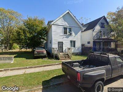
36 S Wheatland Ave Columbus, OH 43204
Central Hilltop NeighborhoodEstimated Value: $135,223 - $163,000
4
Beds
2
Baths
1,393
Sq Ft
$107/Sq Ft
Est. Value
About This Home
This home is located at 36 S Wheatland Ave, Columbus, OH 43204 and is currently estimated at $149,056, approximately $107 per square foot. 36 S Wheatland Ave is a home located in Franklin County with nearby schools including Highland Elementary School, Westmoor Middle School, and West High School.
Ownership History
Date
Name
Owned For
Owner Type
Purchase Details
Closed on
Jan 19, 2024
Sold by
Psd Group2 Llc
Bought by
Thompson Charles
Current Estimated Value
Purchase Details
Closed on
Feb 25, 2019
Sold by
M & Opm Properties Inc
Bought by
Psd Group2 Llc
Purchase Details
Closed on
Dec 29, 2004
Sold by
Kent Lawrence and Kent Marcia E
Bought by
M & Opm Properties Inc
Purchase Details
Closed on
Jul 27, 1998
Sold by
Walls Delmer L and Bach Maybeline
Bought by
Kent Marcia E
Purchase Details
Closed on
Aug 4, 1995
Sold by
Payne Rex
Bought by
Kent Marcia E
Purchase Details
Closed on
Dec 27, 1979
Bought by
Kent Marcia E
Create a Home Valuation Report for This Property
The Home Valuation Report is an in-depth analysis detailing your home's value as well as a comparison with similar homes in the area
Home Values in the Area
Average Home Value in this Area
Purchase History
| Date | Buyer | Sale Price | Title Company |
|---|---|---|---|
| Thompson Charles | $133,000 | Landsel Title Agency | |
| Psd Group2 Llc | $20,000 | Landsel Title Box | |
| M & Opm Properties Inc | -- | -- | |
| Kent Marcia E | -- | -- | |
| Kent Marcia E | -- | -- | |
| Kent Marcia E | -- | -- |
Source: Public Records
Tax History Compared to Growth
Tax History
| Year | Tax Paid | Tax Assessment Tax Assessment Total Assessment is a certain percentage of the fair market value that is determined by local assessors to be the total taxable value of land and additions on the property. | Land | Improvement |
|---|---|---|---|---|
| 2024 | $1,993 | $43,480 | $5,640 | $37,840 |
| 2023 | $1,968 | $43,470 | $5,635 | $37,835 |
| 2022 | $783 | $14,740 | $2,770 | $11,970 |
| 2021 | $934 | $14,740 | $2,770 | $11,970 |
| 2020 | $1,039 | $14,740 | $2,770 | $11,970 |
| 2019 | $764 | $12,290 | $2,310 | $9,980 |
| 2018 | $834 | $12,290 | $2,310 | $9,980 |
| 2017 | $879 | $12,290 | $2,310 | $9,980 |
| 2016 | $995 | $14,640 | $3,540 | $11,100 |
| 2015 | $906 | $14,640 | $3,540 | $11,100 |
| 2014 | $908 | $14,640 | $3,540 | $11,100 |
| 2013 | $527 | $17,220 | $4,165 | $13,055 |
Source: Public Records
Map
Nearby Homes
- 106 S Oakley Ave
- 2219 W Broad St
- 138 S Wheatland Ave
- 60 N Oakley Ave
- 58 N Wayne Ave
- 95 Midland Ave
- 53 N Wayne Ave
- 96 S Eureka Ave
- 34-36 Midland Ave
- 148 S Eureka Ave
- 152 S Eureka Ave
- 156 S Eureka Ave
- 148-150 Midland Ave
- 151 N Wheatland Ave
- 42 Whitethorne Ave
- 44 Whitethorne Ave
- 146 N Wayne Ave
- 139 N Wayne Ave
- 161 N Wheatland Ave
- 204 Midland Ave
- 36 S Wheatland Ave
- 38 S Wheatland Ave
- 30 S Wheatland Ave
- 44 S Wheatland Ave
- 50-52 S Wheatland Ave
- 50 S Wheatland Ave Unit 52
- 52 S Wheatland Ave
- 33 S Highland Ave
- 37 S Highland Ave
- 2285 W Broad St
- 43-45 S Highland Ave
- 21 S Wheatland Ave
- 2305 W Broad St
- 19 1/2 S Wheatland Ave
- 31 S Wheatland Ave
- 43 Highland Ave
- 64 S Wheatland Ave
- 45 S Wheatland Ave
- 43 S Highland Ave
- 49 S Highland Ave