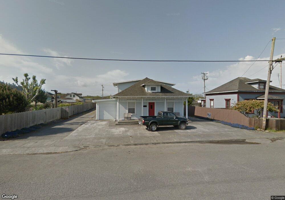
360 Railroad Ave Fields Landing, CA 95537
Fields Landing NeighborhoodEstimated Value: $318,000 - $373,795
2
Beds
1
Bath
1,140
Sq Ft
$301/Sq Ft
Est. Value
About This Home
This home is located at 360 Railroad Ave, Fields Landing, CA 95537 and is currently estimated at $342,699, approximately $300 per square foot. 360 Railroad Ave is a home located in Humboldt County with nearby schools including South Bay Elementary School and Pine Hill Elementary School.
Ownership History
Date
Name
Owned For
Owner Type
Purchase Details
Closed on
Dec 3, 2020
Sold by
Brux Bob
Bought by
Sanders Tyler E
Current Estimated Value
Home Financials for this Owner
Home Financials are based on the most recent Mortgage that was taken out on this home.
Original Mortgage
$220,000
Interest Rate
2.65%
Mortgage Type
New Conventional
Create a Home Valuation Report for This Property
The Home Valuation Report is an in-depth analysis detailing your home's value as well as a comparison with similar homes in the area
Home Values in the Area
Average Home Value in this Area
Purchase History
| Date | Buyer | Sale Price | Title Company |
|---|---|---|---|
| Sanders Tyler E | $250,000 | Fidelity Natl Ttl Co Of Ca |
Source: Public Records
Mortgage History
| Date | Status | Borrower | Loan Amount |
|---|---|---|---|
| Previous Owner | Sanders Tyler E | $220,000 |
Source: Public Records
Tax History
| Year | Tax Paid | Tax Assessment Tax Assessment Total Assessment is a certain percentage of the fair market value that is determined by local assessors to be the total taxable value of land and additions on the property. | Land | Improvement |
|---|---|---|---|---|
| 2025 | $3,262 | $308,491 | $119,066 | $189,425 |
| 2024 | $3,262 | $302,443 | $116,732 | $185,711 |
| 2023 | $3,171 | $296,514 | $114,444 | $182,070 |
| 2022 | $994 | $81,755 | $33,229 | $48,526 |
| 2021 | $932 | $80,153 | $32,578 | $47,575 |
| 2020 | $908 | $79,332 | $32,244 | $47,088 |
| 2019 | $890 | $77,777 | $31,612 | $46,165 |
| 2018 | $877 | $76,253 | $30,993 | $45,260 |
| 2017 | $876 | $74,759 | $30,386 | $44,373 |
| 2016 | $948 | $73,294 | $29,791 | $43,503 |
| 2015 | -- | $72,194 | $29,344 | $42,850 |
| 2014 | -- | $70,781 | $28,770 | $42,011 |
Source: Public Records
Map
Nearby Homes
- 335 C St
- 6498 Bell Terrace Rd
- 2008 Burns Dr
- 105 Blue Spruce Dr
- 6639 Emerson Ct
- 110 Barscape Ln
- 2259 Norman Ct
- 6829 Bret Harte Ln
- 7285 Dauber Ln
- 6481 Humboldt Hill Rd
- 11 Crab St
- 98 Perch St
- 14 Crab St
- 6306 Pryor St
- 2335 Bongio Ct
- 6911 Vista Rd
- 0000 Worthington Dr
- 2079 Surfside Dr
- 2080 Horizon Dr
- 7382 Berta Rd
- 344 Railroad Ave
- 6731 West Ave
- 6640 Fields Landing Rd
- 6670 Spring St
- 6773 West St
- 6712 Harrison Ave
- 6730 Harrison St
- 333 Railroad Ave
- 6744 West Ave
- 321 Railroad Ave
- 6742 Harrison Ave
- 6766 West Ave
- 0 Railroad Ave
- 6691 2nd St
- 280 Railroad Ave
- 420 Railroad Ave
- 281 Central Ave
- 6721 Harrison Ave
- 350 Central Ave
- 6729 Harrison Ave
Your Personal Tour Guide
Ask me questions while you tour the home.