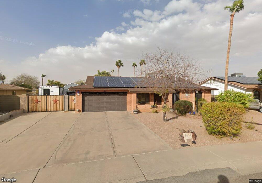
3638 W Anderson Dr Glendale, AZ 85308
Deer Valley NeighborhoodEstimated Value: $348,354 - $429,000
--
Bed
2
Baths
1,583
Sq Ft
$255/Sq Ft
Est. Value
About This Home
This home is located at 3638 W Anderson Dr, Glendale, AZ 85308 and is currently estimated at $403,339, approximately $254 per square foot. 3638 W Anderson Dr is a home located in Maricopa County with nearby schools including Mirage Elementary School, Desert Sky Middle School, and Deer Valley High School.
Ownership History
Date
Name
Owned For
Owner Type
Purchase Details
Closed on
Jan 17, 1996
Sold by
Associates Relocation Management Co Inc
Bought by
Haycock Randy L and Haycock Joni L
Current Estimated Value
Home Financials for this Owner
Home Financials are based on the most recent Mortgage that was taken out on this home.
Original Mortgage
$97,342
Outstanding Balance
$2,589
Interest Rate
7.14%
Mortgage Type
FHA
Estimated Equity
$400,750
Purchase Details
Closed on
Jan 10, 1996
Sold by
Million Shawn M and Million Karen L
Bought by
Associates Relocation Management Co Inc
Home Financials for this Owner
Home Financials are based on the most recent Mortgage that was taken out on this home.
Original Mortgage
$97,342
Outstanding Balance
$2,589
Interest Rate
7.14%
Mortgage Type
FHA
Estimated Equity
$400,750
Create a Home Valuation Report for This Property
The Home Valuation Report is an in-depth analysis detailing your home's value as well as a comparison with similar homes in the area
Home Values in the Area
Average Home Value in this Area
Purchase History
| Date | Buyer | Sale Price | Title Company |
|---|---|---|---|
| Haycock Randy L | $97,900 | Transamerica Title Ins Co | |
| Associates Relocation Management Co Inc | $97,900 | Transamerica Title Ins Co |
Source: Public Records
Mortgage History
| Date | Status | Borrower | Loan Amount |
|---|---|---|---|
| Open | Haycock Randy L | $97,342 |
Source: Public Records
Tax History Compared to Growth
Tax History
| Year | Tax Paid | Tax Assessment Tax Assessment Total Assessment is a certain percentage of the fair market value that is determined by local assessors to be the total taxable value of land and additions on the property. | Land | Improvement |
|---|---|---|---|---|
| 2025 | $1,568 | $18,220 | -- | -- |
| 2024 | $1,542 | $17,353 | -- | -- |
| 2023 | $1,542 | $31,010 | $6,200 | $24,810 |
| 2022 | $1,485 | $23,920 | $4,780 | $19,140 |
| 2021 | $1,551 | $21,920 | $4,380 | $17,540 |
| 2020 | $1,522 | $20,710 | $4,140 | $16,570 |
| 2019 | $1,475 | $19,230 | $3,840 | $15,390 |
| 2018 | $1,424 | $17,570 | $3,510 | $14,060 |
| 2017 | $1,375 | $15,270 | $3,050 | $12,220 |
| 2016 | $1,298 | $15,660 | $3,130 | $12,530 |
| 2015 | $966 | $13,760 | $2,750 | $11,010 |
Source: Public Records
Map
Nearby Homes
- 3602 W Campo Bello Dr
- 3434 W Danbury Dr Unit 103
- 3434 W Danbury Dr Unit 204
- 3643 W Grovers Ave
- 3420 W Danbury Dr Unit C130
- 3821 W Danbury Dr
- 3405 W Danbury Dr Unit D121
- 17402 N 39th Ave
- 3833 W Woodridge Dr
- 17628 N 39th Ave
- 17809 N 34th Ave
- 3935 W Muriel Dr
- 17848 N 34th Ln
- 4020 W Anderson Dr
- 3833 W Phelps Rd
- 3917 W Juniper Ave
- 4001 W Libby St
- 3747 W Aire Libre Ave
- 3645 W Grandview Rd
- 3346 W Aire Libre Ave
- 3632 W Anderson Dr
- 3644 W Anderson Dr
- 3631 W Campo Bello Dr Unit 3
- 3637 W Campo Bello Dr
- 3625 W Campo Bello Dr
- 3643 W Campo Bello Dr
- 3626 W Anderson Dr
- 3637 W Anderson Dr Unit 3
- 3650 W Anderson Dr
- 3631 W Anderson Dr
- 3643 W Anderson Dr
- 3619 W Campo Bello Dr
- 3649 W Campo Bello Dr
- 3620 W Anderson Dr
- 3625 W Anderson Dr
- 17402 N 36th Ln
- 3638 W Hartford Ave
- 3632 W Campo Bello Dr
- 3638 W Campo Bello Dr
- 17250 N 36th Ln