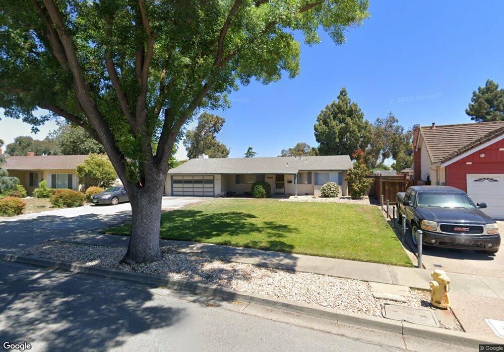
36472 Cypress Point Dr Newark, CA 94560
Estimated Value: $1,269,000 - $1,526,590
3
Beds
2
Baths
1,912
Sq Ft
$744/Sq Ft
Est. Value
About This Home
This home is located at 36472 Cypress Point Dr, Newark, CA 94560 and is currently estimated at $1,422,148, approximately $743 per square foot. 36472 Cypress Point Dr is a home located in Alameda County with nearby schools including Lincoln Elementary School, Newark Junior High School, and Newark Memorial High School.
Ownership History
Date
Name
Owned For
Owner Type
Purchase Details
Closed on
Nov 13, 2020
Sold by
Delgrande Nancy
Bought by
Delgrande Nancy and Delnancy Kerr Del
Current Estimated Value
Purchase Details
Closed on
Aug 25, 1999
Sold by
Hachey Donald D and Hachey Carole A
Bought by
Delgrande Nancy
Home Financials for this Owner
Home Financials are based on the most recent Mortgage that was taken out on this home.
Original Mortgage
$150,000
Outstanding Balance
$29,080
Interest Rate
3.35%
Estimated Equity
$1,393,068
Create a Home Valuation Report for This Property
The Home Valuation Report is an in-depth analysis detailing your home's value as well as a comparison with similar homes in the area
Home Values in the Area
Average Home Value in this Area
Purchase History
| Date | Buyer | Sale Price | Title Company |
|---|---|---|---|
| Delgrande Nancy | -- | None Available | |
| Delgrande Nancy | $338,000 | American Title Co |
Source: Public Records
Mortgage History
| Date | Status | Borrower | Loan Amount |
|---|---|---|---|
| Open | Delgrande Nancy | $150,000 |
Source: Public Records
Tax History
| Year | Tax Paid | Tax Assessment Tax Assessment Total Assessment is a certain percentage of the fair market value that is determined by local assessors to be the total taxable value of land and additions on the property. | Land | Improvement |
|---|---|---|---|---|
| 2025 | $6,631 | $519,468 | $155,840 | $363,628 |
| 2024 | $6,631 | $509,284 | $152,785 | $356,499 |
| 2023 | $6,446 | $499,300 | $149,790 | $349,510 |
| 2022 | $6,357 | $489,511 | $146,853 | $342,658 |
| 2021 | $6,201 | $479,915 | $143,974 | $335,941 |
| 2020 | $6,095 | $474,997 | $142,499 | $332,498 |
| 2019 | $6,010 | $465,685 | $139,705 | $325,980 |
| 2018 | $5,920 | $456,556 | $136,967 | $319,589 |
| 2017 | $5,770 | $447,605 | $134,281 | $313,324 |
| 2016 | $5,707 | $438,831 | $131,649 | $307,182 |
| 2015 | $5,688 | $432,240 | $129,672 | $302,568 |
| 2014 | $5,533 | $423,773 | $127,132 | $296,641 |
Source: Public Records
Map
Nearby Homes
- 7728 Hazelnut Dr
- 8106 Pebble Beach Ave
- 36184 Toulouse St
- 36563 Beutke Dr
- 7482 Birkdale Dr
- 7843 Railroad Ave
- 6417/6433 Thornton Ave
- 36075 Crystal Springs Dr
- 36063 Crystal Springs Dr
- 6449 Cedar Blvd
- 6328 Zulmida Ave
- 6364 Noel Ave
- 37029 Olive St
- 37471 Bay Crest Rd
- 37541 Bay Crest Rd
- 37532 Bay Crest Rd
- 37119 Hickory St
- 37515 Sea Bank St
- 9263 Vista Cove Way
- 37721 Bay Crest Rd
- 36458 Cypress Point Dr
- 36484 Cypress Point Dr
- 36434 Cypress Point Dr
- 36526 Spruce St
- 36461 Cypress Point Dr
- 36548 Spruce St
- 36475 Cypress Point Dr
- 36435 Cypress Point Dr
- 36420 Cypress Point Dr
- 7763 Hazelnut Dr
- 36482 Spruce St
- 7787 Hazelnut Dr
- 7749 Hazelnut Dr
- 7735 Hazelnut Dr
- 36411 Cypress Point Dr
- 7799 Hazelnut Dr
- 36470 Spruce St
- 7727 Hazelnut Dr
- 36406 Cypress Point Dr
- 36399 Shorehaven Place
Your Personal Tour Guide
Ask me questions while you tour the home.