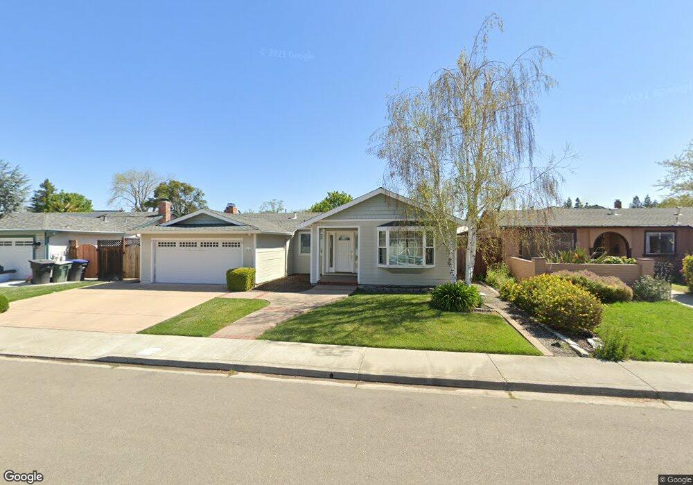
3659 Platt Ct S Pleasanton, CA 94588
Valley Trails NeighborhoodEstimated Value: $1,345,000 - $1,606,000
3
Beds
2
Baths
1,757
Sq Ft
$829/Sq Ft
Est. Value
About This Home
This home is located at 3659 Platt Ct S, Pleasanton, CA 94588 and is currently estimated at $1,457,101, approximately $829 per square foot. 3659 Platt Ct S is a home located in Alameda County with nearby schools including Donlon Elementary School, Thomas S. Hart Middle School, and Foothill High School.
Ownership History
Date
Name
Owned For
Owner Type
Purchase Details
Closed on
Nov 13, 1997
Sold by
Fisher Larry A and Fisher Rita
Bought by
Jefferies Dean and Jefferies Nancy D
Current Estimated Value
Home Financials for this Owner
Home Financials are based on the most recent Mortgage that was taken out on this home.
Original Mortgage
$50,000
Outstanding Balance
$8,220
Interest Rate
7.3%
Estimated Equity
$1,448,881
Purchase Details
Closed on
Oct 16, 1994
Sold by
Fisher Larry A and Fisher Rita
Bought by
Fisher Larry A and Fisher Rita
Create a Home Valuation Report for This Property
The Home Valuation Report is an in-depth analysis detailing your home's value as well as a comparison with similar homes in the area
Home Values in the Area
Average Home Value in this Area
Purchase History
We collect this data history from publicly available records. To have your information removed, we recommend requesting removal directly through your county’s website.
| Date | Buyer | Sale Price | Title Company |
|---|---|---|---|
| Jefferies Dean | $190,000 | Nortwestern Title Company | |
| Fisher Larry A | -- | -- |
Source: Public Records
Mortgage History
We collect this data history from publicly available records. To have your information removed, we recommend requesting removal directly through your county’s website.
| Date | Status | Borrower | Loan Amount |
|---|---|---|---|
| Open | Jefferies Dean | $50,000 |
Source: Public Records
Tax History
| Year | Tax Paid | Tax Assessment Tax Assessment Total Assessment is a certain percentage of the fair market value that is determined by local assessors to be the total taxable value of land and additions on the property. | Land | Improvement |
|---|---|---|---|---|
| 2025 | $4,683 | $400,331 | $91,010 | $316,321 |
| 2024 | $4,683 | $392,346 | $89,226 | $310,120 |
| 2023 | $4,627 | $391,516 | $87,476 | $304,040 |
| 2022 | $4,384 | $376,840 | $85,761 | $298,079 |
| 2021 | $4,270 | $369,314 | $84,080 | $292,234 |
| 2020 | $4,215 | $372,457 | $83,218 | $289,239 |
| 2019 | $4,264 | $365,155 | $81,586 | $283,569 |
| 2018 | $4,176 | $357,997 | $79,987 | $278,010 |
| 2017 | $4,069 | $350,979 | $78,419 | $272,560 |
| 2016 | $3,752 | $344,099 | $76,882 | $267,217 |
| 2015 | $3,682 | $338,930 | $75,727 | $263,203 |
| 2014 | $3,745 | $332,293 | $74,244 | $258,049 |
Source: Public Records
Map
Nearby Homes
- 3671 Platt Ct S
- 3749 Platt Ct N
- 4093 Alta Ct
- 3901 Canyon Ct
- 3909 Canyon Ct
- 4061 Holland Dr
- 3370 Morgan Ct
- 6738 Rancho Ct
- 4159 Amberwood Cir
- 5943 Corte Arboles
- 6235 Roslin Ct
- 6894 Heath Ct
- 6159 Corte Padre
- 6156 Corte Padre
- 2709 Calle de la Loma
- 4622 Muirwood Dr
- 4350 Columbine Dr
- 7747 Desertwood Ln
- 2865 Longspur Way
- 6168 Inglewood Dr
- 3647 Platt Ct S
- 3640 Hawaii Ct S
- 3652 Hawaii Ct S
- 3635 Platt Ct S
- 3683 Platt Ct S
- 3628 Hawaii Ct S
- 3664 Hawaii Ct S
- 3662 Platt Ct S
- 3650 Platt Ct S
- 3686 Platt Ct S
- 3616 Hawaii Ct S
- 3676 Hawaii Ct S
- 3623 Platt Ct S
- 3638 Platt Ct S
- 3695 Platt Ct S
- 3698 Platt Ct S
- 3688 Hawaii Ct S
- 3635 Gettysburg Ct S
- 3626 Platt Ct S
- 3649 Hawaii Ct S
Your Personal Tour Guide
Ask me questions while you tour the home.