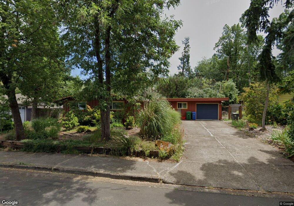
370 E 36th Ave Eugene, OR 97405
Southeast Eugene NeighborhoodEstimated Value: $402,000 - $430,000
3
Beds
1
Bath
1,020
Sq Ft
$407/Sq Ft
Est. Value
About This Home
This home is located at 370 E 36th Ave, Eugene, OR 97405 and is currently estimated at $414,855, approximately $406 per square foot. 370 E 36th Ave is a home located in Lane County with nearby schools including Camas Ridge Community Elementary School, Spencer Butte Middle School, and South Eugene High School.
Ownership History
Date
Name
Owned For
Owner Type
Purchase Details
Closed on
Jan 19, 2012
Sold by
Pickett John D
Bought by
Matthies Peter Jay and Nelsen Peggy Jean Matthies
Current Estimated Value
Purchase Details
Closed on
May 24, 2001
Sold by
Pickett John D and Pickett Joyce
Bought by
Pickett John D and John D Pickett & Joyce Pickett Family Tr
Create a Home Valuation Report for This Property
The Home Valuation Report is an in-depth analysis detailing your home's value as well as a comparison with similar homes in the area
Home Values in the Area
Average Home Value in this Area
Purchase History
| Date | Buyer | Sale Price | Title Company |
|---|---|---|---|
| Matthies Peter Jay | $149,000 | First American Title | |
| Pickett John D | -- | -- |
Source: Public Records
Tax History
| Year | Tax Paid | Tax Assessment Tax Assessment Total Assessment is a certain percentage of the fair market value that is determined by local assessors to be the total taxable value of land and additions on the property. | Land | Improvement |
|---|---|---|---|---|
| 2025 | $3,118 | $160,031 | -- | -- |
| 2024 | $3,079 | $155,370 | -- | -- |
| 2023 | $3,079 | $150,845 | $0 | $0 |
| 2022 | $2,885 | $146,452 | $0 | $0 |
| 2021 | $2,709 | $142,187 | $0 | $0 |
| 2020 | $2,719 | $138,046 | $0 | $0 |
| 2019 | $2,626 | $134,026 | $0 | $0 |
| 2018 | $2,472 | $126,333 | $0 | $0 |
| 2017 | $2,361 | $126,333 | $0 | $0 |
| 2016 | $2,303 | $122,653 | $0 | $0 |
| 2015 | $2,236 | $119,081 | $0 | $0 |
| 2014 | $2,191 | $115,613 | $0 | $0 |
Source: Public Records
Map
Nearby Homes
- 555 Stafford Ct
- 585 E 36th Ave
- 0 E 39th Ave
- 275 E 39th Ave
- 434 E 39th Ave
- 4023 Donald St Unit K
- 790 E 32nd Ave
- 170 E 40th Ave
- 310 1/2 E 31st Ave Unit 1
- 1180 E 37th Ave
- 75 W 35th Place
- 4295 Ferry St
- 3023 Hummingbird Ln
- 4320 Fox Hollow Rd
- 3031 Hummingbird Ln
- 910 E 43rd Ave
- 1210 E 38th Ave
- 3790 Onyx St
- 4364 Fox Hollow Rd
- 3605 Emerald St
Your Personal Tour Guide
Ask me questions while you tour the home.