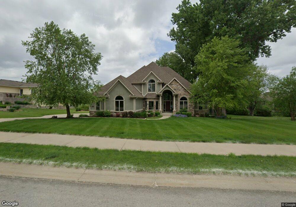
3703 Prairie Sage Dr Norwalk, IA 50211
Estimated Value: $628,521 - $780,000
5
Beds
5
Baths
2,830
Sq Ft
$245/Sq Ft
Est. Value
About This Home
This home is located at 3703 Prairie Sage Dr, Norwalk, IA 50211 and is currently estimated at $693,380, approximately $245 per square foot. 3703 Prairie Sage Dr is a home located in Warren County with nearby schools including Oviatt Elementary School, Lakewood Elementary School, and Orchard Hills Elementary School.
Ownership History
Date
Name
Owned For
Owner Type
Purchase Details
Closed on
Aug 24, 2022
Sold by
Cunningham Michael A
Bought by
Amc Real Estate Llc
Current Estimated Value
Home Financials for this Owner
Home Financials are based on the most recent Mortgage that was taken out on this home.
Original Mortgage
$475,000
Outstanding Balance
$445,283
Interest Rate
5.51%
Mortgage Type
New Conventional
Estimated Equity
$248,097
Purchase Details
Closed on
Dec 12, 2005
Sold by
United Properties Investmentes Company L
Bought by
Cunningham Michael A and Cunningham Melinda S
Home Financials for this Owner
Home Financials are based on the most recent Mortgage that was taken out on this home.
Original Mortgage
$460,000
Interest Rate
6.36%
Mortgage Type
Construction
Create a Home Valuation Report for This Property
The Home Valuation Report is an in-depth analysis detailing your home's value as well as a comparison with similar homes in the area
Home Values in the Area
Average Home Value in this Area
Purchase History
| Date | Buyer | Sale Price | Title Company |
|---|---|---|---|
| Amc Real Estate Llc | $525,000 | -- | |
| Cunningham Michael A | $90,000 | None Available |
Source: Public Records
Mortgage History
| Date | Status | Borrower | Loan Amount |
|---|---|---|---|
| Open | Amc Real Estate Llc | $475,000 | |
| Previous Owner | Cunningham Michael A | $460,000 |
Source: Public Records
Tax History Compared to Growth
Tax History
| Year | Tax Paid | Tax Assessment Tax Assessment Total Assessment is a certain percentage of the fair market value that is determined by local assessors to be the total taxable value of land and additions on the property. | Land | Improvement |
|---|---|---|---|---|
| 2025 | $13,486 | $821,300 | $202,300 | $619,000 |
| 2024 | $13,472 | $716,900 | $93,100 | $623,800 |
| 2023 | $12,882 | $716,900 | $93,100 | $623,800 |
| 2022 | $12,842 | $576,900 | $93,100 | $483,800 |
| 2021 | $12,834 | $576,900 | $93,100 | $483,800 |
| 2020 | $12,834 | $543,500 | $93,100 | $450,400 |
| 2019 | $12,990 | $543,500 | $93,100 | $450,400 |
| 2018 | $12,592 | $0 | $0 | $0 |
| 2017 | $13,070 | $0 | $0 | $0 |
| 2016 | $12,966 | $0 | $0 | $0 |
| 2015 | $12,966 | $0 | $0 | $0 |
| 2014 | $12,072 | $502,100 | $0 | $0 |
Source: Public Records
Map
Nearby Homes
- 3806 Bluestem Rd
- 1609 Garland Ave
- 1603 Garland Ave
- 1512 Garland Ave
- 1528 Garland Ave
- 1608 Garland Ave
- 1606 Garland Ave
- 1602 Garland Ave
- 1600 Garland Ave
- 1520 Garland Ave
- 9360 Brooks Place
- 9368 Brooks Place
- 9373 Brooks Place
- 2113 Chandler Ct
- Seymour Plan at Holland Pointe
- Everly Plan at Holland Pointe
- Fremont Plan at Holland Pointe
- Chester Plan at Holland Pointe
- Eldridge Plan at Holland Pointe
- Monroe Plan at Holland Pointe
- 3720 Bluestem Rd
- 3625 Prairie Sage Dr
- 3712 Bluestem Rd
- 3702 Prairie Sage Dr
- 3706 Prairie Sage Dr
- 3704 Bluestem Rd
- 3628 Prairie Sage Dr
- 3611 Prairie Sage Dr
- 3624 Prairie Sage Dr
- 3717 Blue Stem Rd
- 3721 Bluestem Rd
- 3601 Prairie Sage Dr
- 3803 Bluestem Rd
- 3713 Bluestem Rd
- 3709 Bluestem Rd
- 3809 Bluestem Rd
- 3612 Prairie Sage Dr
- 3620 Prairie Sage Dr
- 3705 Bluestem Rd
- 3615 Bluestem Rd