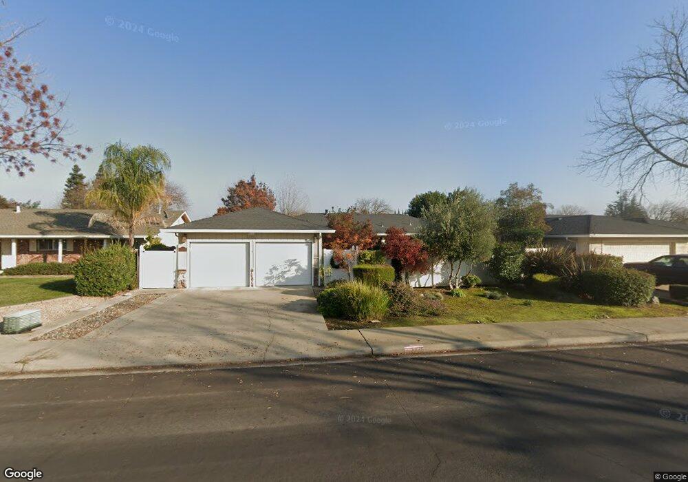
3728 Columbine Dr Modesto, CA 95356
Central Modesto NeighborhoodEstimated Value: $387,000 - $525,000
3
Beds
2
Baths
1,602
Sq Ft
$288/Sq Ft
Est. Value
About This Home
This home is located at 3728 Columbine Dr, Modesto, CA 95356 and is currently estimated at $461,019, approximately $287 per square foot. 3728 Columbine Dr is a home located in Stanislaus County with nearby schools including Woodrow Elementary School, Somerset Middle School, and Grace M. Davis High School.
Ownership History
Date
Name
Owned For
Owner Type
Purchase Details
Closed on
Jan 13, 2006
Sold by
Kendall Ollie Lou
Bought by
Kendall Ollie Lou
Current Estimated Value
Home Financials for this Owner
Home Financials are based on the most recent Mortgage that was taken out on this home.
Original Mortgage
$518,625
Interest Rate
6%
Mortgage Type
Reverse Mortgage Home Equity Conversion Mortgage
Create a Home Valuation Report for This Property
The Home Valuation Report is an in-depth analysis detailing your home's value as well as a comparison with similar homes in the area
Home Values in the Area
Average Home Value in this Area
Purchase History
| Date | Buyer | Sale Price | Title Company |
|---|---|---|---|
| Kendall Ollie Lou | -- | Fidelity National Financial |
Source: Public Records
Mortgage History
| Date | Status | Borrower | Loan Amount |
|---|---|---|---|
| Closed | Kendall Ollie Lou | $518,625 |
Source: Public Records
Tax History Compared to Growth
Tax History
| Year | Tax Paid | Tax Assessment Tax Assessment Total Assessment is a certain percentage of the fair market value that is determined by local assessors to be the total taxable value of land and additions on the property. | Land | Improvement |
|---|---|---|---|---|
| 2025 | $957 | $93,578 | $19,539 | $74,039 |
| 2024 | $938 | $91,744 | $19,156 | $72,588 |
| 2023 | $919 | $89,946 | $18,781 | $71,165 |
| 2022 | $880 | $88,183 | $18,413 | $69,770 |
| 2021 | $863 | $86,454 | $18,052 | $68,402 |
| 2020 | $850 | $85,568 | $17,867 | $67,701 |
| 2019 | $833 | $83,891 | $17,517 | $66,374 |
| 2018 | $815 | $82,247 | $17,174 | $65,073 |
| 2017 | $794 | $80,636 | $16,838 | $63,798 |
| 2016 | $788 | $79,056 | $16,508 | $62,548 |
| 2015 | $775 | $77,870 | $16,261 | $61,609 |
| 2014 | $771 | $76,346 | $15,943 | $60,403 |
Source: Public Records
Map
Nearby Homes
- 313 W Union Ave
- 325 Standiford Ave Unit 52
- 325 Standiford Ave Unit 40
- 325 Standiford Ave Unit 32
- 325 Standiford Ave Unit 18
- 3600 Columbine Dr Unit 6
- 3408 Darryl Ln
- 3312 Whitehorse Ave
- 3316 Sherwood Ave Unit 55
- 4125 Mchenry Ave Unit 36
- 4125 Mchenry Ave Unit 63
- 4125 Mchenry Ave Unit 134
- 4125 Mchenry Ave Unit 55
- 4125 Mchenry Ave
- 4125 Mchenry Ave Unit 13
- 4125 Mchenry Ave Unit 43
- 4125 Mchenry Ave Unit 54
- 4024 Mchenry Ave Unit 50
- 4024 Mchenry Ave Unit 26
- 4104 Ogden Ct
- 3800 Columbine Dr
- 3724 Columbine Dr
- 3729 Marigold Ln
- 3801 Marigold Ln
- 3725 Marigold Ln
- 3720 Columbine Dr
- 3804 Columbine Dr
- 3725 Columbine Dr
- 3721 Marigold Ln
- 3805 Marigold Ln
- 3721 Columbine Dr
- 601 Violet St
- 3808 Columbine Dr
- 3716 Columbine Dr
- 3809 Marigold Ln
- 3717 Marigold Ln
- 605 Mayflower St
- 3728 Marigold Ln
- 3724 Marigold Ln
- 3800 Marigold Ln