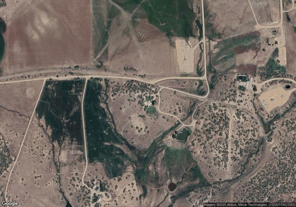
377 Frontier Dr Ignacio, CO 81137
Estimated Value: $722,000 - $1,107,189
4
Beds
3
Baths
3,456
Sq Ft
$281/Sq Ft
Est. Value
About This Home
This home is located at 377 Frontier Dr, Ignacio, CO 81137 and is currently estimated at $971,797, approximately $281 per square foot. 377 Frontier Dr is a home located in La Plata County with nearby schools including Florida Mesa Elementary School, Escalante Middle School, and Durango High School.
Ownership History
Date
Name
Owned For
Owner Type
Purchase Details
Closed on
Jan 23, 2018
Sold by
Hebert Ijeffrey M and Phenix Leann M
Bought by
Reilly John J and Reilly Suzanne
Current Estimated Value
Purchase Details
Closed on
Oct 15, 2010
Sold by
Parcell Robert L and Parcell Kathleen Card
Bought by
Hebert Jeffrey M and Phenix Leann M
Home Financials for this Owner
Home Financials are based on the most recent Mortgage that was taken out on this home.
Original Mortgage
$360,000
Interest Rate
4.39%
Mortgage Type
New Conventional
Purchase Details
Closed on
May 22, 1998
Bought by
Hebert Jeffrey M and Phenix Leann M
Create a Home Valuation Report for This Property
The Home Valuation Report is an in-depth analysis detailing your home's value as well as a comparison with similar homes in the area
Purchase History
| Date | Buyer | Sale Price | Title Company |
|---|---|---|---|
| Reilly John J | $570,000 | Land Title Guarantee Co | |
| Hebert Jeffrey M | $450,000 | Colorado Land Title Co | |
| Hebert Jeffrey M | $88,000 | -- |
Source: Public Records
Mortgage History
| Date | Status | Borrower | Loan Amount |
|---|---|---|---|
| Previous Owner | Hebert Jeffrey M | $360,000 |
Source: Public Records
Tax History Compared to Growth
Tax History
| Year | Tax Paid | Tax Assessment Tax Assessment Total Assessment is a certain percentage of the fair market value that is determined by local assessors to be the total taxable value of land and additions on the property. | Land | Improvement |
|---|---|---|---|---|
| 2025 | $2,228 | $57,100 | $19,890 | $37,210 |
| 2024 | $1,914 | $44,590 | $14,370 | $30,220 |
| 2023 | $1,914 | $47,730 | $15,380 | $32,350 |
| 2022 | $1,779 | $50,080 | $16,140 | $33,940 |
| 2021 | $1,790 | $42,180 | $11,650 | $30,530 |
| 2020 | $1,686 | $40,920 | $11,430 | $29,490 |
| 2019 | $1,373 | $40,920 | $11,430 | $29,490 |
| 2018 | $1,349 | $40,280 | $11,290 | $28,990 |
| 2017 | $1,424 | $43,530 | $11,290 | $32,240 |
| 2016 | $1,521 | $47,120 | $11,260 | $35,860 |
| 2015 | $1,425 | $47,120 | $11,260 | $35,860 |
| 2014 | -- | $38,900 | $11,260 | $27,640 |
| 2013 | -- | $38,900 | $11,260 | $27,640 |
Source: Public Records
Map
Nearby Homes
- 58 Rawhide Rd
- 416 County Road 513
- 192 Rawhide Rd
- 134 Rawhide Rd
- 769 & 784 Bareback Ln
- 1250 Wrangler Way
- 1308 Wrangler Way
- 201 Cowboy Trail
- 104 Chicken Hawk Ln
- 769 Amp; 784 Bareback Ln
- 3805 County Road 510
- 142 Soaring Eagle Dr
- 100 & 110 Wrangler Way
- 8257 Colorado 172
- TBD County Road 510
- 68 Cody Rd
- 41 Derby Dr
- 329 Payne Ln
- 8257 St Hwy 172
- 140 Etta Place
- 131 Russett
- 0 Russett Unit 740777
- 0 Russett Unit 679396
- 0 Russett Unit 709002
- 0 Frontier Dr
- 1465 County Road 513
- 531 Frontier Dr
- 2007 513
- 2007 County Road 513
- 0 County Road 513 Unit 761278
- 0 Cr 513 Unit 752034
- 0 Cr 513 Unit 744862
- 131 Russet Ridge St
- 160 Russet Ridge St
- 0 Russet Ridge Unit 764618
- 0 Russet Ridge Unit 746747
- 0 Russet Ridge Unit 644813
- 0 Russet Ridge Unit 695032
- 0 Russet Ridge Unit 625882
- 0 Russet Ridge Unit 631802
