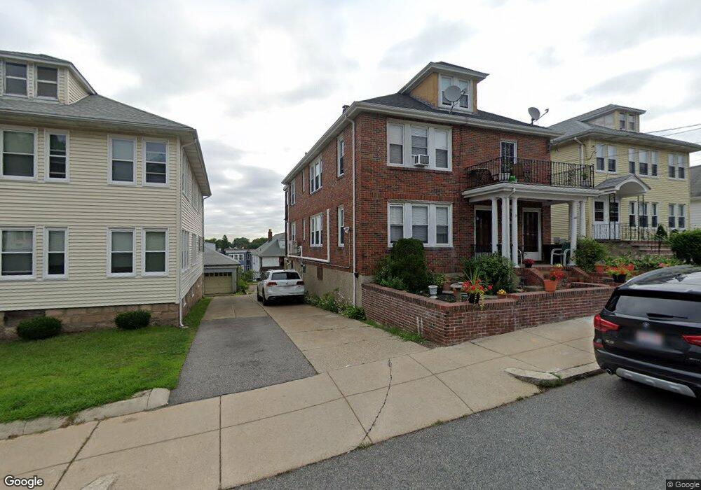
38 Cedrus Ave Unit 40 Roslindale, MA 02131
Roslindale NeighborhoodEstimated Value: $961,000 - $1,116,000
4
Beds
2
Baths
2,842
Sq Ft
$366/Sq Ft
Est. Value
About This Home
This home is located at 38 Cedrus Ave Unit 40, Roslindale, MA 02131 and is currently estimated at $1,039,421, approximately $365 per square foot. 38 Cedrus Ave Unit 40 is a home located in Suffolk County with nearby schools including Brooke Charter School Roslindale, Sacred Heart STEM School, and St. Clare High School.
Ownership History
Date
Name
Owned For
Owner Type
Purchase Details
Closed on
May 17, 2018
Sold by
Fanouriakis Helen
Bought by
Fanouriakis Ft
Current Estimated Value
Purchase Details
Closed on
Dec 13, 2006
Sold by
Fanouriakis Helen and Mavrides Sophia
Bought by
Fanouriakis Helen and Fanouriakis James C
Home Financials for this Owner
Home Financials are based on the most recent Mortgage that was taken out on this home.
Original Mortgage
$200,000
Interest Rate
6.31%
Mortgage Type
Purchase Money Mortgage
Create a Home Valuation Report for This Property
The Home Valuation Report is an in-depth analysis detailing your home's value as well as a comparison with similar homes in the area
Home Values in the Area
Average Home Value in this Area
Purchase History
| Date | Buyer | Sale Price | Title Company |
|---|---|---|---|
| Fanouriakis Ft | -- | -- | |
| Fanouriakis Helen | -- | -- | |
| Fanouriakis Helen | $200,000 | -- |
Source: Public Records
Mortgage History
| Date | Status | Borrower | Loan Amount |
|---|---|---|---|
| Previous Owner | Fanouriakis Helen | $200,000 |
Source: Public Records
Tax History Compared to Growth
Tax History
| Year | Tax Paid | Tax Assessment Tax Assessment Total Assessment is a certain percentage of the fair market value that is determined by local assessors to be the total taxable value of land and additions on the property. | Land | Improvement |
|---|---|---|---|---|
| 2025 | $9,974 | $861,300 | $228,300 | $633,000 |
| 2024 | $8,395 | $770,200 | $237,500 | $532,700 |
| 2023 | $7,952 | $740,400 | $228,300 | $512,100 |
| 2022 | $7,324 | $673,200 | $207,600 | $465,600 |
| 2021 | $7,041 | $659,900 | $203,500 | $456,400 |
| 2020 | $6,684 | $633,000 | $183,200 | $449,800 |
| 2019 | $6,293 | $597,100 | $148,000 | $449,100 |
| 2018 | $5,903 | $563,300 | $148,000 | $415,300 |
| 2017 | $5,847 | $552,100 | $148,000 | $404,100 |
| 2016 | $5,625 | $511,400 | $148,000 | $363,400 |
| 2015 | $5,326 | $439,800 | $137,900 | $301,900 |
| 2014 | $4,940 | $392,700 | $137,900 | $254,800 |
Source: Public Records
Map
Nearby Homes
- 295 Kittredge St
- 5 7 Hemman St
- 55 Metropolitan Ave
- 69 Metropolitan Ave
- 124 Glendower Rd Unit 2
- 34 Averton St
- 0 Averton St
- 276 Cornell St
- 89 Glendower Rd
- 142 Metropolitan Ave Unit A
- 75 Glendower Rd
- 142 Birch St
- 142 Birch St Unit 1
- 142 Birch St Unit 2
- 67 Hautevale St
- 112 Roslindale Ave Unit 2
- 80 Roslindale Ave Unit 3
- 25 Crandall St
- 17 Metcalf St
- 65 Birch St Unit 3
- 34 Cedrus Ave Unit 36
- 34 Cedrus Ave Unit 2
- 42 Cedrus Ave Unit 44
- 36 Cedrus Ave Unit 1
- 48 Cedrus Ave
- 30-32 Cedrus Ave
- 30 Cedrus Ave Unit 32
- 32 Cedrus Ave Unit 1
- 188 Cornell St
- 194 Cornell St Unit 196
- 190 Cornell St
- 190 Cornell St Unit 2
- 26 Cedrus Ave Unit 28
- 198 Cornell St
- 184 Cornell St
- 184 Cornell St Unit 1
- 184 Cornell St Unit 2
- 39 Cedrus Ave Unit 2
- 37 Cedrus Ave Unit 2
- 39 Cedrus Ave Unit 1